

Route – Bankfoot to Dunkeld to Dalguise to Strathtay to Kenmore to Amulree to Buchanty to Tullybelton to Bankfoot. For route map click here.
See route on Strava.
- Weather – hot and sunny with only a gentle breeze.
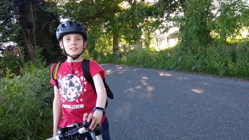
- Bike type – road bike
- Distance travelled – 66.15 miles
- Riding time – 5 hours 6 minutes
- Maximum speed – 33.8 mph
- Average speed – 13.0 mph
- Height climbed – 4284 feet
The weather in Scotland has been unbelievably dry and sunny for the past few months so Dad and I have been taking advantage of it and going out cycling as much as we possibly can. One of my favourite routes we have done this summer was when we cycled around beautiful Glen Lyon and Loch Tay at the end of May and I have been desparate to go back to the area ever since. So it was on a sunny sunday afternoon near the end of June that we returned to the valleys and hills of Perthshire for an amazing day out on our bikes.
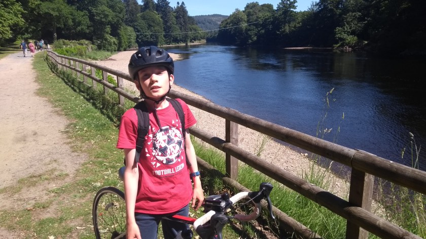
After parking the car on the main street in the village of Bankfoot, which is just off the main A9 road about 10 miles north of Perth, we got on our bikes and headed north out of the village. This was on the B867 road which forms part of National Cycle Route no.77. It is a fairly quiet and flat road that takes you through peaceful countryside made up of woodlands and fields of sheep, cows and barley, with rolling hills in the distance. Before too long, the road ended at a junction onto the very busy A9 trunk road. It’s not a road you really want to cycle on if you have any sense. Thankfully, we didn’t have to brave the traffic though and we followed the Route 77 signs onto a nice tarmac cycle path. The path took us the last mile or 2 to Dunkeld, passing right through the car park of the train station, before going through an underpass to the other side of the main road and into the town. Here we cycled over a grand bridge over the River Tay and then right through the town centre which was hoaching with tourists enjoying the weather and the ice cream. It was too early for us to stop for a 2 scoop cone (although Dad wanted to of course…) so we carried on and turned left at the next cycle route 77 sign, through an amazing old archway, out of the town and into what appeared to be a private country estate.
The cycle route took us into the woods and then right along the side of the River Tay. Due to the long period of dry weather, the water level was really low and there were some little beaches visible at the sides. We didn’t have time to stop and paddle or build a sandcastle though… Somewhere along the way the nice smooth tarmac path turned into a bumpy, gravelly track which was very hard to cycle on with skinny road bike tyres. I almost wished we’d gone on the A9 instead (!), it was that horrible to ride on. Better with a mountain bike on this path so take note. After a slow couple of miles, we emerged unscathed from the trees and up a ramp until we came out onto a shared use path right along the side of the A9 road. Heading againsts the flow of the fast traffic, the few hundred metres on this rather narrow pavement was not pleasant at all but at least it didn’t last long and it did take us back over to the other side of the river and to the junction with the B898 road where we followed the cycle route signs pointing right. Soon we were away from the speeding cars and lorries of the A9.
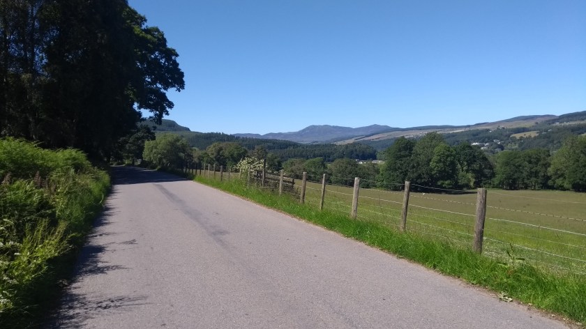
The B898 basically follows the River Tay for 9 miles and is one of the nicest cycling roads you can imagine. It’s a good surface, has very little in the way of traffic, it’s very flat with only a few small hills and the views along the Tay Valley are great. You can even see some of the high mountains away in the distance at some points. Eventually, the B road runs out and becomes the A827 heading for Aberfeldy on the south side of the Tay. However, our route was to follow the north side of the river so we turned right over a bridge to the other side and then took the next left turn onto the back road which was part of National Cycle Route no.7.

This road was even quieter than the B898 and was equally flat and nice to cycle on as it follows the River Tay upstream. The road passes in and out of the trees so we got some welcome shade from the strong sun. We also got some really nice views of the river at times and passed a nice looking little golf course at Strathtay. Before too long we caught sight of the strange-looking bridge that leads you across the river into Aberfeldy. Dad remembered that there was a brilliant ice cream shop there and suggested making a short detour to get some. It had been rather good but I told him I wanted to keep going so we headed straight onto the B846 with Dad mutterering away to himself (something about being a bit peckish I believe…). The B846 heads for Glen Lyon and we cycled on it last time we were here. It’s nice and flat and fast going, and the further along it you go the better the views of the hills and mountains become. Just after the River Lyon meets the River Tay, we turned off the B road and onto a narrow road and followed the Tay a few more miles until we reached the A827 again at Kenmore on the shores of Loch Tay. We turned left and sped downhill through the village. Dad spotted yet another ice cream place but I said “no” again. I didn’t want to stop now because I was too excited about the massive challenge facing us next – the climb up Kenmore Hill, one of the longest and steepest hill climbs in Scotland!

So we turned right off the A road onto the minor road on the south side of Loch Tay. But after only a few metres, we turned left onto a very narrow but smooth road and the start of Kenmore Hill. This is a really seriously hard climb as it takes you up to well over 500m high, climbing nearly 1400 feet in 3 miles. The first section is by far the hardest though (well over 20% gradient in places) and with some really steep, sharp corners to negociate. I managed fine though and pedalled up through the trees at a reasonable speed, leaving Dad flagging behind (no doubt wishing he’d been allowed to have his ice cream). After what seemed like ages, I emerged from the trees and the hills on the left and behind us really started to come into view and it was obvious that I’d climbed a long way up already in quite a short distance.

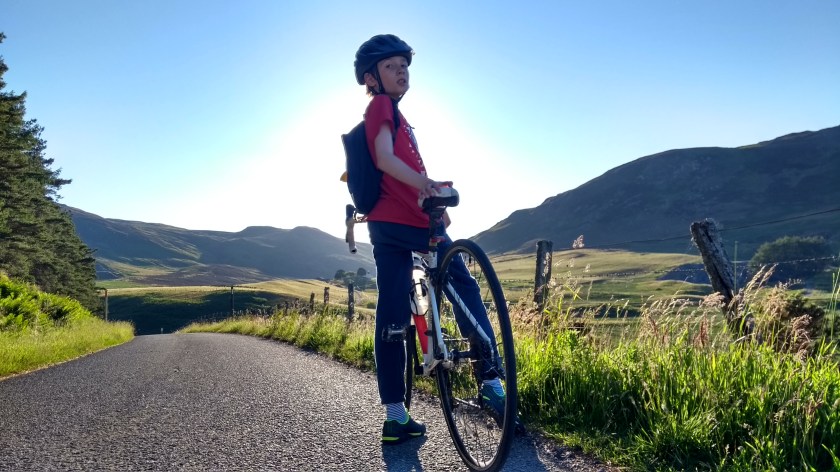
After crossing a cattle grid overgrown with weeds, there was a brief slightly downhill section (or at least it felt downhill compared to the previous mile!). At the end of the “downhill” I passed a house on the corner of the road and then it became very steep once again, through the trees at first and then finally out onto the open moorland. From there, the climb gets quite a bit easier thankfully. This is good because if you have made it this far without stopping, your legs will be pretty broken by now. Well, Dad’s were – I was still remarkably fine… The gradual climb seemed to go on and on and on forever, passing a tiny lochan on the left and if you look behind, there are increadible views of the high mountains, including Schiehallion, which seem much closer than they really are.
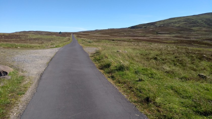
It is a very bare and bleak, heathery landscape this high up and you can imagine it’s not the best place to get caught in a blizzard… It was lovely today though in the warm sun with hardly any wind at all. It isn’t that obvious when you have actually reached the top of the hill but when I was sure I was definitley heading down the other side, I stopped to wait for Dad. After 10 minutes enjoying the most stunning views down into Glen Quaich below, Dad finally showed up. As usual he told me he’d stopped to take lots of photos so that’s why he was so slow…

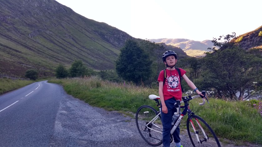
The descent down the hill into Glen Quaich was extremely fast (this side of the hill is possibly even steeper than the one we’d come up and I reckon it will be amazing to cycle up it) but there’s quite a few hairpin bends to watch out for so we were braking hard and trying to go as safely as possible around those corners. In a matter of minutes we were right down into one of the nicest glens you will ever see, cycling on one of the quietest

roads you’ll ever ride on. Loch Freuchie looked lovely as we approached it and we could see more hills and mountains off in the distance, getting closer and closer as we cycled along the side of the loch. The road is mainly flat or slightly downhill through the glen so it is quite a fast ride. At one point a couple of sheep decided to race us along the road before giving up and diving through a gap in the fence and into a field. Soon we arrived in the tiny village of Amulree, where the narrow road ends. We’d done more than 40 miles by now so I finally agreed to stop for a break and we sat in the sun, enjoying a feast of oatcakes, salad, Parma Ham, cheese, blueberries and crisps. Sadly, there was no ice cream shop anywhere to be seen so Dad had to make do with a Yorkie bar…
Next we turned right onto the A822. This is one of the quietest A main roads I’ve cycled on and also one of the most scenic. It takes you through the Sma’ Glen where steep mountains tower above you on both sides of the narrow valley as the road follows the River Almond for a few miles. The sun was quite low in the sky by now so this made the views even more impressive. Eventually, we came to a junction on the left and turned off onto the B8063, following the river into Glen Almond. This narrow road was the quietest of all and took us into some of the most peaceful countryside in Perthshire, travelling in and out of the trees, passing endless fields and giving us fine views down the valley to the east. We could even see the Lomond Hills a long way away in the distance.
Shortly after passing Logiealmond Primary School we turned left onto a single track road, heading for the hills again and the interestingly named Little Glenshee. I’ve never been to “big” Glenshee, high up in the mountains south of Braemar, but I imagine someone must have thought this glen looked like a miniature version of it. There was no sign of a ski centre here though but it did have one of the most unusual pieces of road ever. At the head of the glen, just before reaching a farm, the road passes through a ford
in the river and just after that it has a 180 degree bend. You literally turn right around and cycle back in the opposite direction for a hundred metres. It was almost like a mini dual cariageway with grass for the central reservation! From there we had the most fun, slightly downhill stretch of road to cycle on for most of the 6 miles back to Bankfoot. We were going so fast at one stage that a tractor in front of us had to pull into the side to let us past! Soon we arrived back at the car and by now it was quite late and even I was feeling peckish. Too late for ice cream but we managed to find a really good chip shop in Dunkeld so we stopped there to fill our faces. We’d had a brilliant day out in the sunshine in Highland Perthshire and I’m already planning my next cycle route up there. Perhaps I’ll cycle up the hill from Glen Quaich and over to Kenmore this time – who knows?!


You climbed the hardest side of glen quaich. Kenmore hill. I often have the impression that the downhill is steeper than the side I have pedalled up. You are a machine cycling these hills at your age! Good luck on your adventures. You are lucky to have a dad who takes you on these adventures.
LikeLike