
Route – Aberfeldy to Dull to Fortingall to Bridge of Balgie to Killin to Kenmore to Aberfeldy. For route map click here.
See route on Strava.
- Weather – very warm and sunny with light winds at first but quite a bit windier after lunchtime.
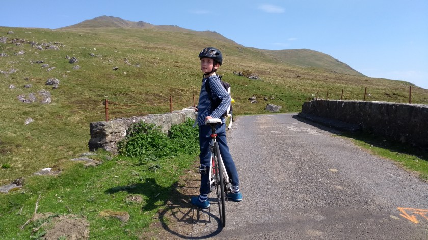
- Bike type – road bike
- Distance travelled – 57.08 miles
- Riding time – 4 hours 35 minutes
- Maximum speed – 31.5 mph
- Average speed – 12.4 mph
- Height climbed – 3751 feet
Regular readers of this blog will have noticed that Dad and I spend most of our time cycling in the Scottish Borders. We really love the beautiful scenery and the fact that there are lots of very quiet roads to cycle on down there. It’s also easy to get to from our house in Midlothian. This week though, I decided that with the weather forecast looking good, it would be nice to travel a bit further afield and go for a ride through an even more spectacular part of the country – Highland Perthshire.
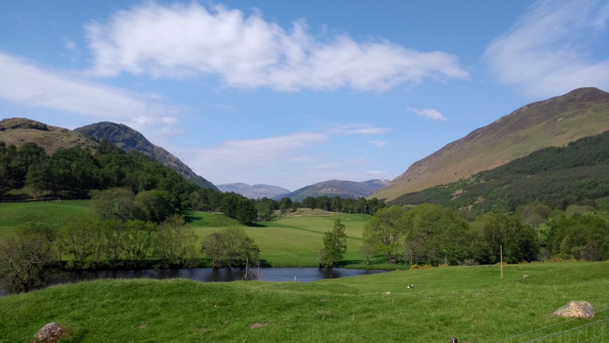
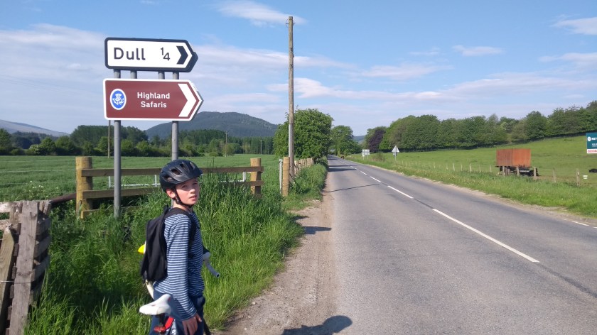
After a 100 minute car journey, listening to Sounds of the Sixties on the radio on the way up the M90 and the A9, we eventually arrived in the lovely Perthshire town of Aberfeldy. I’ve been here before when walking in the mountains but had never cycled in this area – until today. We parked near the river close to the play park and immediately cycled over an unusual looking bridge with traffic lights which took us onto the north side of the River Tay. Even at 9am it was already quite hot as we sped along the nice, flat road surface of the B846 past such interestingly named places as Weem and Dull. As we cycled
along, the views started to get better and better and at one point we could see the impressive mountain Schiehallion in the distance (I climbed up it when I was only 5 believe it or not). After a few easy miles we turned left onto a minor road signposted for Glen Lyon. It was on this road that we spotted a sign warning of a cycle event but we saw no cyclists around so we continued on through the pleasant countryside on the mainly flat road. Soon we came to a village called Fortingall which had some strange old houses with thatched roofs and shortly after that we turned right at the signpost onto the narrow road that would take us through Glen Lyon.

Dad had told me in the car on the way up that Glen Lyon was the most beautiful glen in Scotland, and I would have to say that he was not wrong. It has a bit of everything: lovely woodlands, narrow gorges, waterfalls and rivers at first and then a more open river valley with amazing mountains all around further down the glen. The road is great to cycle on too with little traffic. It is mainly slightly uphill in this direction but with lots of short ups and long downs and corners to keep things fun. We cycled right around the back side of Ben Lawers (the 5th highest mountain in Scotland I believe) which I climbed with Dad and my sister Isla last summer. Despite all the fine warm weather recently, there were still quite a few patches of snow high up in the hills. About halfway along
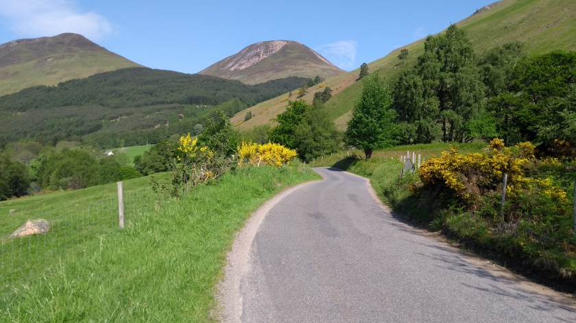
Glen Lyon, we started to see groups of cyclists racing towards us. There were literally hundreds of people cycling east down the glen and we were the only ones heading west. As we found out later they were taking part in what must have been an amazing cycle event called the Tour of the Highlands, a 3 day event covering 300 miles and all the steepest hills (and all the ski centres) in Scotland and we appeared to be tackling about 30 miles of their Day 1 route – only in reverse! After about 10 miles of the most enjoyable cycling through the glen we came to a small village called Bridge of Balgie. Here we turned left, over a small bridge (strangely enough) and onto a very narrow road that would even closer to the mountain Ben Lawers…
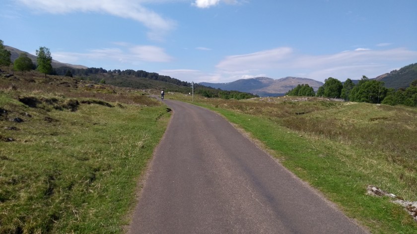
This road is another of the best cycling climbs in Scotland according to my current favourite book. It is about a 4.5 mile climb to the high point in the road at almost 600m, quite gradually uphill at first but then much steeper for a long long time as the road winds its way upwards into the mountains. It’s a really spectacular ride and the stunning views more than make up for the tired legs as you pedal ever upwards. The view of the

Tarmachan ridge was amazing and looks so close to the road. Streams of cyclists were still passing us on this road, flying down the steep hill towards Glen Lyon. The road surface wasn’t the best, rather gravelly in places so I bet it was a bit of a tricky descent for them – much easier going up (well sort of…). There’s a reservoir just past the top of the pass and I waited here for about 3 minutes until Dad finally arrived! I thought it was quite an easy hill but he obviously found it much harder. He claims he kept stopping to take photos…

On the way back down the other side of the hill the road surface is much smoother and although steeper and quite bendy, looked like a safer descent to me. The parking area for Ben Lawers was totally mobbed today because of the good weather and there were loads of cars parked on the grass verges too. We got some fine views of the mountains, including Beinn Ghlas which you climb on the way up to Ben Lawers, as we free-wheeled
down the hill. We also got our first view of Loch Tay far down below. In a couple of minutes, we’d reached the bottom and turned right onto the A827 road, heading for Killin. Although a main road, this is fairly quiet, has a good surface for cycling and is fairly flat so we were able to go at a good speed. The view of the loch and the mountains in the distance was very nice too. A few miles later we’d left Perthshire and entered Stirlingshire and soon we arrived in the town of Killin (which was crowded with tourists). Here, after about 33 miles, we had our first stop of the day and ate our lunch (sausage rolls, crisps and grapes) sitting on a rock next to the lovely Falls of Dochart.

After our tasty lunch we followed the sign for Cycle Route no.7 which is just opposite the Falls. This is a minor road which basically follows along the side of Loch Tay for 17 miles to the town of Kenmore. This road has a 40 mph speed limit to encourage walkers and cyclists and you would think that a road following a loch would be a nice easy flat ride (which would also encourage cyclists you would imagine). Well, don’t be fooled. This road is a hard cycle as there are virtually no flat sections and it is all short ups and

downs (with a few longer, steeper ups and downs as well). After our efforts of cycling over the Ben Lawers road we found this road to be the hardest part of the day strangely enough and we made slow progress. It was a very nice road though and after a few miles cycling in the trees, eventually the views of the loch and the high mountains on the other side of the water come in to view. In fact some of the best views of the day were of the five mountains of the Ben Lawers ridge about halfway along this road so it’s well worth stopping for a photo (and a rest!).

When we got to Kenmore (by now back in Perthsire again by the way), there were loads of people paddling in the loch, playing on the beach and sun bathing. We decided not to join them though and after a bit of decision making, decided to take the shortest route back to Aberfeldy, 6 miles along the A827. The first mile or so was rather steep (about 7.5% gradient) but after that it was all downhill and then flat along the side of the River Tay all the way back to the car. As usual, we decided to seek out an ice cream shop and within seconds, we found one. “Cones” in Aberfeldy is highly recommended as the amount of ice cream they gave us in a 2 scoop tub or cone was about as much as 4 scoops at any other ice cream shop! It was the perfect end to one of the best days ever. It was my first time cycling in Highland Perthshire and it certainly won’t be my last.


That looks wonderful, Rowan! What a beautiful ride – you’ve inspired us to try it!
LikeLiked by 1 person
It’s amazing, especially if you get good weather like we did. Glen Lyon is one of my favourite cycling roads so even if you don’t do the whole route you should at least go there…
LikeLike