

Route – Peebles to Lyne Station to Stobo to Drumelzier to Tweedsmuir to Cappercleuch to Crosslee to Yarrow to Traquair to Peebles. For route map click here.
See route on Strava.
- Weather – rather windy, cool and cloudy.
- Bike type – road bike
- Distance travelled – 74.95 miles
- Riding time – 5 hours 31 minutes
- Maximum speed – 34.7 mph
- Average speed – 13.6 mph
- Height climbed – 4364 feet
One of the most well known road cycling events in Scotland is the Tour o the Borders which takes place every September. It takes in the beautiful Tweed, Ettrick and Yarrow valleys and to make it even more enjoyable for the cyclists, the roads are completely closed to traffic during the event. I have wanted to take part in the “tour” for a couple of years now but unfortunately, you have to be at least 16 years old to enter so I will not be allowed for another 5 years! Dad and I have ridden most parts of the route before (sometimes in reverse) during various cycles runs we’ve had in the area, but we had never ridden the complete 75 mile circuit in one go. So, about 4 weeks ago, since I’m not able to enter in September, we set off on a sunday morning to have our own tour of the Borders.
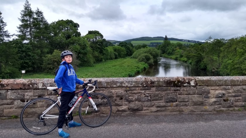
We started off from the car park next to the Eastgate Theatre in Peebles and cycled right through the town centre, turning left at the mini-roundabout and over the bridge to the other side of the River Tweed. We then immediately turned right off the main road, right again soon after and then a quick left onto Bonnington Road. This road soon took us out of the residential zone and into the lovely Borders coutryside, passing Cademuir Hill on the right, cycling right around the hill into the Tweed Valley, following the Manor Water to the point where it meets the River Tweed. The grand old bridge is a fine point for a scenic photo so we stopped there briefly before tackling a short but very steep climb up to the junction with the A72.
The A72 is relatively quiet as far as “A” roads go so we went left and basically followed the course of the Tweed for quite a while. We weren’t on the main road for long before we reached Lyne Station, and turned off onto a single track road which quickly took us to the B712. As I mentioned in a previous blog, this is one of the nicest roads you can cycle on. It’s mostly straight, smooth and slightly downhill, with very little traffic and amazing views of the River Tweed, the woodlands, fields and hills all around. After a wee while, we turned right onto a much narrower road and immediately started going uphill. This hill is known as the Dreva climb and is the first of 5 main climbs on the route. It’s a

relatively easy gradient and doesn’t last too long. On the way up you get some of the best views of the Tweed Valley, so Dad took quite a few photos as I raced ahead. At the top, we turned left at a junction and sped down the hill into the valley once more and soon came to a junction with the B712 once again. It would have been much easier to just stay on the B712 all the way, but the Dreva climb was really nice so I didn’t mind at all. In fact, I’m starting to really enjoy going up long steep hills so this one barely even made me break sweat…!

The B712 soon took us to the junction with our 2nd main road of the day, the A701. This road doesn’t have a very nice surface for cycling as it’s rather worn out and bumpy and there’s a lot of pot holes to avoid along the way. However, the scenery is stunning and it’s not all that busy really. It’s also mainly quite flat with only a few short, easy hills along the way as it follows the ever narrowing River Tweed through the Border hills towards its source about 15 miles to the south. We were only going about 7 miles though and turned off into the village of Tweedsmuir. It was here, as we crossed a hump-backed bridge over the Tweed, that we first spotted a yellow Cycle Event sign pointing in the direction we were travelling. It wasn’t the Tour o the Borders but perhaps we’d accidentally found ourselves in some other cycling sportive – who knew?! We hadn’t seen any other cyclists though so perhaps we were even in the lead!

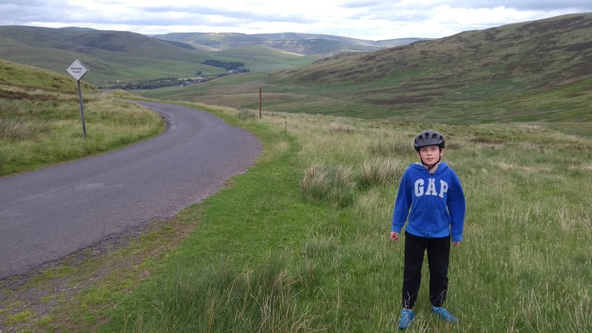
Anyway, we followed the yellow sign along the single track road into the hills, climbing gradually up to the Talla Reservoir. With the steep slopes of the hills going straight down into the water, it almost looks like a Norwegian Fjord – so Dad said. I’m sure he must be right (he usually is!). After and easy mile or 2 of flat riding along the water side, we turned the corner around the head of the reservoir and immediately saw the 20% sign which told us of the steep climb coming up – the infamous Wall of Talla. We did this climb a few weeks before and I’d found it very hard but this time, possibly because I knew what to expect, the very steep slopes didn’t seem too bad and I managed to keep cycling at a reasonable speed all that way to the top, leaving Dad floundering miles behind

(stopping to enjoy the view of the Talla Reservoir down below no doubt). About halfway up, the first group of cyclists from the event caught us up. One of them commented that this was “brutal” as he pedalled slowly past, not going that much quicker that I was. The second half of the climb was much easier than the first and before too long, I had made it to the top where I had to wait for quite a long time until Dad eventually appeared (with his phone full of pictures no doubt). I’d already had my rest so after allowing him a quick drink, I made Dad keep going and we sped down the long gradual hill for a few miles to

the Megget Reservoir which looks like it would be a nice place to stop for a picnic on a sunny day. We kept going though and after a few short ups and downs, we enjoyed a magnificent, long and fast descent all the way down to Cappercleuch on the shores of St Mary’s Loch.
There we turned left onto the A708, still following the cycle event signs. Just around the corner we discovered a feeding station for the event cyclists, and for a minute we considered chancing our arm and stopping for a free feed. In the Tour o the Borders, they apparently supply the riders with quality macaroni pies (my favourite!) but today, the feed stop looked rather more basic and there were no pies to be seen so we decided to give it a miss… After a quick ride along the side of the loch and then a short uphill then downhill section on the quiet main road, we arrived at a crossroads next to the Gordon Arms hotel. In the “Tour”, the short route turns left here and heads back to Peebles, but the long route turns right, and takes you through some of the most scenic (and hilly) parts of the Borders. After a quick lunch of oatcakes and crisps we took the long way and so did today’s cycle event. This section of the B709 is extremely nice, with basically no traffic, and it climbs very gradually up to well over 300 m so the views are great. It is known as the Berry Bush climb, possibly because of all the wild blueberry bushes growing along the side of the road. Along this section we actually caught up with one of the slower cyclists taking part in the event and she told us it was a 100 mile sportive starting and finishing in Langholm – so she still had a long way to go to get to the finish but at least it would be more downhill than up for the rest of the day…

After a fast descent down the other side of Berry Bush, we soon arrived in the Ettrick Valley where we turned left onto the B7007, leaving the yellow signs of the cycle event behind at last. This is one of my favourite roads and was one of the easiest parts of the day. It’s a nice surface for cycling on, mainly flat or slightly downhill and the views of the hills and the river valley are lovely. You rarely see any cars on this road either so it’s

pretty much perfect. After about 8 or so easy miles, we turned left onto a minor road which leads away from the valley and up into the hills again. This hill is known as Witchy Knowe and the road soon starts climbing quite steeply as it twists and turns its way upwards. There are crash barriers along the roadside which really emphasises how steep some of the corners are and the views back down to the Ettrick Valley are amazing. As is becoming the norm on hill climbs, Dad was starting to struggle so I left him behind and headed up the hill as fast as I could. I think I waited at the top for 5 minutes before he finally got there, gasping for a Yorkie bar… The view down the other side of the hill to the Yarrow Valley is even better than the views on the side we had cycled up and the descent down the hill was, despite the cattle grids, very fast and a lot of fun.
At the bottom of the hill we turned left onto the A708 once again and cycled back along the Yarrow valley towards the Gordon Arms. It was only slightly uphill but all into the strong wind so we found these 4 or 5 miles quite hard and it was slow going for while. But after a quick banana beside the hotel, we felt re-energised and set off up the last big hill of the day, the Mount Benger climb on the B709. This is a road we’d cycled on lots of times but always in the other direction. Today, the climb seemed rather easy. It was only about 2% gradient and we were able to go at well over 10mph most of the way up in quite a high gear. We spotted a lot of wild blueberry bushes along the side of the road once again – sadly none ready to east though. After a quick photo at the top, we then had a great time freewheeling all the way down the other side to Traquair. Be careful on the way down though as the road surface isn’t the best and you’ll need to stay near the middle of the road to avoid the pot holes. At least we didn’t have very many cars to avoid though…

At Traquair, we turned left onto the B7062 for the last 7 miles back to Peebles. This is mainly flat or slightly downhill, following the River Tweed all the way, in and out of the trees. A mile or 2 outside Peebles however, there was one last sting in the tail with a rather steep and unexpected uphill section. It was the last thing we needed after over 70 miles but at least it wasn’t uphill for too long. It was though, possibly the hardest hill of the day! Or maybe we were just tired… Whatever, we were soon back in Peebles filling our faces with ice cream (2 scoops of course). The perfect end to a perfect tour of the Borders.


