

Route – Stow to Lauder to Blainslie to Langshaw to Galashiels to Clovenfords to Stow. For route map click here.
See route on Strava.
- Weather – Mainly sunny and a bit hazy later on. Quite warm and a light breeze.
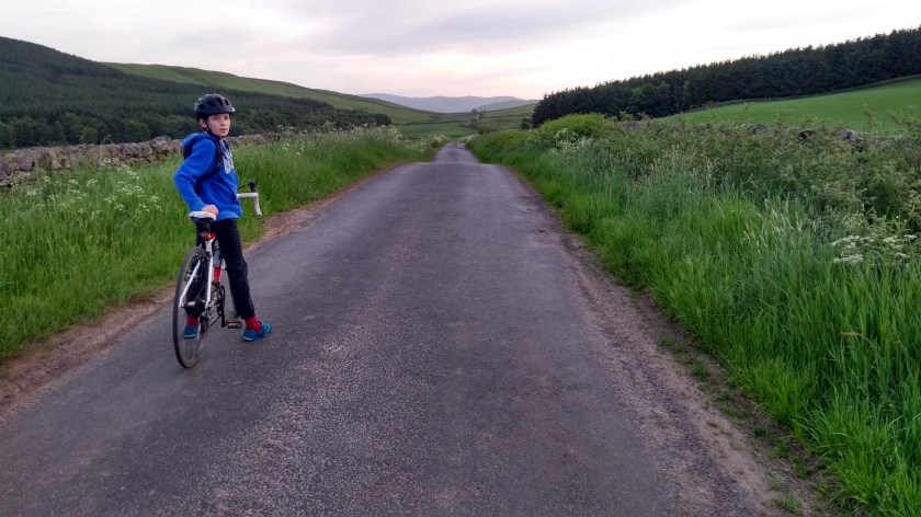
- Bike type – Road bike
- Distance travelled – 29.54 miles
- Riding time – 2 hours 27 minutes
- Maximum speed – 32 mph
- Average speed – 12.1 mph
- Height climbed – 2741 feet
Dad and I have been going out cycling in the evenings quite a lot recently as the weather has been really good (mostly anyway). One day we had an early tea and then drove down the road to Stow in the Scottish Borders to attempt one of the hilliest routes you could possibly imagine…
We parked the car at the train station and cycled down the hill, over the Gala Water where we got a lovely view of the church, crossed over the main A7 road and on to the B6362. Straight away we passed a sign warning of a 15% gradient ahead and as we turned the corner to leave the village behind, the road really did start to climb steeply. By the time we’d reached a patch of trees a few hundred yards up the hill, it really did start to feel like 15%. Dad, as usual, kept stopping for photos and I soon left him far behind as I pedalled as fast as I could in gear 1, around another bend and then out of the trees and back into the sunshine. From there onwards, the climb wasn’t nearly so steep and in fact, seemed quite easy as I sped up the gradual slope into what is known locally as Lauder Common. The road really does go right over the top of the hill so you get an incredible view in all directions. We could see the Eildon Hills on the right and the Lammermuirs straight ahead. I waited at the top for a few minutes until Dad finally appeared (too many photos obviously). Then we took off down the other side of the hill, a very fast and fun couple of miles down to the town of Lauder.

In Lauder we turned right and had to negotiate the rather busy A68 road for about half a mile. Thankfully most of this was through the town so was in a 30 mph zone and it was perfectly safe. Just after leaving town, we turned right onto a minor road to escape the traffic. Just there, dad spotted a rather nice looking cycle path with a good surface that appeared to go all the way back to Lauder, so it looks as though we could have avoided the main road. We will have to investigate this another day. Anyway, the minor road was quiet and took us through some peaceful Borders countryside with lots of trees and fields. There were lots of long straight sections, quite a few short uphills and some long downhills so it was quite a pleasant and interesting road to cycle on. What made it even more interesting is that it passed through several small settlements, all of which contain the word Blainslie in their name…

After passing through all the Blainslie’s we turned right at a signpost for Langshaw. This took us onto an unexpectedly steep narrow road which seemed to go straight up for ages. It seemed much harder than the 15% hill we climbed going out of Stow but at least the view back down to the valley below was quite nice. At the top we passed some signs for the Southern Upland Way (which is a long distance walking route through the Borders) and we enjoyed some lovely views of the hills in the distance. The road then went very steeply downhill. It was very fast for a mile or 2 and there were a few sharp corners to negotiate so we had to be very careful. We also had to try and avoid a group of cyclists puffing their way up the hill – it actually looked much harder than the other side that we had climbed!
At the bottom of the hill we came to Langshaw which is little more than a few houses and a farm. There we turned right and after a few hundred yards we took the next left onto another single track road. It was uphill once again but this time it was a much more gradual climb along the deserted and very scenic road. Soon enough we were speeding back down the other side of the hill, past some farms again and taking care not to go too fast on the sharp bends. This road came out at the main A7 road where we went left. There was no way to avoid the half mile or so in the traffic but it was downhill and very fast all the way to (and through) Galashiels. The road was a bit bumpy though so it was not the most pleasant road to cycle so fast. When we came to a mini roundabout just before the train station, we went right around the roundabout and headed back in the same direction we had come from – only this time we joined onto a very nice new cycle path called the Clovenfords Link. Apart from a short section, it was all off road for the 4 miles or so to Clovenfords and was a very pleasant ride. Unlike the rest of this route, it was mostly quite flat and for the last 2 miles or so it made use of a shared use path along the side of the main A72 road. As we neared the village, it became slightly downhill and we free-wheeled the rest of the way there.

We turned right at the roundabout and headed straight up yet another long and steep hill on the B710 as we left Clovenfords behind. Although steep, it was much easier than some of the other hills we’d cycled up so far. At the top of the hill we turned left onto a very narrow, very quiet back road that took us through some on the nicest scenery in the Borders. It was mostly uphill of course but quite gradual for once, and the view of the setting sun shining onto a small reservoir near the top of the hill was very nice. We met some horses on the way up and then on the way back down the hill we ended up chasing a hare along the road at about 30 mph. We were too fast for the hare so before being overtaken, it decided to get out of the way and jumped straight off the road and up and over a 5 foot high wall. It was really quite an impressive leap for a small animal. For a minute there Dad was almost convinced it was a kangaroo…! After that we had an amazingly fast descent (be careful on the corners though), then had to slow down to a crawl because some sheep were blocking the road and refusing to move. Eventually, some ladies came out from a nearby house and rounded them up into a field and we were able to cycle the last mile or 2 back to the car in Stow in peace.
It had been less than 30 miles, but with nearly 3000 feet of climbing (as much as you’d expect to do in 50 or 60 miles), this was by far our hardest cycle route to date. It was definitely one of my favourites though and I’d highly recommend it.


