Tour de Galloway day 5: Machars Meander

Route – Newton Stewart to Wigtown to Bladnoch to Kirkinner to Garlieston to Sorbie to Whauphill to Culmalzie to Newton Stewart. For route map click here.

See route on Strava.

  • Weather – dry, mainly sunny and quite warm with very little wind.
  • Bike type – road bike
  • Distance travelled – 34.59 miles
  • Riding time – 2 hours 22 minutes
  • Maximum speed – 27.7 mph
  • Average speed – 14.7 mph
  • Height climbed – 1257 feet

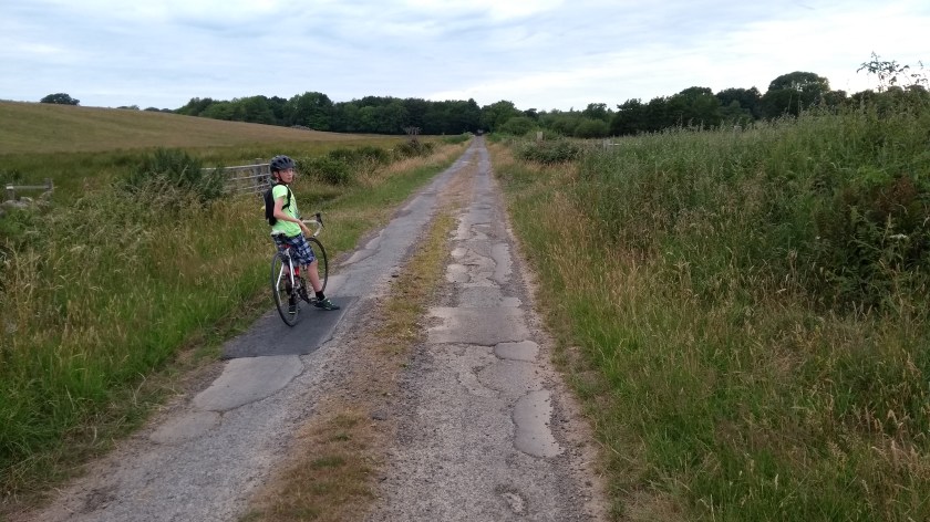
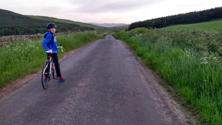
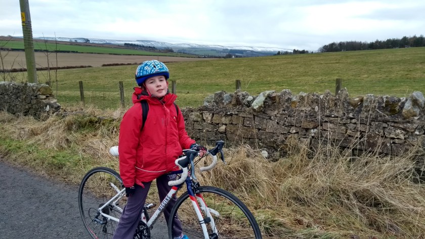
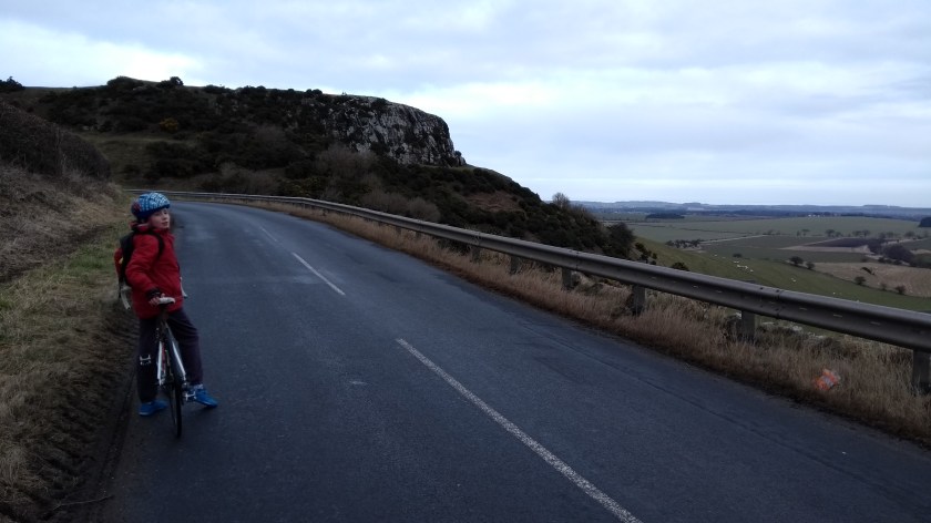
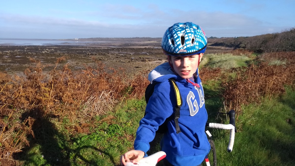
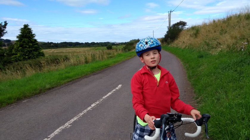
Because of the rubbish weather and dark evenings it has been really hard to get out cycling recently. However, this afternoon Dad and I finally managed to get out for our first cycle ride in 3 weeks. Unfortunately, it rained for most of the 3 hours we were out and it turned out to be a rather grim plod. Much less grim, however, was our summer holiday this July when the weather was lovely and it was light till late in the evening and we were able to go cycling everyday. On day 5 of our Tour de Galloway, after enjoying a nice day at the beach, we managed to get our bikes out after teatime to go for a meander through The Machars…

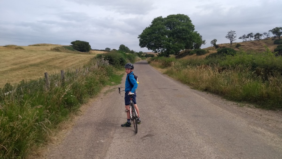
The Machars is the name of the peninsula to the south of Newton Stewart in Galloway and it is made up of a mainly quite flat rural landscape with picturesque little villages dotted around the coast. Our route began with a quick 6 mile blast down the minor road from Nether Barr to Wigtown which we’ve written about previously. After a short ride through the town centre we turned left onto the A714 road and sped down the slight slope at around 25 mph for the mile or so to the distillery at Bladnoch. The main road was fairly quiet but after crossing the impressive bridge over the River Bladnoch, we decided to turn left onto an even quieter back road which took us under an ancient,

IMG_20180711_181705030

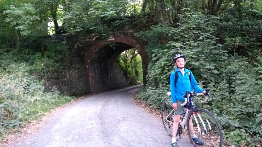
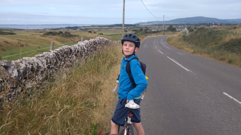
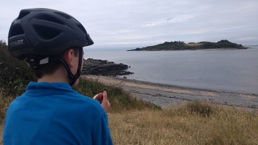
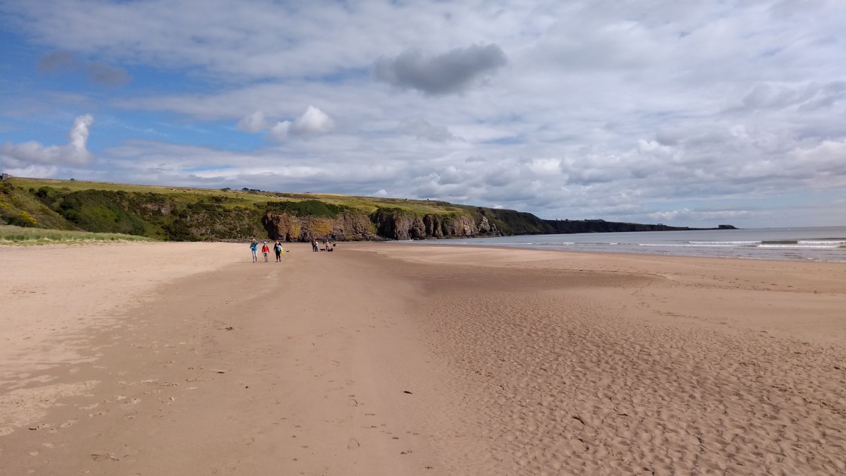
overgrown railway bridge and through the middle of nowhere for a couple of miles before looping back around to the main road again. It was kind of a pointless long cut but we like long cuts and if there’s a chance to avoid a main road, we usually take it! On the A road we went left and headed south for a while on the mostly flat, fast and smooth road, passing through a couple of small villages on the way. Shortly after Kirkinner, we turned left onto the B7004. This road is the longest, straightest road I’ve ever been on and was slightly downhill all the way to the coastal village of Garlieston so we raced the 4 miles there in no time at all. Or at least it would have been quick if Dad hadn’t kept stopping to take photos along the way. I suppose it was quite a scenic ride as we passed in and out of the trees on our way to the coast. We stopped at the harbour to enjoy the views over the mud flats of Garlieston Bay bathed in evening sunshine.

IMG_20180711_184638887

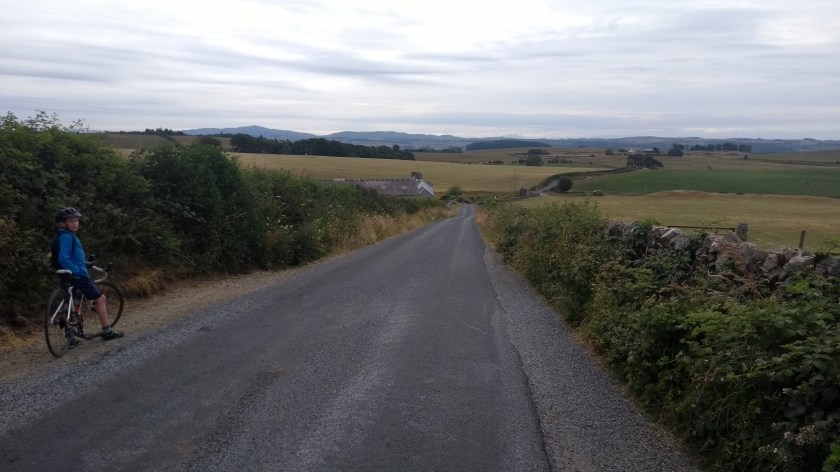
After that we headed west along the B7004 again but soon turned off onto the B7052 and headed generally west again for a few miles through pretty much deserted but picturesque Machars countryside on a road that varied from amazingly smooth to terribly bumpy to anything in between. This seems to be typical of most of the roads in Galloway so it’s always wise to keep your eyes pealed so you can try to avoid the worst of the bumps and potholes…

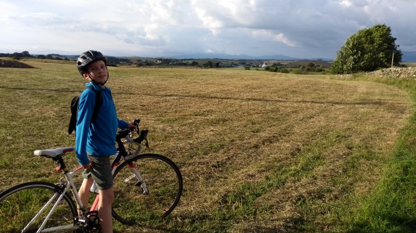
When we reached the village of Sorbie, we turned right and headed north on the A746 for a short distance before turning back onto the B7052 again, heading generally north-west for many miles. We saw no traffic at all for what seemed like hours as we cycled through the sun-drenched countryside. In fact it seemed spookily quiet. It was as if everyone had stayed indoors to watch the England v Croatia semi-final of the World Cup which was being played that evening – when they could have been out cycling, enjoying the beautiful countryside and weather! Anyway, we eventually reached Culmalzie where we turned right briefly before heading more or less north again for a long time through a deserted landscape of endless cow fields with the Galloway hills far away in the distance.

IMG_20180711_193023244

England were already 1-0 up by the time we came to a junction with the B733 road. Here we went right for half a mile before turning left onto a very narrow road that was covered in loose chippings. It wasn’t the nicest road to cycle on but it also took us up the only real hill of the day so it was actually a pleasant change from all the easy, flat roads we’d been on for the rest of the trip. We were heading north-east for the final few miles back to Nether Barr with the late evening sun starting to set. Unfortuanely, I realised that one of my tyres had a puncture so we had to stop and Dad spent an age changing the inner tube. By this time, Croatia had equalised so we took off back down a rather steep hill towards the junction with the A714 road again. Speeding down the rather bumpy narrow road we enjoyed amazing views of the Cairnsmore of Fleet hill straight ahead, towering above the otherwise fairly flat landscape. It looks like it would be a fine hill to climb one day and probably has brilliant views from the top.

IMG_20180711_203326804

So, after a quick half mile on the main road back to our accomodation in the fading daylight, we had made it back in time to watch the extra time period of the England v Croatia match. Sadly for England, they experienced Scotland-like glorious failure as Croatia scored with 10 minutes to go to reach their first ever World Cup final…

Dad and I normally prefer slighty more challenging and hilly cycle routes but our easy meander through the Machars in the evening sunshine was very enjoyable and highly recommended.

Tour de Galloway day 4: Gatehouse of Fleet to Kirkcudbright

Route – Gatehouse of Fleet to Kirkcudbright to Borgue to Carrick Bay to Gatehouse of Fleet. For route map click here.

See route on Strava.

  • Weather – fairly cloudy but bright and reasonably warm with light winds.
  • Bike type – road bike
  • Distance travelled – 25.29 miles
  • Riding time – 1 hour 54 minutes
  • Maximum speed – 31.1 mph
  • Average speed – 13.3 mph
  • Height climbed – 1290 feet

On day 4 of our summer holiday in Galloway, Dad and I were up reasonably early and drove the 20 miles or so to the picturesque little town of Gatehouse of Fleet. We parked on the appropriately named Fleet Street in the outskirts and set off on our bikes, cycling north-eastwards through the town centre for a short distance, crossing a bridge over the Water of Fleet before heading out of town on the B727 Old Military Road. Although it didn’t look it, our legs told us this road was suspiciously uphill as it turned the corner and took us back southwards with trees on both sides of the road. A mile or so later we turned left onto a very narrow country road which headed even more steeply uphill. The road had recently been covered with loose chippings so it wasn’t the most pleasant ride up the hill but we made it to the top soon enough. From there we could see the sea far way on the right – and that’s exactly where we were headed. But first we discovered we had some dangers to negociate on what should have been a lovely quiet road in the middle of nowhere. Tractors! And there was seemingly a constant stream of the massive

IMG_20180710_092245871

farm vehicles carrying trailers full of silage to and from the farm at the top of the hill. This was extremely annoying as each time a tractor flew around a corner, we had to move quickly over and stop on the grass verge to avoid being flattened. I would say this was the busiest and most dangerous road I’ve ever cycled on and it came as a bit of a relief when we finally made it down the other side of the hill and came to a junction with what was seemingly now only the second busiest road in the region – the A75!

We actually only cycled on the main road for about 20 yards before turning off onto another minor road (this one very quiet thankfully) and headed mainly downhill on our way to the coast. Eventually we came to another main road, the A755. Here we turned left and sped down the hill for a mile or so to Kirkcudbright, crossing over the impressive old bridge as we entered the harbour town. Kirkcudbright is a lovely town with a brilliant fish and chip shop but it was too early for a fish cake supper so we turned around and headed back over the bridge again. Then we took the next left onto the B727

IMG_20180710_094650239

and followed the signs for Cycle Route no.7 which took us right along the side of the River Dee estuary, giving us picturesque views back over the bay to Kirkcudbright. This road was quite windy and although there were no big hills, it was rather more up and down than you’d expect for a coastal road. It was also quite busy with traffic at times, though no tractors this time… After a while the road took us back inland and we reached a village called Borgue. There we turned left onto a much quieter, mostly single track road which seemed to take us mainly downhill as we headed back towards the coast again. The views over to the islands in the bay and the hills of Galloway far beyond

IMG_20180710_101055111

were quite nice. Eventually we arrived at a junction and went left at the sign for the beach and cycled the last mile or so along a bumpy narrow road down to Carrick Bay where we stopped for a snack and to enjoy the views from the beach. Carrick Bay is one the nicest beaches I’ve been to. It’s quite a stony beach but there’s lots of sand when the tide goes out. In fact, when we were there earlier in the holiday, the tide was right out and we were able to walk through the shallow water and mud flats all the way over to one of the islands. There’s also loads of rock pools there and this is the only beach where we’ve ever seen live prawns swimming about in the pools. As Dad discovered though, they are impossible to catch! He did catch a tiny crab though…

IMG_20180710_102952004

After the beach we headed back along to the junction and turned left onto the quiet road again. The road took us past many fields of cows and then we passed the Cream o’ Galloway visitor centre where we considered stopping for an ice cream but somehow or other, we managed to simply cycle past without filling our faces with a scoop or 2. Most unlike us… Soon enough we came to a long and straight section of narrow road with lots of long grass at the sides. There was a sign warning that the road was liable to flooding but thankfully, it was dry enough today and we didn’t have to do any swimming… Just before the road reached the busy A75 again, we turned left and followed the cycle route 7 signpost which took us off road onto a lovely smooth cycle path. It wasn’t smooth for long though as the path headed into the woods and turned into a rather less lovely

IMG_20180710_110853962

rough, slightly overgrown forest path. We kept going anyway but it was really quite bumpy and not at all suitable for our road bikes. Thankfully, we made it back to Gatehouse of Fleet without crashing or having any punctures. Actually, it was lucky we took the bumpy route as it meant we cycled right through the very impressive Cally Palace Hotel and Golf Course before heading back through the town to the car, so it turned out to be a rather nice way to end a very nice circular route.

Tour de Galloway day 1: Newton Stewart to Wigtown Loop

Route – Newton Stewart to Wigtown to Challoch to Newton Stewart. For route map click here.

See route on Strava.

  • Weather – Sunny at first, then clouding over. Warm with light winds.
  • Bike Type – Road bike
  • Distance travelled – 23.27 miles
  • Riding time – 1 hour 31 minutes
  • Maximum speed – 27.7 mph
  • Average speed – 15.3 mph
  • Height climbed – 832 feet

For our summer holidays this year we went to Dumfries and Galloway in the south-west of Scotland. We stayed in very nice self-catering accomodation at Nether Barr just outside the town of Newton Stewart and since the weather forecast looked good for the whole week, we decided to bring our bikes. There’s lots of other things to do in Dumfries and Galloway apart from riding a bike (going to the beach was my favourite activity!) but I was still determined to make sure I got out cycling everyday of the holidays, even if just for a short ride. Dad came up with the suggestion that since the Tour de France had just started, we should have our very own “Tour de Galloway”, so after tea on our first evening we headed rode off into the sunshine to begin the first stage of the Tour…

IMG_20180707_184742978

National Cycle Route no.73 goes right past Nether Barr so we followed that south all the way to Wigtown. At first you have a choice of the A714 road or a shared use path. The path looked a bit gravelly is places and the road seemed fairly quiet so we chose that for the first half mile or so. We then turned left onto a very narrow, virtually traffic-free road which took us down very close to the River Cree estuary and then the Sound of Fleet. Along the way we enjoyed great views of the impressive looking hill called Cairnsmore of Fleet on the other side of the water, as well as a view of the higher mountains in the Galloway Forest Park behind us. The road was very straight and almost completely flat so we were able to go very fast along here. However, the surface varied from nice and smooth to very bumpy with grass growing down the middle of the road. This was pretty typical of most of the roads we cycled on in the area – they were either brilliant or horrendous, with nothing in between! Anyway, after 5 or 6 flat miles we came to our first hill of the day, a rather steep but short climb which took us up into the town of Wigtown.

IMG_20180707_191000907_HDR

Wigtown is famous for being Scotland’s book town. There’s loads of nice book shops here – even all the cafes sell books too – but they were all closed for the day so we just cycled through the town centre and then out into the countryside again on the B733 road. This road was very quiet, was mainly quite flat with just a few short ups and downs and took us past countless fields of cows (there seem to be cows everywhere down here!). After a while, we came to a sign for Newton Stewart and followed it, turning right onto a very narrow back road which took us through some rather remote land (and more cow fields), climbing relatively high up at first and then gradually descending down the other side of the small hill. The views to the hills in the north were very nice as we sped down the hill. This road had been covered in loose chippings not to long ago so although it wasn’t bumpy, it wasn’t really the nicest road to cycle on with a road bike.

IMG_20180707_200249179

Before too long we reached a junction with the busiest main road in the area, the A75. We could have turned right and taken the main road a mile or so back to our accomodation. But we like a long cut so we crossed straight over onto what Google Maps says is an old military road. The road surface was certainly old and worn out with very poorly filled in pot holes all along the way. The line of grass along the middle was at times wider than the remaining tarmac! This road was long and straight and totally flat (apart from the bumps…) and it seemed like the road to nowhere as there’s no places along the way, just trees and fields and millions of rabbits. At one point we began to wonder if the road would ever end. Eventually it did though and we turned right onto the B7027, speeding down the hill for the short distance until we joined the A714 once more. This road took us mostly downhill the last mile or so to Newton Stewart. It was especially fast just as we entered the town and speed sensor warned us that we were going 30 mph. Then we had an unexpectedly steep hill to climb through the town centre before heading back out of the town. At the outskirts we had to cross the roundabout on the A75 road which we could have passed through much earlier if we hadn’t taken the long, wacky, bumpy back road. A long, wacky, bumpy back road way is always much more enjoyable than a mile of a busy road though – don’t you agree?

So after one last little sprint south along the A714, we arrived back at Nether Barr. Our first impressions of Galloway is that it’s a lot less hilly than Midlothian and the Borders but it was still a very pleasant, extremely quiet and scenic place to place to cycle. Once the bikes were packed away, I immediately got out my map to start planning the route for day 2 of the Tour de Galloway…

Stow to Galashiels (the hilliest way possible)

Route – Stow to Lauder to Blainslie to Langshaw to Galashiels to Clovenfords to Stow. For route map click here.

See route on Strava.

  • Weather – Mainly sunny and a bit hazy later on. Quite warm and a light breeze.
  • Bike type – Road bike
  • Distance travelled – 29.54 miles
  • Riding time – 2 hours 27 minutes
  • Maximum speed – 32 mph
  • Average speed – 12.1 mph
  • Height climbed – 2741 feet

Dad and I have been going out cycling in the evenings quite a lot recently as the weather has been really good (mostly anyway). One day we had an early tea and then drove down the road to Stow in the Scottish Borders to attempt one of the hilliest routes you could possibly imagine…

We parked the car at the train station and cycled down the hill, over the Gala Water where we got a lovely view of the church, crossed over the main A7 road and on to the B6362. Straight away we passed a sign warning of a 15% gradient ahead and as we turned the corner to leave the village behind, the road really did start to climb steeply. By the time we’d reached a patch of trees a few hundred yards up the hill, it really did start to feel like 15%. Dad, as usual, kept stopping for photos and I soon left him far behind as I pedalled as fast as I could in gear 1, around another bend and then out of the trees and back into the sunshine. From there onwards, the climb wasn’t nearly so steep and in fact, seemed quite easy as I sped up the gradual slope into what is known locally as Lauder Common. The road really does go right over the top of the hill so you get an incredible view in all directions. We could see the Eildon Hills on the right and the Lammermuirs straight ahead. I waited at the top for a few minutes until Dad finally appeared (too many photos obviously). Then we took off down the other side of the hill, a very fast and fun couple of miles down to the town of Lauder.

IMG_20180605_184455230

In Lauder we turned right and had to negotiate the rather busy A68 road for about half a mile. Thankfully most of this was through the town so was in a 30 mph zone and it was perfectly safe. Just after leaving town, we turned right onto a minor road to escape the traffic. Just there, dad spotted a rather nice looking cycle path with a good surface that appeared to go all the way back to Lauder, so it looks as though we could have avoided the main road. We will have to investigate this another day. Anyway, the minor road was quiet and took us through some peaceful Borders countryside with lots of trees and fields. There were lots of long straight sections, quite a few short uphills and some long downhills so it was quite a pleasant and interesting road to cycle on. What made it even more interesting is that it passed through several small settlements, all of which contain the word Blainslie in their name…

IMG_20180605_185721750_HDR

After passing through all the Blainslie’s we turned right at a signpost for Langshaw. This took us onto an unexpectedly steep narrow road which seemed to go straight up for ages. It seemed much harder than the 15% hill we climbed going out of Stow but at least the view back down to the valley below was quite nice. At the top we passed some signs for the Southern Upland Way (which is a long distance walking route through the Borders) and we enjoyed some lovely views of the hills in the distance. The road then went very steeply downhill. It was very fast for a mile or 2 and there were a few sharp corners to negotiate so we had to be very careful. We also had to try and avoid a group of cyclists puffing their way up the hill – it actually looked much harder than the other side that we had climbed!

IMG_20180605_194351818_HDR

At the bottom of the hill we came to Langshaw which is little more than a few houses and a farm. There we turned right and after a few hundred yards we took the next left onto another single track road. It was uphill once again but this time it was a much more gradual climb along the deserted and very scenic road. Soon enough we were speeding back down the other side of the hill, past some farms again and taking care not to go too fast on the sharp bends. This road came out at the main A7 road where we went left. There was no way to avoid the half mile or so in the traffic  but it was downhill and very fast all the way to (and through) Galashiels. The road was a bit bumpy though so it was not the most pleasant road to cycle so fast. When we came to a mini roundabout just before the train station, we went right around the roundabout and headed back in the same direction we had come from – only this time we joined onto a very nice new cycle path called the Clovenfords Link. Apart from a short section, it was all off road for the 4 miles or so to Clovenfords and was a very pleasant ride. Unlike the rest of this route, it was mostly quite flat and for the last 2 miles or so it made use of a shared use path along the side of the main A72 road. As we neared the village, it became slightly downhill and we free-wheeled the rest of the way there.

IMG_20180605_204449466

We turned right at the roundabout and headed straight up yet another long and steep hill on the B710 as we left Clovenfords behind. Although steep, it was much easier than some of the other hills we’d cycled up so far. At the top of the hill we turned left onto a very narrow, very quiet back road that took us through some on the nicest scenery in the Borders. It was mostly uphill of course but quite gradual for once, and the view of the setting sun shining onto a small reservoir near the top of the hill was very nice. We met some horses on the way up and then on the way back down the hill we ended up chasing a hare along the road at about 30 mph. We were too fast for the hare so before being overtaken, it decided to get out of the way and jumped straight off the road and up and over a 5 foot high wall. It was really quite an impressive leap for a small animal. For a minute there Dad was almost convinced it was a kangaroo…! After that we had an amazingly fast descent (be careful on the corners though), then had to slow down to a crawl because some sheep were blocking the road and refusing to move. Eventually, some ladies came out from a nearby house and rounded them up into a field and we were able to cycle the last mile or 2 back to the car in Stow in peace.

It had been less than 30 miles, but with nearly 3000 feet of climbing (as much as you’d expect to do in 50 or 60 miles), this was by far our hardest cycle route to date. It was definitely one of my favourites though and I’d highly recommend it.

Ettrick Valley Circular Route

Route – Ettrickbridge to Ashkirk to Alemoor Reservoir to Tushielaw to Ettrickbridge. For route map click here.

See route on Strava.

  • Weather – Sunny and reasonably warm with only a slight breeze.
  • Bike type – road bike
  • Distance travelled – 31.74 miles
  • Riding time – 2 hours 42 minutes
  • Maximum speed – 32.2 mph
  • Average speed – 11.8 mph
  • Height climbed – 2116 feet

A while ago, Dad discovered a really nice cycle route in the Borders and he kept telling me it was his favourite route ever. Eventually I gave in to his pestering and agreed to try it out – and he was right, we had an amazing day out in one of the most beautiful parts of Scotland.

The route starts in the village of Ettickbridge, about 5 miles from Selkirk, one of the main towns in the Scottish Borders. As the name suggests, it is located right next to the Ettrick Water and we immediately crossed a bridge over the river and headed East along the Ettrick Valley. The valley is extremely picturesque and the views got even better as the quiet road climbed gradually uphill for a mile or so. Soon enough, we turned right off the “main” road and onto a very narrow minor road (signposted for Ashkirk). As we approached the turn off, the minor road appeared impossibly steep but Dad told me that it looks a lot worse than it is – and he was right. I even sped away ahead of Dad at this point, stopping only so we could get a photo of the view behind us. The road flattens out for a short distance before climbing steeply again after another right turn, heading up and up and up, with the views of the hills all around getting better all the time. There were even some snow patches next to the roadside, that’s how high up this road was and Dad was convinced he spotted a Golden Eagle as well (I’m sure it was just a Buzzard though…). We actually cycled this way around the same time last year when we stopped here to roll our Easter eggs. This time, we stopped at the cattle grid right at the highest point on the road and had a quick snack – not boiled eggs this time but carrot sticks and celery!

IMG_20180324_105200374

The next few miles are basically all downhill until the village of Ashkirk. The road has a nice smooth surface and is very quiet but there are quite a few sharp corners and it is quite steep so we had to be careful not to go too fast at times. Along the way, we had a nice view as far as the snow covered Cheviot Hills just over the border in England. We turned right in Ashkirk and cycled along the side of a river, through the trees and past a golf course for a couple of easy miles before the next steep hill of the day. It was quite a long but reasonably gradual climb which took us up to a very high and remote part of the Borders. After crossing another cattle grid, the views of the hills and the valley below really open up and the cycling was also brilliant: along here you get a few miles of easy, fast, slightly up and down high level riding. It’s probably one of my favourite sections of road anywhere. At the end of the high section, there’s yet another cattle grid so we stopped here for an early lunch. This time we did have some boiled eggs, along with oatcakes, cheese and Parma ham…

IMG_20180324_115143117

After the cattle grid the road forks into two. We chose the right option and sped down the long gradual hill for ages, enjoying the amazing scenery all around us. We saw some amazing Beech trees and some lovely horses ran over to see us at one point. Soon enough we got to the bottom of the hill at the junction with the B711 road near Roberton. We turned right and then almost immediately turned right once more, staying on the B711. This road goes steeply uphill straight away but it was worth it as the views behind us to the South were incredible. The Cheviot (the highest of the Cheviot Hills) could clearly be seen from here. From the top of the hill, the next 10 miles or so are fairly easy, mainly quite flat and the road has a nice new surface in places. It takes you through some of the remotest parts of the Borders, following a small river through the hills, with really no settlements along the way apart from a couple of farms. I bet it is very bleak in a snow storm (and there were many remnants of snow drifts to be seen today) but on a warm sunny day like today it was extremely nice. Alemoor Reservoir is particularly peaceful and well worth stopping to enjoy the view. Also, as you cycle along, keep your eye open for the ancient stone signpost which tells you it is 9 miles to Hawick.

IMG_20180324_125659092_BURST001

Eventually, we reached the end of the road and reached the Ettrick Valley once more, crossing another bridge over the Ettrick Water at Tushielaw (which is little more than a couple of houses, a hotel and a farm) and turning right onto the B709. After a few hundred yards the B709 turns left and heads uphill, heading for the Yarrow Valley. We went straight on though, onto the B7009 which took us through the Ettrick Valley for the final 8 miles or so back to the car in Etrrickbridge. It’s possible that this is my favourite road for cycling on ever (even better than the high road earlier on today). It is so pleasant for cycling on: the views of the hills and valley are stunning; the road surface is good; there are no real hills, just a few undulations and it is mainly slightly downhill and very fast; and incredibly, the road is almost completely traffic free. If you think this route might be too long and hilly for you, you should at least make sure you cycle along some of the Ettrick Valley on the B7009 – it is amazing and you won’t be disappointed.

IMG_20180324_134941888


Cycling in the Snow

Route – Gorebridge to Crichton to Tynehead to Heriot to Middleton to Carrington to Gorebridge. For route map click here.

See route on Strava.

  • Weather – Dry, reasonably mild, some sun, some cloud, some mist and no wind.
  • Bike type – road bike
  • Distance travelled – 27.54 miles
  • Riding time – 2 hours 26 minutes
  • Maximum speed – 27.1 mph
  • Average speed – 11.3 mph
  • Height climbed – 1887 feet

In my previous blog I mentioned how difficult it had been to get out on our bikes this winter due to the constantly cold, icy and snowy weather. Well, at the end of February and the start of March we had a week of very heavy snow and all the roads that we normally cycle on were blocked with snow drifts higher than me. It was brilliant fun! Apart from the fact that cycling was impossible… Finally, by last Sunday, the roads had been cleared and the snow had thawed enough to allow us to go out for a ride. And with a fair bit of snow still on the hills and at the roadside, it made for one of the most scenic cycle rides we’ve ever had.

IMG_20180311_082536181

We started from the house as usual and headed out of Gorebridge along Vogrie Road, heading up the minor road to Fushiebridge. Just before Fushie the road forks in two so we took the left option and tackled our first steep hill of the day. I raced Dad up the hill and left him for dead (he claims he was admiring the remains of the snow drifts so that’s why he was so slow). At the top of the hill we got some fine views over to the Moorfoot hills on the right, still covered in large patches of snow. Then we sped down the other side to the Borthwick crossroads where we headed straight over and onto one of the smoothest roads around, heading for Crichton. The melting snow had caused a bit of flooding so we had to take it easy at times. Soon enough we were heading down the stupidly steep road into the gorge near Crichton Castle. Because of all the blind corners and the fact that the road was wet, Dad made us go as slow as possible so that we didn’t crash. I thought he was going stupidly slow though and found it hard not to crash into him… Then it was on to the 2nd steep hill of the day, the endless climb up through the ancient Beech trees until we finally reached the hamlet of Crichton at the top. We’d only gone about 5 miles but I was knackered already!

Next we turned right onto the B6367. This is a lovely road, very quiet for a B road, only a few short hilly bits and quite a nice surface to cycle on. It’s also got some nice views of the Midlothian countryside with the hills in the distance. After a couple of miles we reached Tynehead and turned right along another lovely smooth section of fairly flat road for a mile or so until we came to the junction with the main A7 road at Fala Hill. As we have discovered previously, the A7 really isn’t too bad to cycle on as it’s reasonably quiet and is nice and wide so it’s easy for cars to overtake. Today, we were only on the road for a mile or 2 and it was almost all downhill and we soon came to the village of Heriot where we turned right onto the B709. We stopped here for a quick snack of carrot sticks and crisps before heading onto one of the best cycling roads in the world. This section of the B709 is quite flat and follows a river along the valley as it twists and turns, with hills on either side. The views are amazing, especially so today with all the snow around. There were quite a few flooded parts along the way but the water wasn’t too deep and it was safe enough as long you went slow. At one point Dad also spotted a dead stoat or ferret (he’s not sure which – see picture below) lying in the middle of the road. It looked like it had quite recently been run down by a car judging by the blood that was trickling out of its mouth.

IMG_20180311_094930992

After a few miles of perfect cycling, we came to the junction with the B7007 and turned right and cycled up the gradual hill as the road took us up and over the top of the Moorfoot Hills. Although the road takes you up over 400m, it’s not steep at all, yet Dad was going so slow at one point that I had to tell him to speed up! There was still a lot of snow piled at the side of the road near the top and we saw one of the most amazing giant snow drifts as well. Thankfully the road was perfectly clear though so there was no problems getting over the hill to the other side. In fact, we saw many other cyclists on this road today – it was probably the first time any of them had managed to get out on their bikes for weeks as well.

IMG_20180311_101108531

After zooming down the other side of the hill with grand views of East and Mid-Lothian in the distance, we turned left onto the very bumpy and muddy narrow road to Middleton. There was much less snow remaining here but there is a snow gate on the road so we stopped to photograph it before having another snack (apple and Yorkie bars). At the crossroads next to the farm we turned left and skirted around the back of the Limeworks. This road was badly flooded in places and there were quite a few pot holes to avoid so we had to keep our speed down. A mile or so further along, next to Castleton Farm, the road was in a similar state so be careful if you cycle this way in the near future. After turning left for a short section along the B6372, we then turned right at the bridge and sped along the very nice, quiet and relatively flat road to Carrington. It’s the quietest village in the world – you never seem to see any people or vehicles apart from other cyclists passing through. After that it was a couple of miles downhill along the minor road to Gore Glen (watch out for pot holes here as well), an annoyingly steep hill to climb out of the glen and then another steep climb back to Gorebridge via the new Kirkhill View housing estate and Arniston Park.

As is often the case, we were home in time for lunch – carrot and corriander soup and crusty bread. Despite all the hills, it had been one of the best cycle runs I’ve ever been on and I’d highly recommend it – especially in the snow!

Gorebridge to North Berwick (vol. 3)

Route out – Gorebridge to Mayfield to Elphinstone to New Winton to Pencaitland to East Saltoun to Bolton to Haddington to Drem to Dirleton to North Berwick. For route map click here.

Route back – Scotrail train to Edinburgh then Borders Railway train to Gorebridge.

See route on Strava.

  • Weather – Dry, cloudy and cold but not much wind.
  • Bike type – road bike
  • Distance travelled – 32.24 miles
  • Riding time – 2 hours 45 minutes
  • Maximum speed – 29.1 mph
  • Average Speed – 11.7 mph
  • Height climbed – 1771 feet

There seems to have been a lot of cold weather this winter compared to normal. I don’t mind this because we’ve been able to go out sledging and building igloos but it has been virtually impossible to get out for a decent cycle run for months now due to the snow, ice and wind chill. Amazingly, even though it was still very cold today, there wasn’t much wind at all and the roads weren’t slippy for once so Dad and I decided to venture out on our bikes.

We left the house at 9:30am and took our usual route through the houses, uphill out of Gorebridge and onto the B6372 heading east. Almost immediately we turned left onto the quiet narrow road that heads steeply up to Camp Wood. As we climbed, we got a fine view over to the snow-covered Moorfoot Hills on our left and at the top of the hill, we were able to see right over to East Lothian and the snowy Lammermuir Hills to the south. The Moorfoots and Lammermuirs always look much more impressive when covered in snow I think. From Camp Wood we sped off down the hill to Mayfield with a great view of the equally impressive and snowy Pentland Hills on our left as we free-wheeled down the smooth road.

IMG_20180218_095905699_HDR

After skirting around the edge of Mayfield, we started climbing up another steep narrow road for half a mile or so until we reached the highest point of the route at d’Arcy. After cycling only 2.5 miles so far we’d already climbed 300 feet – possibly one of the hardest starts to a route ever! From d’Arcy, we turned left and cycled along the quiet high road (there was even some snow at the side in places) and we enjoyed some amazing views over to Edinburgh and the Pentland Hills once more. We then turned left at the next junction and headed north towards Whitehill for a few hundred yards before turning right onto the rather bumpy but very scenic road to Fordel Mains farm, along which you get some of the best views in Midlothian as you look down upon Edinburgh and Fife in the distance. Soon enough we were speeding down the hill along the (very quiet) A6124, out of Mid and into East Lothian where we had to stop at the traffic lights at Crossgatehall.

When the lights changed to green we turned right onto the B6414 and climbed up the gradual hill for a couple of miles to the village of Elphinstone. This road is reasonably quiet and you get some good views on your right of the Lammermuir Hills as you cycle along. Just past Elphinstone we turned right at the sign for “Research Centre” and after half a mile or so of easy riding (passing the research centre on the way – no idea what they research there though) we turned right onto another B road briefly before a quick left turn onto another narrow and flat but smooth back road which took us quickly to the B6355. This is a nice road, not too busy and it has a good surface. It’s also very scenic, with good views of the hills in front of you. We even spotted a couple of rather grand

IMG_20180218_105804230_HDR

turreted gatehouses to private Estates near Pencaitland so we stopped to have a nosey as usual. Not far after East Saltoun, we turned left onto the B6368 and sped down the hill to a nice little village called Bolton. We didn’t stop though and carried on along this road, following the River Tyne until we came to the town of Haddington.

As you enter the town, there is a bridge across the river with traffic lights and it was here that I had my first ever crash. As we approached down the hill towards the bridge, the lights changed to amber and even though there would have been plenty time to get across, Dad apparently disagreed and decided to stop for some reason. I must have braked too hard and my back wheel skidded on the damp road surface and I ended up on the floor. Thankfully there was little damage to me (just a small bump to the knee) or the bike but it was a bit scary at the time. It was lucky the road was quiet and there were no cars anywhere near us at the time. So after dusting myself down and having a quick bag of crisps and an apple, we were back on the road again. We left the town as quickly as possible and took the road signposted for Camptown. This is a lovely road that takes you steeply up into the lesser known Garleton Hills. At least it should be a lovely road as it’s a nice smooth surface and you get great views behind you of the lammermuirs and then a fine view of the Firth of Forth as you descent the other side of hill. Unfortunately, far too many cars seem to use this road (probably as a short cut) and many of them drive far too fast and overtake when it’s not safe to do so. So take care if you decide to cycle this way.

IMG_20180218_123232588

In fact, taking care is the main piece of advice for the last 8 miles of the route from here to North Berwick. We’ve tried out a few routes to North Berwick now and each time, the section from the Haddington area northwards has been entirely unpleasant. Even though the roads are only B class, do not be fooled by this. They are very busy (busier than most A roads in Midlothian), have lots of bad corners and there are a lot of bad drivers out there. At one point just before Drem, a white van decided to overtake us even though there was a car coming the other way. Shortly after that we observed the worst piece of driving ever on the B1345 near Fenton Barns when an impatient driver decided he could wait no longer to get past so he decided use a layby on the left to undertake us! Dad couldn’t believe it and indicated this to the driver by holding up one of his fingers…

Thankfully, the rest of the journey was less eventful but was completely spoiled by the heavy traffic. We were glad to turn off briefly into the peaceful village of Dirleton and then onto the shared use cycle path next to main road that took us to our destination. After all that, we decided to go for a well deserved ice cream before getting the train home. As much as I like East Lothian, I think we’ll be sticking to the much quieter and more pleasant southern and western parts of the region from now on.

Gorebridge to Newcraighall

Route out – Gorebridge to Edgehead to Whitecraig to Newcraighall. For route map click here.

Route back – Newcraighall to Brunstane to Royal Infirmary of Edinburgh to Gilmerton to Eskbank to Newtongrange to Gorebridge. For route map click here.

See route on Strava.

  • Weather – dry and sunny but very windy and cold.
  • Bike type – road bike
  • Distance travelled – 25.7 miles
  • Riding time – 2 hours 10 minutes
  • Maximum speed – 25.9 mph
  • Average speed – 11.8 mph
  • Height climbed – 1400 feet

A couple of Sundays ago Dad and I managed to get out for a cycle to Edinburgh, or to be exact, Newcraighall on the Eastern side of the city. Unfortunately we were fooled by the weather though. Looking out the window at lunchtime, it had looked like a lovely sunny day, perfect for a bike ride. Sadly, as we cycled along the B6372 from Gorebridge towards Edgehead, we soon discovered that it was very windy and it was blowing straight from the north. This was 90 degrees to our direction of travel, making cycling in a straight line very tricky and the wind chill was very severe too. As well as making us cold, the wind also slowed us down a lot (especially me…) but rather than turning around and heading home, we soldiered on and we actually had quite a nice time.

IMG_20171112_135234283

After turning off the B6372, we headed extremely slowly into the wind up the steep hill through Edgehead. Eventually we reached the top of the hill and got some brilliant views over to Edinburgh and Fife in the distance. Soon we turned right onto the narrow and bumpy road to Fordel Mains Farm and we stopped at our usual spot around halfway along to enjoy the views of Arthur’s Seat and the Pentland Hills. We didn’t stop for long though as we had to try and keep warm… After the farm we took the A6124 and sped down the steep hill as fast as we could manage without freezing to death (probably only about 20 mph today). Another cyclist zoomed past us at about twice the speed! We stayed on this road for a mile or so more of gentle free(ze)-wheeling until we reached the roundabout just outside Musselburgh. Here we turned left and cycled through the village of Whitecraig (not much to see there) and then turned right at the mini-roundabout, following the signs for Cycle Route no.1. Soon after that we turned left and followed the cycle route off road onto well surfaced cycle path that takes you right into the centre of Edinburgh with very few road sections. The path was quite quiet today (not many dog walkers around) and relatively sheltered from the wind so I enjoyed this part of the ride as we skirted round the golf course in Musselburgh and Queen Margaret University before reaching Newcraighall train station. We didn’t see any trains today annoyingly.

Soon we came to another station at Brunstane. This is the toughest section of the route as you have to cycle up and over the footbridge to get to the other side of the railway line. With our road bikes, we found this impossible so we just pushed our bikes but if you have a mountain bike, you may manage to cycle up those wooden steps. Not long after that we came to a signpost pointing to Rosslyn Chapel. We hadn’t been this way before but knew it would take us in the direction of home so decided to give that signposted route a go. It turned out to be quite a nice route, well signposted and mainly on quiet residential streets and shared use paths, taking us through Craigmillar with its amazing

IMG_20171112_145848596

high rise flats, passing right alongside the Royal Infirmary and then taking us through Moredun and Gilmerton. It was all uphill and quite a struggle at times but eventually we came to the outskirts of the city, not far from the bypass, and we got a great view southwards to the Moorfoot Hills in the distance. We could even see Gorebridge from here. So we free-wheeled down the new shared use path at the side of the busy Lasswade Road and at the mini-roundabout we ignored the sign for Rosslyn Chapel and turned left and cycled for about half a mile on a fairly busy “C” road until another mini-roundabout where we popped off the road again onto another shared use path next to the A772. (Interestingly, there is a new cycle path being created that runs alongside the “C” road on an old railway line. It looks like it will be finished soon so we are planning to be the first people to use it!) Anyway, we stayed on the path for a while and it took us past Dobbies Garden Centre before we reached the busy A7 road. Here we had to be very careful crossing over onto the path at the other side of the road.

After that we took the B6392 road until Eskbank Toll roundabout in Dalkeith. It’s a busy road at times but it has a cycle lane at the side of the road to keep you safe. Then we cycled down the hill past Newbattle Abbey on the B703, before a rather long and slow uphill slog through Newtongrange for the last couple of miles to Gorebridge. It was a hard cycle, much hillier than you would imagine and very cold and slow because of the annoying wind. Thankfully, Dad made homemade pizza for tea (with king prawns, black olives and mushrooms) so that was excellent!

Gorebridge to North Berwick (volume 2)

Route out – Gorebridge to Pathhead to West Saltoun to Pencaitland to Boggs Holdings to Longniddry to Aberlady to Gullane to Dirleton to North Berwick. For  route map click here.

Route back – North Berwick to Edinburgh train, then Edinburgh to Gorebridge train.

See route on Strava.

  • Weather – sunny with light winds and pleasantly warm.
  • Bike type – road bike
  • Distance travelled – 30.07 miles
  • Riding time – 2 hours 1 minute
  • Maximum speed – 31.6 mph
  • Average speed – 14.9 mph
  • Height climbed – 748 feet

During the school holidays in October we only had a about one day when the weather wasn’t either wet or very windy or both. So, Dad and I made the most of that day and went for a cycle to North Berwick in East Lothian which is, conveniently,  home of our favourite ice cream shop. We had cycled there before earlier this year but this time I decided to take Dad a much more direct route which is mostly flat or slightly downhill for almost the whole way so it was a nice easy ride.

The route began with a climb straight up and out of Gorebridge to the top of Lady Brae (basically the only hard hill of the day), but soon we were speeding along the B6372 in the sunshine, passing Vogrie Country Park, heading East towards the the coast far away in the distance. This road is sometimes a bit busy with traffic but not today, and it was a pleasant ride along the smooth road surface for a few miles. Just after the village of Dewartown we turned right and zoomed down the steep hill into Ford, admiring the impressive Lothian Bridge viaduct on the left as we climbed quickly up a short steep hill into Pathhead. The viaduct carries the traffic along the busy A68 road and when we reached the village, we had to wait for a good couple of minutes for a break in the traffic before we were able to cross the road and continue our journey on a minor road which took us downhill through some woods and then past some lions guarding a grand

IMG_20171020_101216559

entrance to a country estate. We stopped long enough for a photo before carrying on along a flat and narrow single track road which took us out of Midlothian and into East Lothian. There had been a lot of potato harvesting recently around here and annoyingly, a good part of this road was thick with mud. Even going as slow as possible we managed to get ourselves and our bikes caked in mud. Dad got dirt stuck between his brake pads and discs and it was making a terrible grinding noise so once the mud ended and when we got to the junction with the B6371, we stopped and he used some water to clean out the brakes. Thankfully the horrible noise stopped…

The next part of the ride took us through quiet East Lothian countryside along lovely wide and smooth road with almost no traffic at all. Not far past Glenkinchie distillery we arrived in the tiny hamlet of West Saltoun, home of my favourite bus stop. Very few buses actually stop there but amazingly, we timed it perfectly as just after we stopped the EVE 123 Gifford Circle bus drove past. This may not sound all that exciting to you, but it was for me because I love buses! Anyway, we sat in the shelter to have a snack of crisps and apples before carrying on.

IMG_20171020_103923846

After a short straight section of minor road, we turned left onto the B6355. This road was a wee bit busier and was also rather muddy in places but soon we reached Pencaitland which is a lovely village. We didn’t stop there though and carried on, straight over the crossroads next to the war memorial and then turned right onto the B6363 which immediately took us through the oddly named place called Boggs Holdings. As well as having a weird name, it also has some of the most horrible, bumpy, worn out road surface you will ever cycle on (a mountain bike with full suspension would be recommended here!) and it’s also quite busy with traffic for some reason. Eventually the road surface improved and we crossed over the busy A1 road and then had a fun long downhill stretch until we reached Longniddry. Just outside the village, we got our first view of the sea so we stopped to enjoy the view and have few oatcakes.

IMG_20171020_112711219

The last 10 miles or so of the route is mostly along a main road, the A198, which is quite a busy road. However, it is very flat so you can go at a good speed, nice and wide which allows cars to overtake safely, and also has some sections where there is a designated cycle lane. So it’s not too bad to cycle on it and it is actually very popular with road cyclists. The views of the coastline, beaches and golf courses as you cycle along are stunning too. We also saw plenty of buses along the way too including the East Coast Buses X6 and 124 and Prentice Coaches 111! Just after leaving Gullane, we spotted that there is a shared use cycle/walking path running alongside the road so we hopped onto that to get out of the traffic. Normally we find that these shared use paths are busy with dog walkers etc. but not today and we had a very enjoyable ride along this section. Soon we came to the end of the path and we had a choice of going back onto the road or diverting through the historic village of Dirleton. We chose the historic route where we cycled past the castle where my Uncle Andrew got married (so Dad said anyway as I can’t remember that far back) and also passed by yet another bus. As we left the village we rediscovered the cycle path again and this took us the last mile or so to North Berwick. This section of path was a smooth surface but also very bumpy because of all the tree roots and other stuff trying to grow through the tarmac. So be careful here. In town, we stopped for lunch at Greggs as usual before stuffing our faces with ice cream (2 scoops for Dad!) at Alandas. Then we headed to the station to get the train to Edinburgh. We changed trains at Waverly Station and got the Tweedbank train the rest of the way home. Completely by chance, when we stopped at Newcraighall station, my Mum, sister Isla and baby Catriona also got on the train. They’d been out shopping all day but I think I much prefer cycling all day!

Redford to Lunan Bay

Route out – Redford to Leysmill to Braehead of Lunan to Lunan Bay. For route map click here.

Route back – Lunan Bay to Inverkeilor to Letham Grange to St Vigeans to Woodville to Guynd to Redford. For route map click here.

See route on Strava here.

  • Weather – mainly bright and warm with sunny intervals but 1 horrible heavy shower just before we finished the route.
  • Bike type – road bike
  • Distance travelled – 29.2 miles
  • Riding time – 2 hours 2 minutes
  • Maximum speed – 31.1 mph
  • Average speed – 14.4 mph
  • Height climbed – 1257 feet

Annoyingly, I had to go back to school this week after the summer holidays. The school holidays are far too short I think. Never mind, it will soon be Christmas… Anyway, a few weeks ago we went to stay with my Granny and Granda for a few days and we took our bikes with us, hoping that there would be at least one decent day to go cycling and luckily there was…

We left Granny’s house in the village of Redford in Angus just after breakfast on a sunny Saturday morning. First we headed north along the B961 road for a mile or 2. This is a fairly quiet road with a nice surface for cycling on. It’s also downhill for a long straight section, and we flew past farms and fields with the Grampian hills far away in the distance. We also passed by a self-service potato shop/shed thing called the Spud Hut along the way. We didn’t stop to buy any tatties though… Soon we came to a crossroads and turned right on to a quiet narrow road, passing more farms and the no.36 bus, crossing over the busy A933 road before coming to the village of Leysmill. After Leysmill, it was mostly a flat ride for a mile or so to the Chapelton crossroads. Here we turned left onto the B965 for a short distance but instead of following this road into Friockheim, we went straight on up a short hill, over a bridge to the other side of the Lunan Water and then turned right onto another very narrow and deserted back road which took us right past Boysack Quarry.

IMG_20170805_093651027

Shortly after the quarry, we came to a junction with the option of going downhill to rejoin the B965 or to head up a steep hill. We chose the difficult way (obviously) and it was worth it because, after the long slog to the top, we got great views across to our destination Lunan Bay as well as fine views back towards the hills in the west. There is a long flattish section to this road along the top which is fun to cycle on and we actually saw quite a lot of other cyclists heading in the opposite direction to us. Eventually, we came to the junction with the busy A92 road which goes from Montrose to Arbroath. I spotted some wild raspberries so we stopped here to stuff our faces for a wee while before braving the main road. Luckily we only had a few yards on the A92 before turning left into Braehead of Lunan where we got amazing views down the hill to the beach below. It was downhill from here all the way to Lunan Bay and soon we turned off into the beach parking area (the road goes through a farm yard and it is very bumpy and has lots of speed bumps too so watch out here…). We had said to Granny that we’d be there by 10am and they (Granny, Granda, Mum and Isla) could meet us if they liked to have a walk along the beach. It turned out that they had only just arrived seconds before us so that was well timed!

After a quick stop at the cafe for a drink, we chained up the bikes and headed for the beach. Lunan Bay is a brilliant beach with amazing sand dunes and when the tide is out far enough, you can go and explore some caves in the cliffs at the north end of the beach. Today the tide was out so that’s what we did. You can also see the East Coast railway line from the beach and I spotted a Virgin train and several Scotrail trains in the hour or so we spent there.

IMG_20170805_110134832

We said goodbye to everyone and headed back onto the road, going left this time past the ruins of Red Castle, up a steepish hill and then turning right to head mostly downhill along a rather narrow but smooth road to the village of Inverkeilor. Here we came to another junction with the A92 but we managed to cross straight over safely enough to join the B965 for around 5 miles of pleasant and fairly flat cycling along the quiet country road. We passed lots of farms along the way and got a good view of the quarry we’d passed earlier on. Soon enough we arrived back at the Chapelton crossroads again but instead of heading straight on to go back the same way, we turned left onto the Arbroath road. This road seemed relatively busy compared to the other roads we’d been on but after only a short distance, we turned right onto a quieter road that led us around the side of Letham Grange golf course. We didn’t see much of the course from the road but there was a lovely old archway so we stopped to photograph it.

IMG_20170805_115607341

Next we turned left onto yet another nice quiet road in the middle of nowhere. This road was really flat and took us around the back of the Condor army base before we eventually arrived at the outskirts of Arbroath at a place called St Vigeans. Here we turned right and although the road was fairly busy, there was a cycle lane to keep us safe. At the junction with the A933 we had to wait ages before there was a suitable break in the traffic before we could turn right. Luckily we turned left almost immediately off the busy road and onto a more suitable single track road through a tiny place Millfield (which used to a have a bike shop where Dad got a mountain bike when he was about 15) and then right onto a lovely smooth and straight road for a mile or so, up and over a large hump to another tiny place called Woodville. Dad spotted some early brambles so we stopped to forage of course.

A few yards after Woodville, we turned left at the crossroads onto a narrow and very straight road which Granda calls the “diagonal road”. If you look at the map you’ll see why he calls it this… It’s a mile or 2 of gradually uphill cycling past endless field until you come to the Guynd at the junction with the B9127. Annoyingly, it came on a very heavy shower at this point so we got rather wet despite putting our waterproof jackets on. At the Guynd, you go sharply down into a dip and then back up the other side before you are rewarded with another long, straight and flat section. This road goes past a solar energy farm which is something you don’t see very often. Where we live, you see fields full of wind turbines all the time but here, there were fields full of solar panels…

IMG_20170805_124607036

After that, we turned right onto the B961 to head the last mile or so back to Redford. First we had to climb the steep hill that takes you past the old war memorial and then just after that, you can see the very distinctive Carmyllie Hall on the left. We stopped to photograph it before speeding back down the hill into the village to arrive at Granny’s just in time for lunch – home-made minestrone soup and Aberdeen rowies!