
Route – Ettrickbridge to Ashkirk to Alemoor Reservoir to Tushielaw to Ettrickbridge. For route map click here.
See route on Strava.
- Weather – Sunny and reasonably warm with only a slight breeze.
- Bike type – road bike
- Distance travelled – 31.74 miles
- Riding time – 2 hours 42 minutes
- Maximum speed – 32.2 mph
- Average speed – 11.8 mph
- Height climbed – 2116 feet
A while ago, Dad discovered a really nice cycle route in the Borders and he kept telling me it was his favourite route ever. Eventually I gave in to his pestering and agreed to try it out – and he was right, we had an amazing day out in one of the most beautiful parts of Scotland.
The route starts in the village of Ettickbridge, about 5 miles from Selkirk, one of the main towns in the Scottish Borders. As the name suggests, it is located right next to the Ettrick Water and we immediately crossed a bridge over the river and headed East along the Ettrick Valley. The valley is extremely picturesque and the views got even better as the quiet road climbed gradually uphill for a mile or so. Soon enough, we turned right off the “main” road and onto a very narrow minor road (signposted for Ashkirk). As we approached the turn off, the minor road appeared impossibly steep but Dad told me that it looks a lot worse than it is – and he was right. I even sped away ahead of Dad at this point, stopping only so we could get a photo of the view behind us. The road flattens out for a short distance before climbing steeply again after another right turn, heading up and up and up, with the views of the hills all around getting better all the time. There were even some snow patches next to the roadside, that’s how high up this road was and Dad was convinced he spotted a Golden Eagle as well (I’m sure it was just a Buzzard though…). We actually cycled this way around the same time last year when we stopped here to roll our Easter eggs. This time, we stopped at the cattle grid right at the highest point on the road and had a quick snack – not boiled eggs this time but carrot sticks and celery!

The next few miles are basically all downhill until the village of Ashkirk. The road has a nice smooth surface and is very quiet but there are quite a few sharp corners and it is quite steep so we had to be careful not to go too fast at times. Along the way, we had a nice view as far as the snow covered Cheviot Hills just over the border in England. We turned right in Ashkirk and cycled along the side of a river, through the trees and past a golf course for a couple of easy miles before the next steep hill of the day. It was quite a long but reasonably gradual climb which took us up to a very high and remote part of the Borders. After crossing another cattle grid, the views of the hills and the valley below really open up and the cycling was also brilliant: along here you get a few miles of easy, fast, slightly up and down high level riding. It’s probably one of my favourite sections of road anywhere. At the end of the high section, there’s yet another cattle grid so we stopped here for an early lunch. This time we did have some boiled eggs, along with oatcakes, cheese and Parma ham…
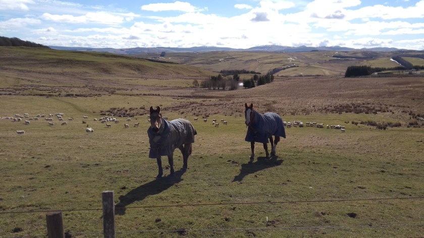
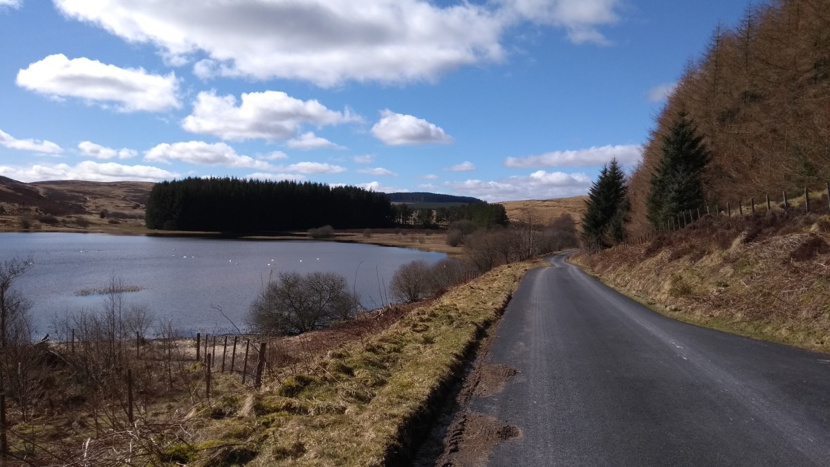
After the cattle grid the road forks into two. We chose the right option and sped down the long gradual hill for ages, enjoying the amazing scenery all around us. We saw some amazing Beech trees and some lovely horses ran over to see us at one point. Soon enough we got to the bottom of the hill at the junction with the B711 road near Roberton. We turned right and then almost immediately turned right once more, staying on the B711. This road goes steeply uphill straight away but it was worth it as the views behind us to the South were incredible. The Cheviot (the highest of the Cheviot Hills) could clearly be seen from here. From the top of the hill, the next 10 miles or so are fairly easy, mainly quite flat and the road has a nice new surface in places. It takes you through some of the remotest parts of the Borders, following a small river through the hills, with really no settlements along the way apart from a couple of farms. I bet it is very bleak in a snow storm (and there were many remnants of snow drifts to be seen today) but on a warm sunny day like today it was extremely nice. Alemoor Reservoir is particularly peaceful and well worth stopping to enjoy the view. Also, as you cycle along, keep your eye open for the ancient stone signpost which tells you it is 9 miles to Hawick.
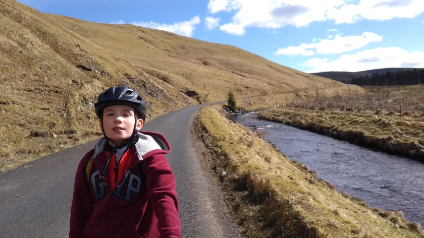
Eventually, we reached the end of the road and reached the Ettrick Valley once more, crossing another bridge over the Ettrick Water at Tushielaw (which is little more than a couple of houses, a hotel and a farm) and turning right onto the B709. After a few hundred yards the B709 turns left and heads uphill, heading for the Yarrow Valley. We went straight on though, onto the B7009 which took us through the Ettrick Valley for the final 8 miles or so back to the car in Etrrickbridge. It’s possible that this is my favourite road for cycling on ever (even better than the high road earlier on today). It is so pleasant for cycling on: the views of the hills and valley are stunning; the road surface is good; there are no real hills, just a few undulations and it is mainly slightly downhill and very fast; and incredibly, the road is almost completely traffic free. If you think this route might be too long and hilly for you, you should at least make sure you cycle along some of the Ettrick Valley on the B7009 – it is amazing and you won’t be disappointed.


