
Route out – Gorebridge to Gladhouse Reservoir to Eddleston to Lyne Station to Peebles to Cardrona to Traquair to Peel to Lindean to Bowden to Newtown St Boswells to Eildon to Newstead to Leaderfoot Viaduct to Gattonside to Melrose to Abbotsford House to Tweedbank. For route maps click here and here. Note: don’t go on the A68 at Leaderfoot as indicated by Google but use the pedestrian bridge to cross the river onto the B6360.
Route back – Scotrail train from Tweedbank to Gorebridge.
See route on Strava.
- Weather – mainly sunny at first but cloudy later with a few spots of rain around lunchtime. Light winds.
- Bike type – road bike
- Distance travelled – 63.9 miles
- Riding time – 5 hours 15 minutes
- Maximum speed – 29.8 mph
- Average speed – 12.2 mph
- Height climbed – 4014 feet
In what has been the longest and coldest winter I can remember, we had yet another snow storm in the first week in April. It is supposed to be Spring though and thankfully, most of the snow had melted by the weekend so Dad and I were able to get out on our bikes again. It turned out to be one of the longest, hardest and, most importantly, best routes we have ever done.
We left the house around 9am on Sunday and took the quiet B6372 road for a couple of easy miles before turning left onto the signposted Cycle Route no.1. This is a narrow road with little traffic but as we passed Castleton Farm the road was very muddy and full of potholes so watch out if you are cycling this way any time soon. We soon left Route 1 and turned right onto a much smoother single track road and went gradually uphill for a few miles heading for Gladhouse Reservoir. The view of the snowy Moorfoot Hills in the
distance as we approached the reservoir was impressive. The road around the reservoir is one of the nicest you will cycle on – flat, smooth and virtually no cars at all. In only a few minutes we came to a junction and turned left, heading for Peebles and this road was equally smooth and quiet, but very slightly uphill, and with great views of the hills all around. Quite suddenly though, the road surface deteriorated just after passing the sign announcing we were in the Scottish Borders. At one point there seemed to be more potholes than road so be careful. Eventually we passed the road end to Portmore Loch and sped down the hill which took us to the junction with the main A703 road.
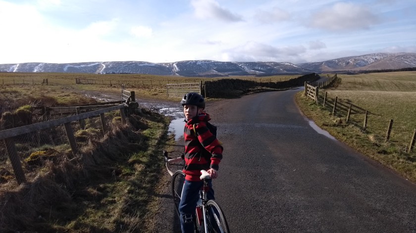
Usually we try to avoid busy main roads but today we had no choice if we were to get to Peebles so we turned left and cycled for a few miles in the traffic. It actually wasn’t too bad as it wasn’t as busy as we had feared and the road was totally flat so we were able to go around 20 mph. Soon enough, we had arrived in the lovely village of Eddleston. Dad suggested stopping here for a snack but I was full of energy for some reason and decided to keep going and we signalled right and followed the minor road to Lyne Station (via Meldons as the sign says). As it turned out, the Meldons are a very nice patch of rolling hills and to cycle through them for 5 miles or so was brilliant. I’d say it is one of the my favourite roads for cycling. The climb up into the hills was very gradual and not hard at all, and the views behind us of the Moorfoots were great, as were the views on all sides in fact. Once up high, there’s a long period of quick, easy riding through the hills on the
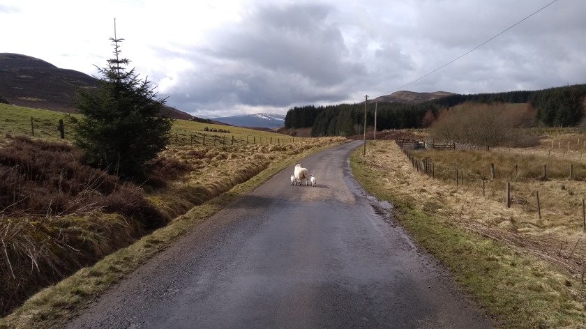
narrow road. Not really any traffic to worry about but we did have to stop a couple of times to avoid some sheep with their lambs. Nearer the end of the road you get some stunning views of the higher mountains of the Southern Uplands in the distance and just before the end, the road splits in two so we went left and free-wheeled down the hill to the junction with the A72 road at Lyne Station.
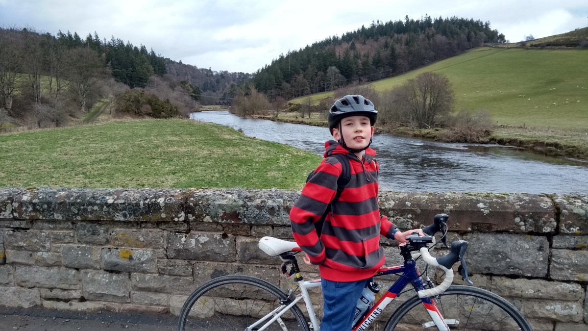
The railway station has been closed for a long time but you can still see where the train track was – it’s now a lovely walk following the River Tweed into Peebles but it’s no use for road bikes so we braved our second main road of the day instead. The A72 was relatively quiet though and quite flat as well so the 2 or 3 miles on it were fine. When we came to a signpost for Manorhead, we turned right onto the minor road, straight down a steep hill and across a bridge over the Tweed. The view from the bridge was one of the best of the day and from there we could also see our next road – heading up an impossibly steep hill! The steep road begins just after the bridge on the left and is

marked with a “road closed” sign. Don’t worry about that (it’s just closed to cars) but you should worry about how steep it is (10% average gradient apparently) and as it is completely straight, that seems to make it even harder. Somehow I managed to cycle up it with no problems though, but Dad was toiling and had to stop halfway (to take a photo he said…). The view of the Tweed Valley behind you as you cycle up is probably worth photographing right enough. The view from the top overlooking Peebles and beyond was just as good so we stopped here for a snack of crisps and apple so that Dad could get an energy boost.
The narrow road took us down another steep hill into Peebles near the high school and we soon came to the B7062 on the south side of the Tweed. We followed this road out of town heading for Traquair about 7 miles away. This a nice road which is mainly quite easy but has a few hilly bits to keep it interesting as it more or less follows the River Tweed in and out of the trees. There’s a fair amount of traffic on this road, especially near to Peebles, but lots of cyclists too so it’s safe enough really. Just after passing Traquair House, we came to the village with the same name and found a nice bench to stop at and had our usual cycling lunch – salad, cheese, Parma Ham and oatcakes.
Next, we followed the B709 downhill to Innerleithen and turned onto Cycle Route no.1 again on the minor road that follows the south side of the Tweed. The first 2 miles of so along here was the muddiest road I’ve ever seen. It really was horrible to cycle on but after that was about 6 miles of pleasantly undulating traffic free cycling along one of the

most scenic valleys in Scotland. Dad spotted 2 red squirrels as they ran across the road and scuttled up a Pine tree and soon after that we came to the Village of Peel where there was loads of wild garlic growing at the roadside. We crossed an old bridge over the river and turned right onto the quietish A707 for a few miles of fairly flat cycling following the river eastwards. Then just at Yair Bridge, we turned left onto the B7060 and followed route no.1 for a few miles up the hill, through the ancient Beech trees and then down the other side before turning right on to the newly restored bridge over the Tweed into Sunderland Hall Estate. The bridge is for walkers and cyclists only and now has 4 painted lanes on the road which I suppose is to keep everyone safe. However, it’s totally pointless having any lanes there – how busy do they really think it’s going to be?! Nice views from the bridge though.
After that we crossed over the busy A7 and onto another minor road which immediately climbed steeply up through the hamlet of Lindean and then up and up and up again for an age. To make it worse, there were a couple of short downhill sections which just meant you had extra climbing to do. After going more than 50 miles already, this hill was a killer and is probably one of the longest and hardest hills we’ve done. Eventually we reached the top near to a giant TV mast where we stopped for a rest before cycling down a much shorter hill, past Lindean Loch nature reserve. It looked like a nice place to visit but we kept going and soon came to the junction with the A699 where we turned left.

Our 4th main road of the day was the nicest of them all, mostly slightly downhill and very fast at times. The road was fairly quiet and the views were stunning. Sadly, there was no real chance to stop and get any photos, which was a shame as the snow covered Cheviot Hills looked amazing in the distance. After a couple of miles we turned left onto the B9359 for a short distance and then right onto the B6398 through the village of Bowden. This road is brilliant as it goes right around the back of the lovely Eildon Hills (my favourite hills for walking) and it is downhill most of the way to Newtown St Boswells. From there, we rejoined Cycle Route no.1 once again and cycled up and down the “closed” road (no cars!) around the side of the Eildons to the outskirts of Melrose. After crossing the very busy A6091 we took a diversion into Newstead and then followed

another “closed” road down to the the Leaderfoot viaduct. No trains run across it nowadays though, just people walking… There we crossed the Tweed once again on a pedestrian bridge and joined the B6360, turning left and heading for Gattonside a few miles away. This is a great road as it is high up above the river and you get great views of the Eildons and the river valley but it is rather busy with traffic so take care here. At Gattonside we used the old Chain Bridge to cross the water once again (you have to push your bikes here) and then we headed to our favourite ice cream shop in Melrose for a well deserved 2 scoops of raspberry (me) and vanilla and chocolate fudge brownie (Dad). We’d done 60 miles by now but still had time to kill before the train home so I suggested popping out to Abbotsford House for a quick look. Dad was feeling a bit worn out but I was fine so I made him go and we cycled through Darnick and past the train station and were soon at poet Sir Walter Scott’s home. We stayed long enough for a couple of photos and to admire the gardens. After that, we cycled back to Tweedbank via a short cycle path which goes from Abbotsford, around Gun Knowe Loch, through a housing estate and almost right back to the train station. We got there just as the train from Edinburgh arrived at the platform.
It was a brilliant day out. Probably one of the best routes we’ve done so highly recommended and strangely not all that tiring despite over 4000 feet of climbing. Even if 64 miles and all the hills are too much for you, take a trip to Eddleston and cycle through the Meldon Hills to Lyne Station and then just cycle back. That would be one of the nicest 10 mile short routes in Scotland and I’ll certainly be going back there soon.


Cool.
LikeLiked by 1 person
That looks brilliant, Rowan! Can’t wait to try it (once we got rid of our colds…). Thanks!
LikeLiked by 1 person