
Route out – Tweedbank to Gattonside to Newstead to Newtown St Boswells to Dryburgh to Clintmains to Kelso to Heiton. For route map click here. Note that Google Maps tells you to go onto the A68 at Leaderfoot but you don’t need to – just use the pedestrian bridge next to the viaduct to cross the river.
Route back – Heiton to Cessford to Jedburgh to Nisbet to Ancrum to Melrose to Tweedbank. For route map click here.
See route on Strava.
- Weather – bright and reasonably sunny in the morning but lots of heavy showers in the afternoon and very windy too.
- Bike type – road bike
- Distance travelled – 62.7 miles
- Riding time – 4 hours 46 minutes
- Maximum speed – 33.7 mph
- Average speed – 13.1 mph
- Height climbed – 2815 feet
Last Saturday, Dad and I took our bikes on the train to Tweedbank in the Scottish Borders to try out a route I’d been thinking about doing for a while – the 4 Abbeys cycle route. This is a signposted circular route though as we found out, the signage is at times vague or even invisible so make sure you bring a map with you so you don’t get lost in the middle of nowhere. Our route is also slightly different in places but 90% of it is the same as the normal route.
After leaving the station we crossed the old bridge to the other side of the River Tweed and headed along the B6360 through Gattonside. This is a nice cycling road – quite quiet, good surface, relatively flat and nice views across to Melrose and the Eildon Hills. Before long we arrived at the Leaderfoot viaduct and immediately after passing underneath it, we nipped off the road on the right and joined a pedestrian bridge which crosses the

River Tweed. Here you get amazing views of the viaduct. We then crossed the river and followed the narrow road (closed to traffic) for the mile or so to the village of Newstead with the Eildon Hills getting closer all the time. After cycling up a steep hill to leave the village we came to the junction with the A6091. This road is very busy so be very careful here. Luckily we only had to go on it for 30 yards and then there’s a right turn lane which we used to cross over onto the mainly traffic-free road that goes along the side of the hills and is actually part of Cycle Route no.1. This is a lovely stretch of road for cycling and has great views along the way of the Borders countryside. There’s also a brilliant fast downhill stretch for the last wee bit as you reach the town of Newtown St Boswells.
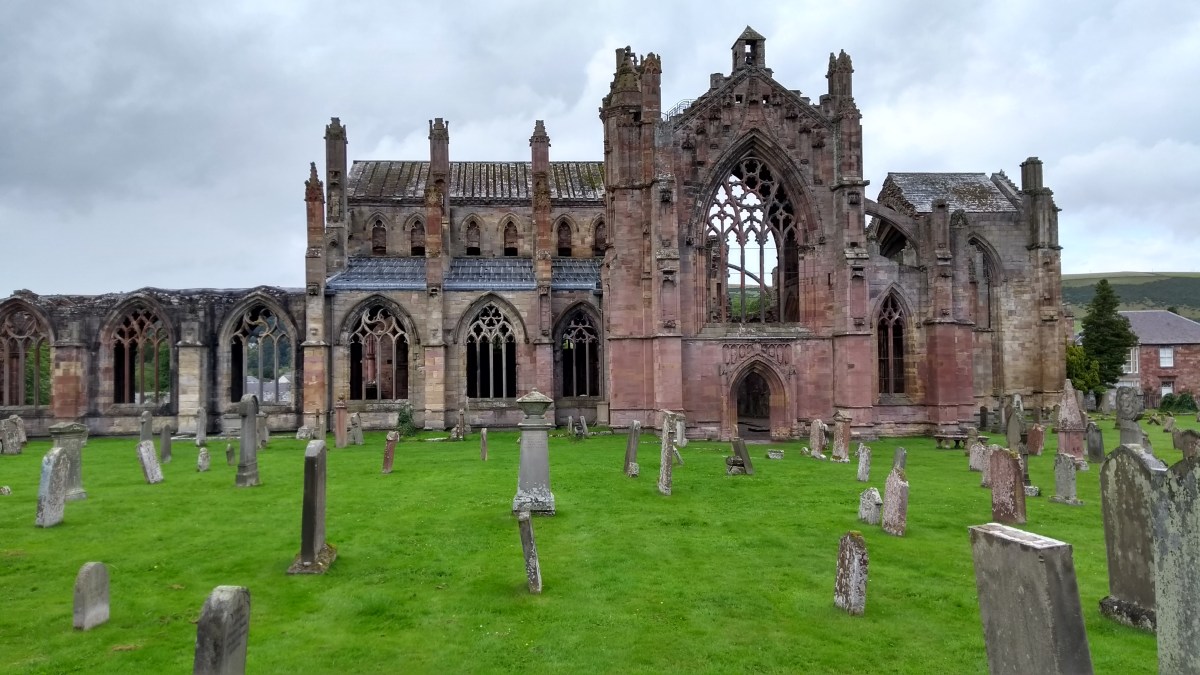
We zoomed through Newtown and then up a steep hill to the junction with the main A68 road. We only had to cross over and onto a narrow side road but the A68 is busy so we had to be very careful here. Soon we arrived at an old pedestrian bridge with a wooden floor which crosses the River Tweed and we stopped here to photograph the nice views. On the other side of the water we cycled up a steep hill and and arrived at our first abbey of the day – Dryburgh Abbey. You can’t really see anything of the abbey from the road and unless you pay loads of money at the visitor centre you are stuffed – or so we thought. Dad went in and asked the man if we could sneak in and take a quick photo but he wasn’t too keen on the idea. He was though kind enough to direct us to a spot in the grounds of the hotel next door where we could see the abbey over a high wall so we did get some photos after all.

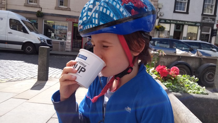
After Dryburgh we had a lovely ride through the countryside for quite a while, mostly slightly downhill and quite fast on a mix of quiet B roads and minor roads with lots of long straight sections. Eventually we arrived at a junction with the A6089 and we had to turn right onto this road for the last mile or so into the town of Kelso. This short section was not pleasant due lots of traffic and idiots overtaking when it wasn’t safe… However, we made it to the town centre in one piece and after stopping to photograph Kelso Abbey (no sneaking around and peaking over high walls required!) we ended up at Greggs the baker for an early lunch.
Leaving Kelso turned out to be a complete nightmare. Our intended route (the signposted route) should have taken us along the A699 for a short way and then down a minor road to Roxburgh on the west side of the river. Unfortunately there was some event on down that road and the road was completely blocked with a traffic jam. Rather than sit in a queue of cars (and ruin our average speed!) we took a diversion along another main road instead, the A698, which would take us the same general direction but on the other side of the river. This turned out to be a bad idea as the road was busy, but even worse, it was straight into the strong wind so we struggled to go at a good speed. It was a lovely road surface though and quite flat too. After about 5 miles of this, passing a village called Heiton along the way, we came to a junction where we could turn off onto the B6401 to re-join the official 4 Abbeys route. Thank goodness for that… From there we had a lovely time cycling along deserted
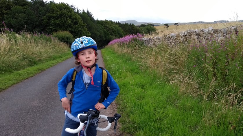
back roads (we saw only 2 cyclists and 2 walkers and no cars at all for a long time). We also had the chance to forage for wild raspberries at one point which is always nice. Just before Jedburgh, there’s a very long gradual hill to climb and then the road goes steeply downhill right into the town centre. On the outskirts of town Dad spotted a road called Rowan Road so we obviously stopped to photograph it before we quickly heading along to Jedburgh Abbey which is a very impressive ancient building overlooking the main road. It is impossible to miss as you cycle along.

After a pleasant cycle through Jedburgh town centre and then along a short riverside path, we came upon the main A68 road on the northern outskirts of town. Here the signpost for the 4 Abbeys route isn’t clear but Dad checked the map and we were able to miss out the busy road and take a minor road that runs mainly in the same direction but on the other side of a river. This road was very quiet apart from a recently killed badger which was lying in the middle of the narrow road. Soon enough we came upon the dreaded A698 again and there was no way to avoid it this time. Thankfully it seemed a lot more pleasant cycling on it with the wind at our backs this time. After less than a mile we turned left onto the B6400. We immediately came upon an unusual narrow metal bridge that took us over the river into the village of Nisbet. From the bridge we got amazing views down the river valley to the East and West. We stayed on the B6410 for a few miles, heading westwards and slightly uphill through pleasant and peaceful countryside until the peace ended at the junction with the A68. We just needed to cross over main road to rejoin the B6400 again on the over side but it was very busy so it took quite a while till there was a suitable break in the traffic. It was there that we spotted an unusual stone bench so we stopped for a short break and watched my favourite bus go by (the Borders Buses 51).

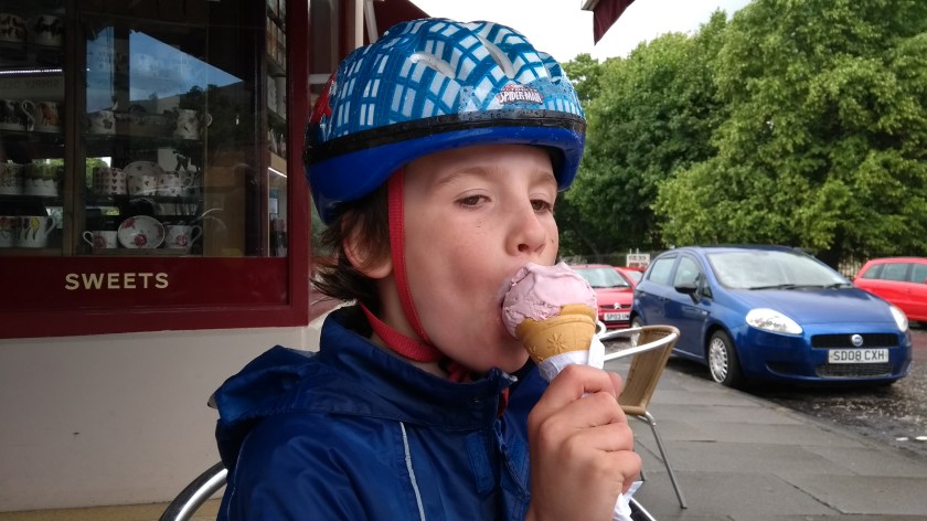
After our bus stop we rejoined the B6400 and cycled through a village called Ancrum. At this point the rain really started to fall heavily so we put our jackets on and pedalled as fast as we could. We had been expecting some showers but it basically rained constantly for the rest of the journey back to Tweedbank. After what seemed like hours of slogging uphill in the wet through what was probably a very nice and scenic landscape (it was certainly quiet and we hardly saw any cars or cyclists), we finally turned off onto the B6359 heading even more steeply uphill, around the Western edge of the Eildon Hills before finally reaching Melrose with an extremely steep and scarily fast downhill section right to the town centre. In the rain, that downhill section wasn’t as much fun as it should have been… Anyway, we made it to our favourite ice cream shop safely enough and filled our faces with raspberry cone (me) and 2 scoop tub (Dad). Dad managed to sneak a photo of the Abbey through the fence too. We made it back to the station with a while to wait until the next train so we went for a quick cycle around Gun Knowe Loch to pass the time. When we got back, the train pulled into the station at exactly the same time as us.
This was a very long and challenging route with lots of hills but apart from the last hour or 2 in the rain, it was very enjoyable. If it sounds too long for you though, you could easily split it up into shorter sections. Right, I’m now ready for Grand Tour of the Scottish Borders volume 6 – where will we go next…?


