
Route out – Rowanburn to Kershope Bridge to Newcastleton Forest to Kielder Forest to Kielder Water to Kielder. For route map click here.
Route back – Kielder to Newcastleton to Rowanburn. For route map click here.
- Weather – mostly sunny and relatively warm with a light breeze but one long rain shower later in the day.
- Distance travelled – 49.91 miles
- Riding time – 5 hours 3 minutes
- Maximum speed – 31.9 mph
- Average speed – 9.8 mph
On the way home from our holiday in Wales in July, we had stopped for a rest in the lovely (and brilliantly named) village of Rowanburn in Dumfries and Galloway, not far from the border between Scotland and England. I had noticed that the roads near Rowanburn looked perfect for cycling so I’d been thinking of going there for a cycle for ages. Finally, last Saturday, Dad and I managed to go back there with our bikes to have a grand tour of the Scotland-England border.
We headed north out of Rowanburn along the B6357. This is lovely smooth road for cycling on and not too busy with traffic. After less than a mile we entered the Scottish Borders and had to cycle up a short but steep 11% gradient section of road so that fairly warmed our legs up. Soon after, we turned right onto the B6318 which immediately took us steeply downhill to a bridge over the Liddel Water and back up another extremely steep hill into Cumbria. We were in England for the first time today! Around here, the Liddel Water marks where the Scotland-England border is for quite a long distance and our route basically followed this in a north-east direction along very quiet, scenic and narrow roads for about 5 miles until we almost reached a place called Kershopefoot. Here, the border changes direction, heading more towards the east along a different river called the Kershope Burn. At a junction, we headed right and then over the border river and up a very steep section, back into the Scottish Borders. The road goes relatively high up here and the views are really nice. Soon we doubled back on ourselves at an acute angle and headed back down the hill to England again at Kershope Bridge. We stopped here to have an early lunch among the sheep to give us an energy boost before tackling the hardest part of the route.
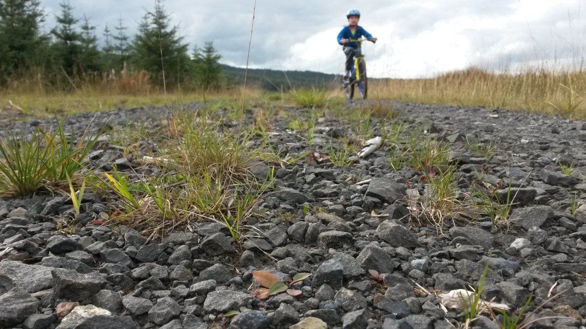
At Kershope Bridge we turned left and followed the signs for National Cycle Route no.10 which took us into the forest on a reasonably smooth landrover track. After a short while the track crossed over a bridge across the burn back into the Newcastleton Forest in Scotland. After this the path followed the border burn for a long time and the path seemed to become bumpier and bumpier along the way. It was also all uphill and really hard going at times and I almost thought about turning back. Luckily I spied some wild blueberries growing at the edge of the fir trees so I stopped to fill my face and I cheered up a bit after that. Eventually, we reached another bridge and this took us over the border again to England and the Kielder Forest in Northumberland. This was the worst section of all as the path became un-ridable due to the loose stones and the steepness of it, even on a mountain bike. After pushing up the slope to the highest point, the path leveled out but the loose stones made it very unpleasant to ride along. I really was wondering why Sustrans had made this a signposted cycle route. It must have been someone’s idea of a joke surely… It would have made a nice walk though. Thankfully, the bumpy loose stoney path ended when it joined onto another forest road. This was a really nice smooth track and was all downhill so we sped the last few miles to the Kielder Water in no time at all. After about 15 miles of deserted forest, we were finally back in civilisation and saw people for the first time in over 2 hours…
We stopped at the reservoir for a much needed break and a snack of oatcakes. Then we headed onto lovely smooth road once again and sped off northwards in the direction of Kielder. This road is unclassified but on this section it was more like an A road, nice and wide with a white line down the middle and a nice surface for cycling on. Not too much traffic either so that was good. Dad spotted a sign post pointing to an interestingly named place called Gowan Burn and we thought about taking a detour to see what was there. But Dad didn’t think we’d have time for that as we still had about 25 miles to go and we wanted to be back at the car by tea time. So, at Kielder village we just stopped at the shop for Smarties (me) and Yorkie (Dad) before heading in the direction of Scotland once more. The road had by now reverted to single track with passing places and the weather had reverted to rain. Despite the weather, we stopped at the border to photograph all the amazing signs.
The last 20 miles or so of the route was along the B6357 again, heading roughly south and following the Liddel Water once more. It was also almost all downhill and very fast through the quiet countryside along the nice smooth road surface. We stopped in the pleasant little village of Newcastleton to have our last proper break of the day before following the river (which turned into the Scotland-England border once again) back to Rowanburn. It was a long and tiring day but we had crossed the border a total of six times and I really enjoyed most of the route. The roads are very good quality, quite quiet and the scenery is nice so I would highly recommend cycling in this area. Apart from cycle route no.10 through the forest that is – that is NOT recommended at all!


One thought on “Grand Tour of the Scotland-England Border”