
Route out – Gorebridge to Carrington to Roslin Glen to Auchendinny to Flotterstone to Balerno to Kirknewton to East Calder to Broxburn to Winchburgh to Abercorn. For route map click here.
Route back – Abercorn to Queensferry to Dalmeny to Edinburgh (Barnton to Haymarket to City Centre to Leith to Portobello) to Musselburgh to Whitecraig to Dalkeith to Newbattle to Newtongrange to Gorebridge. For route map click here then here. Note that Google maps doesn’t show the correct route through Newbattle. When you reach a bridge over the River South Esk, turn off the main path and follow the path marked “Lord Ancrum’s Wood” on the South-East side of the river until you reach the B703.
- Weather – mostly sunny, quite windy and reasonably warm (but freezing cold along the east coast from Portobello to Musselburgh).
- Distance travelled – 66.6 miles
- Riding time – 6 hours 42 minutes
- Maximum speed – 35.6 mph
- Average speed – 9.9 mph
- Height climbed – 3300 feet
When cycling through the Scottish Borders, Dad and I often end up following the “Borders Loop” cycle route signs so I decided to investigate whether there was a such a thing as a “Lothians Loop” cycle route. It appears that there isn’t, so I made up my own one. It’s one of our longest and most adventurous routes so far, visiting the Mid, West and East Lothian, as well as Edinburgh City. Hope you like it…
After leaving Gorebridge at 7:30am, we were soon heading down the deserted minor road through Gore Glen to the village of Carrington. The low sun was just starting to emerge from the clouds and Dad thought it made some of the trees look really nice so he kept stopping to take photos. I suppose he was right enough. From Carrington, we took the road signposted for Rosewell. The first half mile is one of the best cycling roads ever as it is very smooth and fast. Then, after turning left at a crossroads, the surface becomes rather more bumpy and worn out. Soon we reached another crossroads and headed straight across the A6094 and onto a quiet back road with views of the Pentlands hills in the distance. After a mile or so, we came to a signpost pointing to Roslin Glen so we went that way, downhill on a farm track for a wee bit and then, as the track turned sharply left, we turned right and headed down some steps (scaredy cat Dad pushed his bike but I cycled) into the picturesque Roslin Glen. There, we followed the Dalkeith to Penicuik railway walk for a pleasant mile or so of deer-spotting, cycling along the good path through the woods until we arrived at the village of Auchendinny.
At Auchedinny, we left the track and turned right onto the road. We immediately came to some traffic lights but they refused to change to green for us so we had to press the button on the pedestrian crossing and then cheekily cycle through the green man to get onto Graham Road which heads uphill past the Glencorse army barracks on the outskirts of Penicuik. Soon we cam to another set of lights but these ones did change to green so we headed straight over the A701 and headed uphill again along Bellwood Road, through some houses and then some trees until the junction with the A702. This is normally a busy road that we avoid but we were there nice and early and there were basically no cars around so we turned right onto the main road and speeded down the hill at 30 mph for a few hundred yards before turning off at the Flotterstone Inn and the entrance to the Pentland Hills.
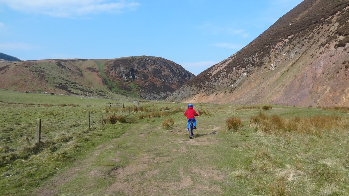
The Pentland Hills are a lovely place to visit but they do tend to get rather busy. However, at 8:30am, it was still relatively quiet and very pleasant to cycle along the minor road, past the Glencorse Reservoir with hills on all sides. Further along the road, deep amongst the hills, we came to Loganlee Reservoir where we stopped for a snack. We saw quite a few other cyclists and people out running as we sat in the sun munching away on our carrot sticks and celery. After a while the road ended and at a signpost, we turned right and headed for Balerno. The path varied from short, bumpy grass to horrible, loose and large stones, to nice smooth dirt so it was hard going at times, though it did seem to be mostly downhill so we still enjoyed it. The views were very nice all the way. At one point, we had to cross a stream and we both ended up with wet feet but they soon dried off. After a while, we said goodbye to Midlothian and said hello to what is technically Edinburgh City. It didn’t look much like a city to me though as we emerged from the hills into a field of sheep and a gate with a sign warning cyclists not to go too fast on the road ahead. The road turned out to be incredibly straight, lined with trees and steeply downhill so we ignored the warning and freewheeled as fast as possible down the hill. It was great fun! In fact, we almost didn’t need to pedal at all for the 2 miles from there to Balerno, which appears to be a nice little town by the way.
After a quick bag of crisps, we left Balerno behind and followed Cycle Route no.75 out of the town, down another really steep hill (this road is a bit bumpy so be careful not to crash). It was then a few more miles through quiet, narrow country roads along Route 75 until we reached Kirknewton, just over the border into West Lothian. It’s quite a steep climb on the way into the village but the way out down the other side is great fun and very fast and you get to cycle over a level crossing, which I really liked. Didn’t see any trains though. We stayed on Route 75 for another mile or so, crossing over the main A71 road at the traffic lights and then heading down a bumpy track into East Calder. There we followed the nice path through the beautiful Almondell Country Park, dodging in between the dog walkers and little children, over a bridge across the River Almond and up a steep hill before rejoining a quiet minor road. This road took us underneath the railway line (where we did see a train) and underneath the M8 motorway, before taking us to the town of Broxburn.
At Broxburn, we spotted a Greggs so we made an unplanned early lunch stop (it was only 10:50am). Sausage, bean and cheese melt plus soup for me, sausage roll and soup for Dad. Very tasty. After lunch we cycled along the B8020 which took us around the side of what I like to call “The Volcano” but Dad says it is actually a giant bing. It’s rather impressive to look at anyway. Soon enough we reached Winchburgh, where we turned left onto the B9080 road. After a mile or so we saw a signpost for Hopetoun House and turned right onto a very quiet tree-lined back road which took us through some nice countryside and underneath the M9 motorway until the junction with the busy A904 road. We could have taken this road directly to Queensferry but took the scenic long cut instead. We went straight over the main road and onto a lovely quiet road for a couple of fast, downhill miles to a tiny place called Abercorn. We missed a turning and ended up in a church yard by mistake but the church was nice and had an impressive bell tower. After retreating 20 yards, I spotted a Route no.76 marker on a gate so we followed that path, down some steep bends into the woods. The track was a bit bumpy for a while but then became a narrow but proper road again as we cycled right past the biggest house I’ve ever seen – Hopetoun House. I bet the whole population of Gorebridge could live inside it… We the followed the quiet road alongside the Firth of Forth, under the new and old Forth bridges and into Queensferry.
I wanted to cycle over the Forth Bridge but Dad thought it was too windy today so we simply carried on past Dalmeny train station (where we saw another train) and then onto Cycle Route no.1, speeding down the hill to Crammond on the outskirts of Edinburgh. After stopping at another bridge over the River Almond for a quick Yorkie bar and boiled egg, we followed route no.1 mainly off road to Haymarket (where we saw a tram and a train) and then through some quietish residential streets until we got to the centre of town. George Street was fairly busy today but there’s a cycle lane to keep us safe. When we got to St Andrews Square, we joined Cycle Route no.75 which took us steeply down Dublin Street and eventually onto a cycle path which went right past one of my favourite places in Edinburgh – The Yard adventure centre. We followed the path for a couple more miles until we reached Leith. Then we followed a signposted cycle route (again mainly off road) for a few miles to Portobello. The weather had been brilliant all day up till then but it was really cold and windy at Portobello beach, so we quickly took a detour away from the coast and went along the busy high street instead. It wasn’t much warmer though and the 2 miles or so cycling along this road to Musselburgh in East Lothian were horrible – right into the strong wind and very cold. Thankfully, Musselburgh has a great ice cream shop called Luca’s so we joined the long queue and eventually got to fill our faces (I had Kit Kat ice cream which was rather good).
My original plan was to head a bit further into East Lothian but by this time I was starting to feel tired so decided I’d rather head the quickest way home instead. So we cycled through Inveresk and Whitecraig (via the interestingly named place called Cowpits) and then joined the cycle path of route no.1 once more for a short time. We then took a detour off the path and headed up past another “volcano” and onto the B6414, where we turned right to re-enter Midlothian and then zoomed down the hill at over the 30 mph speed limit into Dalkeith. We rejoined route no.1 again for another short section through Woodburn and then onto a cycle path as far as Newbattle Golf Course. Then, just next to the humped bridge, we cycled through a gap in the wall and into Lord Ancrum’s Wood. It’s not very long but this is an amazing path with lots of short ups and downs which follows the River South Esk past Newbattle Abbey. It’s a nice hard packed surface which is easy to cycle on. Lots of interesting and ancient trees to see and more wild garlic than even I could eat! There’s one really steep bit near the end that goes down some steps (I cycled down it but as usual, Dad had to push…). We then headed left onto the B703 for half a mile before heading onto the quieter road called The Beaches, uphill into Newtongrange. Then it was simply 2 miles of gradual uphill cycling to get home, first along the Bryans path and then up Stobhill Road into Gorebridge. We arrived home just in time for tea.
It had been a very long but enjoyable day – in fact, that was the longest cycle run I’ve ever done at over 66 miles – but we did manage to complete our Lothian Loop. It’s probably one of the most varied routes we’ve ever done with all sorts of different road surfaces and paths and travelling through such a huge variety of countryside and urban areas. Definitely one to repeat sometime.


