Gorebridge to Temple on a Sunny Evening

Route out – Gorebridge to Gore Glen to Carrington to Temple. For route map click here.

Route back – Temple to Castleton Farm to Halkerston Farm to Fushiebridge to Gorebridge. For route map click here.

  • Weather – hot and sunny and hardly any wind.
  • Distance travelled – 12.09 miles
  • Riding time – 1 hour 22 minutes
  • Maximum speed – 25.4 mph
  • Average Speed – 8.6 mph

It was a lovely sunny evening so Dad and I went for a short cycle after tea on a circular route to Temple and back. Tonight we saw baby cows, baby horses, 1 tractor, 2 trains, only 3 cars but loads of bikes. For a change, we headed downhill out of Gorebridge and soon we were zooming down the steep slope into Gore Glen, where I reached my fastest speed of the day. After that, it was all uphill along a very quiet single track road until we reached the village of Carrington where we stopped at a bench to have a quick oatcake and a drink.

The road from Carrington to Temple is a proper road with a white line down the middle and you normally see a few cars on this section. Tonight, however, it was deserted because there was a sign saying “road closed” just at the edge of Carrington village. We decided to take a chance and ignored the sign and headed towards Temple anyway. As it turned out, the sign had lied and only one lane of the road was shut for roadworks for only about 100 yards.

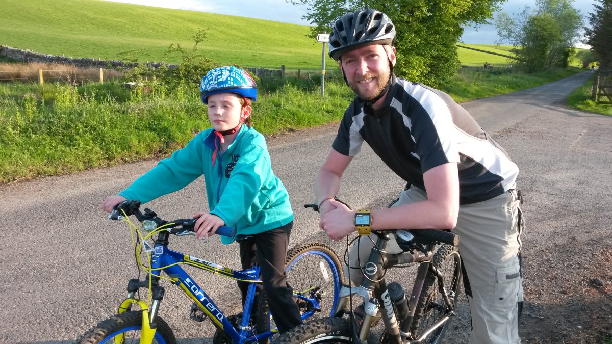
The road into Temple is very rough and bumpy and also extremely steep but the village is really lovely so we stopped there for another oatcake. A mile or so after Temple, we bumped into Dad’s friend Scott from North Middleton, who was also out on his bike. Dad used to play in a band called Dropkick with Scott until he left the band a year and a half ago so that he could go cycling more often with me… I made Scott pose for a photo before he went on his way to Gladhouse Reservoir a few miles further along the road.

We headed in the opposite direction and when we reached Castleton Farm, we turned right onto a narrow road which took us gradually uphill to the highest point on the route at Halkerston Farm. This is a very quiet road and I don’t think I’ve ever seen another cyclist on it – maybe it’s our secret road. Near the bottom of the hill you get a really good view over the Pentland hills and near the top the view is even better: you can see Gorebridge, Edinburgh, the Firth of Forth and the Lomond Hills in Fife. After the farm it was downhill all the way to Fushiebridge and after another short uphill section, we were soon back home in Gorebridge.

Gorebridge to Peaston Circular Route

Route out – Gorebridge to Edgehead to Cousland to Peaston. For route map click here.

Route back – Peaston to Windy Mains to Crichton to Gorebridge. For route map click here.

  • Weather – sunny and not much wind. Freezing at first but much warmer after Cousland.
  • Distance travelled – 24.18 miles
  • Riding time – 3 hours 8 minutes
  • Maximum speed – 26.5 mph
  • Average speed – 7.7 mph

On Saturday morning we got up at 5:14 am and were out on our bikes before 6 o’clock. We were up so early because I was going out in the afternoon with Mum so we had to be back before lunchtime. Going cycling so early was good because the roads were very quiet and we saw lots of wildlife: deer, pheasants, squirrels and even a brown bear (more about him later on…). The bad thing about cycling in the early morning, even in mid-May on lovely sunny day, is that it was extremely cold. It will soon be summer but there was lots of frost on the ground and for the first hour of the journey, my hands were freezing! And because I was freezing, I was pedaling really slow…

As usual, the first mile from our house is straight uphill but after that, it was an easy ride along the B6372 passed Vogrie Country Park to the village of Edgehead. After another steep uphill section we stopped on the narrow road to Fordel Mains farm to look at the amazing view over to Edinburgh, The Pentland Hills, Fife and beyond. It was here that we saw the brown bear for the first time when he tried to steal my bike… About a mile from here is a place called Cousland and we stopped on a bench to have a quick snack and also to warm up our frozen fingers by clapping our hands. The cheeky bear must have followed us there and he managed to sneak onto my knee when Dad was taking a photo.

After Cousland there’s a really fast downhill section and it it was here that I reached my fastest speed of the day. Soon we came to the A6093 road at the border with East Lothian. Normally we avoid main roads but because it was very early in the day, the traffic was very light so we headed east for about half a mile and then turned right at the really amazing old road sign, heading towards Peaston. There are lots of amazing old-fashioned signs in East Lothian and I love them because they give the distances with fractions of a mile. According to this one, Peaston is 2 1/4 miles.

As it turned out, there’s not much in Peaston apart from lots of old farm building and cottages that are crumbling and falling down. Dad said it was looked like a ghost town so we didn’t even stop there. Soon we reached another favourite road sign of mine – Slow Bad Bend – next to the sawmill at Windy Mains. A mile after the sawmill we reached the ford. This is where a stream flows over the top of the road at the border of East and Mid Lothian. Here we stopped for a snack and once again, spotted the brown bear as he tried to steal one of my chocolate digestives. After I rescued my biscuit, we headed through the scenic countryside along Salters’ Road. This is a really lovely quiet road and we didn’t see any traffic until we reached the main A68 road. At one point we cycled underneath some electricity pylons and you could hear them making a crackly buzzing sound.

We crossed over the A68 and cycled down the minor road to Crichton. There’s only a few houses here and after that you come to one of the steepest hills in the world! We sped down into the gorge and then crawled back up the other side in gear 1. On the way back up, we got a good view of the ruined Crichton Castle. After a short relatively flat section we came to Borthwick crossroads where we turned right, uphill yet again, for the last mile or so back to Gorebridge.

Gorebridge to Dewar over the mountains

Route out – Gorebridge to Borthwick to North Middleton to Middleton to Blackhope Farm to Dewar. For route map click here.

Route home – Dewar to Blackhope Farm to Middleton to Fushiebridge to Gorebridge. For route map click here.

  • Weather – sunny and cloudy, cool with a chilly wind on high ground.
  • Distance travelled – 23.69 miles
  • Riding time – 2 hours 53 minutes
  • Maximum speed – 27.8 mph
  • Average speed – 8.2 mph

On Sunday morning I decided to take Dad on a cycle run over the top of the Moorfoot Hills. We had been along the B7007 from Middleton to Innerleithen many times in the car but had always thought that it would be a bit too steep for us to cycle on. As it it turned out, we were completely wrong and it wasn’t too difficult at all.

The first mile or so from Gorebridge was all uphill and extremely steep but soon you got a great view across to the Pentland Hills in one direction and the Moorfoot Hills in another. From there it was downhill all the way to Borthwick Castle and it was here that I reached my fastest speed of the day. Just before the castle, we crossed a bridge over the Borders railway but didn’t see any trains. We then had a short steep section which took us to the village of North Middleton. Here, we used the underpass to cross the busy A7 main road, before heading uphill once more, passing by a dead badger before reaching Middleton, where we stopped for a snack next to the National Cycle Network signpost.

From Middleton we headed gradually uphill for around 3 miles as we headed to the highest point of the road through the Moorfoot Hills. It was quite an easy ride and I even managed to ride all the way up in gears 8 and 9. On the way the views across to the Pentland Hills, Edinburgh and Fife were really good. We could even see some snow capped mountains a long way north as well as the new Forth Road Bridge peaking up above the horizon. We stopped for an early lunch of tiger prawns and cheese sandwiches just off the main road at the start of the track which leads to Blackhope Farm. From there we could see the second highest of the Moorfoot hills, Blackhope Scar. After lunch, we speeded the rest of the way downhill to our destination Dewar. There isn’t much in Dewar but we did discover an old bus which appears to have been turned into into someone’s house.

On the way back we spotted a massive bird flying close to the ground. Dad said it was much bigger than a Buzzard and may even have been an Eagle but he wasn’t sure. At the highest point in the road, we stopped to look at the unusual signpost which told us that we were 404m above sea level and that Newcastle was 168 miles away – a bit too far for us. I thought we would be lucky to do that in 5 or 6 days! We took a slightly different route back to Gorebridge from Middleton, by passing North Middleton and Borthwick and heading back via Fushiebridge. Luckily for me, we stopped at the railway bridge just in time to see a train going passed on its way to Gorebridge station so we followed it the last couple of miles back to our staring point.