Tour de Galloway day 7 (final stage): Newton Stewart Loop

Route – Newton Stewart to Minnigaff to Creebridge to Newton Stewart. For route map click here.

See route on Strava.

  • Weather – mainly cloudy but warm and dry with very little wind.
  • Bike type – road bike
  • Distance travelled – 9.35 miles
  • Riding time – 39 minutes
  • Maximum speed – 26.2 mph
  • Average speed – 14.4 mph
  • Height climbed – 476 feet

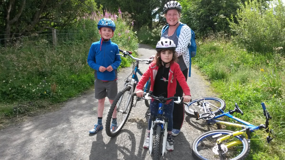
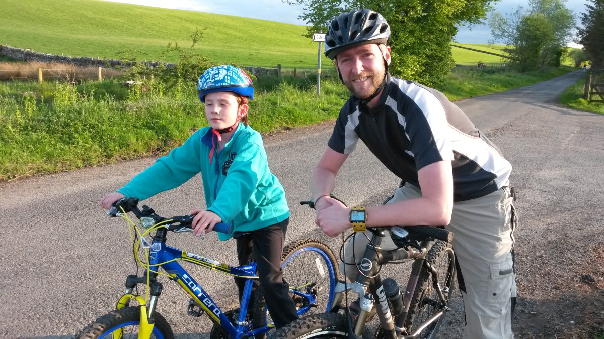
On the final day of our summer holiday in Galloway, Dad and I just had time for a short cycle around the Newton Stewart area. Since I had been the quickest over the first 6 days of the “tour”, the final stage was more or less a procession to celebrate my amazing victory over Dad… Anyway, the route may have been short but it turned out to be one of the most pleasant of the entire week.

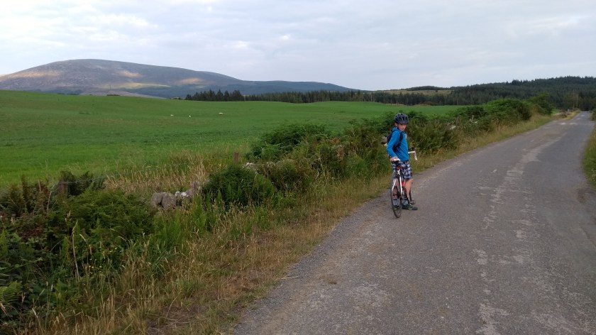
We started off by following the river Cree northwards on the cycle path of Cycle Route no.73 for the mile or so into Newton Stewart. The path ends when you reach Aldi and Sainsburys and we then had to cycle through a car park and along a back street until it ran out and rejoined the main road through town. There we turned right and then right again over the old bridge across the River Cree. Just over the bridge we then turned left and followed the minor road out of town. We cycled gradually uphill along the narrow, fern-lined road, through the trees for a mile or before the trees parted to give us a magnificent view northwards across the valley to Glen Trool away in the distance. It was

IMG_20180713_193258240_HDR

one of the best views we’d had all week and the highest mountain in the region The Merrick was clearly visible. The road was completely deserted and was so peaceful to cycle on. After a few miles we reached the high point on the road and turned a corner to the right and one of the most impressive hills in the area – Cairnsmore of Fleet – came into view. After seeing this hill from a distance and from other angles earlier in the week, the close up “side view” was an unexpected surprise. After that we sped down the slight hill to the junction with the A712 road.

IMG_20180713_194133808

The A712 road is commonly known as the Queens Way and is a stunning road to travel on through the heart of the Galloway Forest from New Galloway to Newton Stewart. Despite being an “A” road it is quite quiet and looks like it would be a fantastic road to cycle on. Today though, we only had time to ride on the few miles back to Newton Stewart and that was so much fun. It was a lovely road surface, all slightly downhill and very fast with nice views and it was so quiet that we didn’t see any traffic whatsoever. The perfect cycling road you might say… Soon, we turned right and cycled through Creebridge on the outskirts of Newton Stewart and back across the bridge into Newton Stewart again. This time we avoided the cycle path and rode up the main street through town and back to Nether Barr via the fairly quiet A714 road.

It was a very short but rather nice way to end our Tour de Galloway. Galloway is an amazing area of Scotland to go on holiday. If you like peace and quiet, beautiful beaches, walking in the hills and forests and most importantly, cycling, you would love it there. I’ll definitely be returning there soon!

Tour de Galloway day 3 (time trial): Newton Stewart to Wigtown

Route out: Newton Stewart to Wigtown. For route map click here.

Route back: the same way but in reverse.

See route on Strava.

  • Weather – sunny and warm but rather windy.
  • Bike type – road bike
  • Distance travelled – 13.18 miles
  • Riding time – 50 minutes
  • Maximum speed – 28.0 mph
  • Average speed – 15.7 mph
  • Height climbed – 300 feet

Dad and I have been out cycling so much over the past couple of months that we haven’t had much time to write much on here, but now that the evenings are getting very dark, we are going to try and catch up with all the best cycle routes we’ve been on this summer. We will start by going back to our holiday in Galloway in July…

Day 3 of the Tour de Galloway was the time trial day. After a fun day out at the beach and also the Cream of Galloway adventure playground (where we ate lots of ice cream obviously) we only had a short time after tea when we could get out on our bikes. I decided to invite my little sister Isla along with us for a time trial race from our accomodation just south of Newton Stewart down the very quiet coast road to Wigtown about 6 miles away. This is part of cycle route no.73 and the road is extremely quiet, very narrow and mostly flat and with the strong wind at our backs we were able to race along at a good speed – my average speed was over 18mph on the way there amazingly, though Isla wasn’t quite so fast… The only hazzard we came across along the way was an annoyingly wide milk tanker that took up the whole width of the road which meant we had to move our bikes completely off the road and into the long grass at the side to avoid being squashed!

IMG_20180709_191933990

The road follows close to the River Cree estuary and just outside Wigtown Dad thought he saw an osprey swooping down close to the water looking for fish. After 6 miles of near flat riding, the short but steep hill that takes you up into the town centre of Wigton is a bit of a shock but even Isla managed to cycle all the way up without getting stuck. We stopped there for a few minutes to have a drink before turning around and heading back the way we came.

IMG_20180709_194557138

On the way back we were forced off the road once again by the same milk tanker heading back from the dairy farm with a full tank of milk this time. We were significantly slower on the way back as it was straight into the strengthening wind the whole way. At times, no matter how fast Isla pedalled, it seemed like she was going backwards! Eventually we made it back to the Nether Barr where we were feeling a bit peckish so we had a bowl of Aldi’s Special Flakes before getting the map out to plan the route for day 4 of the Tour de Galloway. So stay tuned for that – I promise it won’t take us another 2 months to write up the next chapter…!

Gorebridge to Rosewell Circular Route

Route out – Gorebridge to Newtongrange to Bonnyrigg to Rosewell. For route map click here.

Route back – Rosewell to Carrington to Gore Glen to Gorebridge. For route map click here.

  • Weather – cool and cloudy but mainly dry and not much wind.
  • Distance travelled – 12.54 miles
  • Riding time – 1 hour 11 minutes
  • Maximum speed – 31.2 mph
  • Average speed – 10.5 mph

Regular readers of this blog will know that I really love anything to do with railways and especially viaducts. Strangely though, there is one very impressive viaduct only a few miles from our house that I hadn’t cycled past before – the Lothianbridge viaduct near Newtongrange. A week ago on Sunday, Dad and I decided to go for a short local cycle run and finally found ourselves cycling underneath one of the finest features of the Borders Railway line.

As usually, we started off from the house in Gorebridge but for a change, headed down hill along Greenhall Road to Stobhill. We then turned off on to the back road to Mayfield (also known as Crawlees Road). During the week this is very busy road used by lots of lorries and vans travelling to and from the industrial estate. It also has lots of really bad corners so isn’t ideal for cycling. However, on a sunday morning it’s basically perfectly fine and it even boasts a lovely smooth surface and brilliant views over to the Pentland Hills and Edinburgh. After passing through the industrial estate we turned left and sped downhill along the B6482 (Bryans Road) into Newtongrange. There’s a speed sensor halfway down the hill and it flashed up that Dad and I were both breaking the 30 mph speed limit! We then maneuvered our way across 2 very odd joined up mini-roundabouts and sped down another short hill to the traffic lights at the junction with the main A7 road – where we got our first view of the amazing viaduct. Luckily the lights changed to red just as we got there so we had time to take a sneaky photograph.

The lights soon changed to green and we cycled as fast as possible on the main road along the side of the viaduct for roughly 300 yards before turning left onto a minor road signposted for Carrington. This very quiet road took us right underneath one of the great giant arches of the viaduct and after about half a mile, we came to a crossroads. We turned right, passing Cockpen and Carrington Parish Church before reaching the town of Bonnyrigg. There, we turned off the road and onto the Dalkeith to Penicuick Railway Path (cycle route no.196). The cycle path is lovely and smooth and straight and even though it’s slightly uphill in this direction, we had soon cycled the 2 miles to the village of Rosewell. Just make sure you keep an eye out for dog poo on the path…

We left the path at Rosewell and cycled along the main road through the village for a short distance before turning off to the left and into the park. After stopping at a bench for a quick apple and drink, we carried on, skirting along the edge of a field and then onto a slightly bumpy farm road. The bumpy road took us close to Whitehill House golf course, past lots of holiday cottages and then through Thornton Farm, where we saw lots of horses. There were also some unusual but nice views of the Pentland Hills from here. After the farm we turned left onto some familiar back roads which took us the remaining 2 miles or so to Carrington. The first section of road was rather bumpy in places but after turning right at the crossroads, you find yourself speeding along on the flattest, smoothest road in the world with fields and trees on either side. It’s also almost completely traffic free. After a while the flatness quickly becomes a steep downhill section and we both zoomed into Carrington at around 30 mph. Carrington is a peaceful place and we stopped there for another quick snack. I counted only 1 car and 8 cyclists passing through in the 10 minutes we were there.

The last section of the route took us along a very narrow back road to Gore Glen. It’s nearly all downhill and very fast (just be careful though as some of the fastest parts of this road are rather bumpy and it would be quite easy to crash…). The climb up from Gore Glen to Povert Road was really the only steep uphill section of the day but at least it was quite a short one. After that it was a few hundred yards along the A7 again and then a left turn into Gorebridge via easily the bumpiest “proper” road in the world – Engine Road. It’s a rutted mess of potholes, ravines and loose stones and is about 50 years overdue some resurfacing work. Anyway, we were back home in time for our lunch of Mushroom soup and oatcakes.

This was a nice easy route with very few hills but lots of long downhill sections and although it was short, it was most enjoyable. This sunday, we went on a much longer and more adventurous route so stay tuned for that one…

Loch Leven Loop

Route Out – Vane Farm to Kinross to Loch Leven’s Larder. Starting point is here. Then follow the cycle path round the loch in clockwise direction (path not shown on Google Maps but it’s impossible to get lost…).

Route Back – Loch Leven’s Larder to Vane Farm.

  • Weather – mostly cloudy, some sunny intervals, very warm and quite windy.
  • Distance travelled – 13.67 miles
  • Riding time – 1 hour 20 minutes
  • Maximum speed – 19.0 mph
  • Average speed 10.2 mph

Last Sunday (31st July) I went for a nice short cycle around Loch Leven in Perth and Kinross with Dad and two special guests, my sister Isla and my Mum. The route is all off road, not too far and almost all flat so was easy enough for Mum to come too. She is not a very experienced cyclist and doesn’t like going on proper roads (she thinks roads are very dangerous), so this was perfect for her. Actually, most of the roads we cycle on have hardly any traffic so are quite safe I think. In many ways, cycle paths like the one at Loch Leven are more dangerous because they are so busy (especially at the weekend) and have many more hazzards to watch out for: young children learning to ride their bikes, dogs, pedestrians, push chairs and worst of all, stupid cyclists who think it’s OK to ride on the right hand side of the path and refuse to move across to the left to let you passed. Also, although the path is a really good surface most of the way, it is quite narrow in places and very overgrown at the sides with nettles, thistles and wild raspberries so you have to take care not to go too near the edge.

We got lots of nice views of the loch as well as the Fife and Perthshire hills today. We also spent a lot of time foraging for raspberries and really stuffed our faces. However, by midday we were still hungry so decided to take a slight detour off the main path and stopped for lunch at Loch Leven’s Larder. I had a smoked haddock quiche which was very tasty. We sat outside for lunch and noticed there were loads of annoying wasps flying around. Luckily for us, they weren’t at all interested in quiche, but did seem to be enjoying the fizzy drinks that the people at every other table were drinking…

One thing to note about this route is that if you park at Vane Farm like we did, you have to go down and then back up some steep steps to go under the underpass which takes you to the start of the path on the other side of the B9097 road. This wasn’t very easy with bikes so parking at the waterside in Kinross might be a better starting point, especially if you have small children. There’s also a nice play park there to keep the kids amused whilst you load the bikes off and on the car.

Temple to Gladhouse Reservoir Circular Route

Route Out – Temple to Gladhouse Reservoir. For route map click here.

Route Back – Gladhouse Reservoir to Rosebery Reservoir to Temple. For route map click here.

  • Weather – mainly cloudy, dry and light winds.
  • Distance travelled – 10.01 miles
  • Riding time – 58 minutes
  • Maximum speed – 27.5 mph
  • Average speed – 10.4 mph

On thursday morning Dad and I took a special guest with us when we went for a short cycle run. The special guest was my sister Isla who is 6 years old and is already quite a good cyclist (but not as good as me obviously…). To shorten the route, we took the car to Temple and started from there. We parked next to a nice old boat believe it or not.

The first part of the route is along a narrow road with a nice smooth surface. It’s also very quiet and we saw only one vehicle all the way to Gladhouse. The road starts to climb steeply uphill about halfway along, near to Yorkston Farm but soon we reached the high point and got a good view over to the Moorfoot Hills as we sped downhill towards the reservoir. We stopped next to the water for some photos and a bag of crisps.

Cycling along the road alongside the reservoir is very pleasant and is mostly flat. The view across the reservoir towards the hills is quite nice too. Eventually, we came to a junction and turned right to head back uphill in the direction of Temple. This road was a little bit busier as it is the back road to Peebles (we saw about 4 cars in a mile!) but it’s safe enough for us and is popular with cyclists (we saw lots of them on this stretch of road). We then joined onto the B6372 which was also a bit busier but still a good cycling road and the mile or 2 we cycled on was mostly downhill so was good fun.

When we saw a signpost for Rosebery Reservoir we turned right onto a very narrow road. There’s a very steep downhill section just before the reservoir and that’s where I reached my fastest speed of the day. I was going so fast that I forgot to stop at the reservoir but Dad and Isla managed to get a quick photo before racing off after me. After the reservoir is a slow uphill section which takes you right through Yorkston Farm where we saw loads of sheep in the farmyard. I think they had been getting their fleeces cut off. Then it’s a lovely smooth ride downhill back to Temple on another quiet single track road. At a secret location somewhere on the road back, we stopped to forage for wild raspberries. Unfortunately though, there weren’t any ripe yet so we were not able to stuff our faces and headed back to the car with empty stomachs…

Gorebridge to Temple on a Sunny Evening

Route out – Gorebridge to Gore Glen to Carrington to Temple. For route map click here.

Route back – Temple to Castleton Farm to Halkerston Farm to Fushiebridge to Gorebridge. For route map click here.

  • Weather – hot and sunny and hardly any wind.
  • Distance travelled – 12.09 miles
  • Riding time – 1 hour 22 minutes
  • Maximum speed – 25.4 mph
  • Average Speed – 8.6 mph

It was a lovely sunny evening so Dad and I went for a short cycle after tea on a circular route to Temple and back. Tonight we saw baby cows, baby horses, 1 tractor, 2 trains, only 3 cars but loads of bikes. For a change, we headed downhill out of Gorebridge and soon we were zooming down the steep slope into Gore Glen, where I reached my fastest speed of the day. After that, it was all uphill along a very quiet single track road until we reached the village of Carrington where we stopped at a bench to have a quick oatcake and a drink.

The road from Carrington to Temple is a proper road with a white line down the middle and you normally see a few cars on this section. Tonight, however, it was deserted because there was a sign saying “road closed” just at the edge of Carrington village. We decided to take a chance and ignored the sign and headed towards Temple anyway. As it turned out, the sign had lied and only one lane of the road was shut for roadworks for only about 100 yards.

The road into Temple is very rough and bumpy and also extremely steep but the village is really lovely so we stopped there for another oatcake. A mile or so after Temple, we bumped into Dad’s friend Scott from North Middleton, who was also out on his bike. Dad used to play in a band called Dropkick with Scott until he left the band a year and a half ago so that he could go cycling more often with me… I made Scott pose for a photo before he went on his way to Gladhouse Reservoir a few miles further along the road.

We headed in the opposite direction and when we reached Castleton Farm, we turned right onto a narrow road which took us gradually uphill to the highest point on the route at Halkerston Farm. This is a very quiet road and I don’t think I’ve ever seen another cyclist on it – maybe it’s our secret road. Near the bottom of the hill you get a really good view over the Pentland hills and near the top the view is even better: you can see Gorebridge, Edinburgh, the Firth of Forth and the Lomond Hills in Fife. After the farm it was downhill all the way to Fushiebridge and after another short uphill section, we were soon back home in Gorebridge.

Redford to Arbroath Circular Route

Route out – Redford to Woodville to Arbroath. For route map click here.

Route back – Arbroath to Guynd to Carmyllie Church to Redford. For route map click here.

  • Weather – cool, hazy and windy at first. Brighter with sunshine and warm from Arbroath onwards.
  • Distance travelled – 13.74 miles
  • Riding time – 1 hour 22 minutes
  • Maximum speed – 24.9 mph
  • Average speed – 10.0 mph

My Granny and Granda live in a tiny village called Redford which is about 15 miles north of Dundee in the Angus countryside. I had noticed a while ago that there are lots of nice quiet roads near their house which looked like they would be perfect for cycling on, and when we went to visit them this weekend, I got the chance to try some of them out. Luckily for me, Dad used to cycle around this area when he was at school so he knows lots of good routes that we could try out. This time we decided to do a circular route from Redford to Arbroath and back.

We headed slightly uphill out of the village on the B961 past Carmyllie Primary School, where Dad used to go when he was younger and Granda was also the headteacher. We soon reached a crossroads and turned right at the signpost for Arbroath. Then we headed up a short but steep hill where, at the top, we could even see Arbroath 5 miles away in the distance. After that we zoomed the rest of the way downhill towards the town in only 20 minutes or so. On the way, just after Woodville, Dad spotted a deer in a field of wheat but I was going so fast that I didn’t even see it.

In the outskirts of Arbroath we stopped at a bus stop to have a snack of oatcakes before heading back out of the town along the B9127 towards Guynd, where we discovered a solar energy farm. There seemed to be hundreds of solar panels in the field and Dad explained to me that these solar panels turned sunlight into electricity.

The Guynd road eventually took us back to the B961 but instead of turning right to head back to Redford, we took a detour along a tiny road so that we could see Carmyllie Church. This was a steep uphill section – Dad said he used to have to push his bike up it until he was at least 14 years old – but I thought it was really quite an easy hill, nowhere near as steep as some of the roads we cycle on in Midlothian. Anyway, the church was quite nice I thought. After that we took another back road, mostly downhill this time, speeded passed by some tractors planting potatoes in a field, before arriving back at Granny and Granda’s house just in time for a big drink of juice and a sneaky biscuit or two…