Temple to Gladhouse Reservoir Circular Route

Route Out – Temple to Gladhouse Reservoir. For route map click here.

Route Back – Gladhouse Reservoir to Rosebery Reservoir to Temple. For route map click here.

  • Weather – mainly cloudy, dry and light winds.
  • Distance travelled – 10.01 miles
  • Riding time – 58 minutes
  • Maximum speed – 27.5 mph
  • Average speed – 10.4 mph

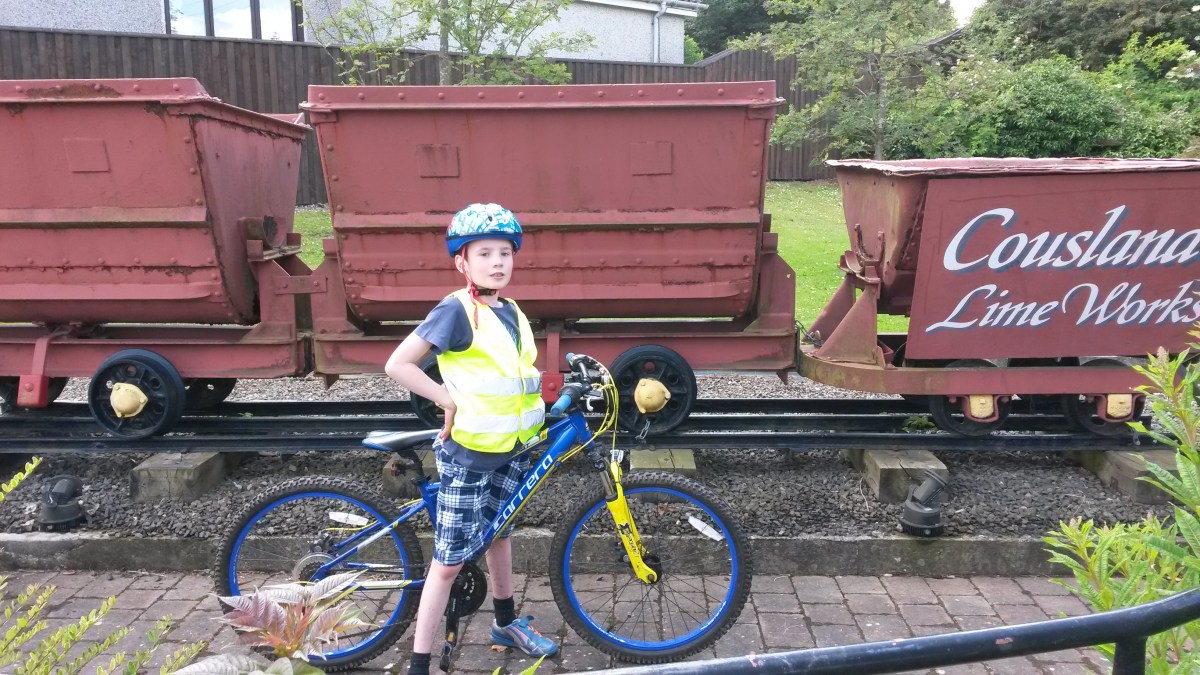
On thursday morning Dad and I took a special guest with us when we went for a short cycle run. The special guest was my sister Isla who is 6 years old and is already quite a good cyclist (but not as good as me obviously…). To shorten the route, we took the car to Temple and started from there. We parked next to a nice old boat believe it or not.

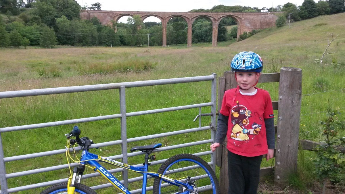
The first part of the route is along a narrow road with a nice smooth surface. It’s also very quiet and we saw only one vehicle all the way to Gladhouse. The road starts to climb steeply uphill about halfway along, near to Yorkston Farm but soon we reached the high point and got a good view over to the Moorfoot Hills as we sped downhill towards the reservoir. We stopped next to the water for some photos and a bag of crisps.

Cycling along the road alongside the reservoir is very pleasant and is mostly flat. The view across the reservoir towards the hills is quite nice too. Eventually, we came to a junction and turned right to head back uphill in the direction of Temple. This road was a little bit busier as it is the back road to Peebles (we saw about 4 cars in a mile!) but it’s safe enough for us and is popular with cyclists (we saw lots of them on this stretch of road). We then joined onto the B6372 which was also a bit busier but still a good cycling road and the mile or 2 we cycled on was mostly downhill so was good fun.

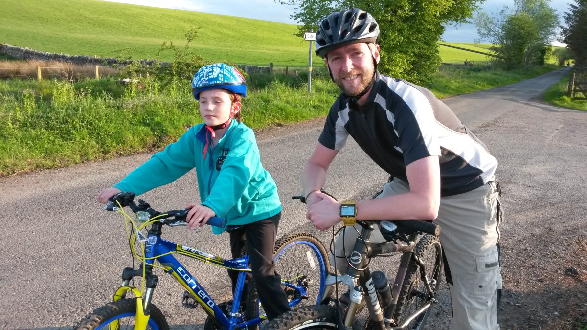
When we saw a signpost for Rosebery Reservoir we turned right onto a very narrow road. There’s a very steep downhill section just before the reservoir and that’s where I reached my fastest speed of the day. I was going so fast that I forgot to stop at the reservoir but Dad and Isla managed to get a quick photo before racing off after me. After the reservoir is a slow uphill section which takes you right through Yorkston Farm where we saw loads of sheep in the farmyard. I think they had been getting their fleeces cut off. Then it’s a lovely smooth ride downhill back to Temple on another quiet single track road. At a secret location somewhere on the road back, we stopped to forage for wild raspberries. Unfortunately though, there weren’t any ripe yet so we were not able to stuff our faces and headed back to the car with empty stomachs…

Grand Tour of the Scottish Borders

Route Out – Gorebridge to Middleton to Dewar to Innerleithen to Peel to Clovenfords. For route map click here.

Route Back – Clovenfords to Bowland to Stow to Fountainhall to Heriot to Middleton to Gorebridge. For route map click here.

  • Weather – hot and sunny with almost no wind.
  • Distance travelled – 58.68 miles
  • Riding time – 6 hours 23 minutes
  • Maximum speed – 29.5 mph
  • Average speed – 9.1 mph

On Tuesday I decided to go for a grand tour of the Scottish Borders which was going to be my longest cycle ever. Dad and I left just after 7am so that we could try and get back home in time for our tea. Amazingly, despite it being the only hot day of the Scottish summer, we actually managed this…

We left Gorebridge on the quiet B6372 road. After a couple of miles, just before turning off onto the sign-posted National Cycle Route no.1, we spotted a hot air balloon floating in the sky so we stopped to photograph it. It was low enough in the sky that we could see and hear the burning flame. This section of Route no.1 is a very quiet single track road which took us around the back of the Middleton Lime Works quarry before we reached Middleton, where we stopped for a quick snack beside a field of chickens. After that, we stayed on Route no.1 and cycled up into the Moorfoot Hills for about 3 miles along the B7007 until, at the top of the hill, we entered the Scottish Borders. The road was very quiet and we got some great views over to the Pentland Hills, Arthur’s Seat in Edinburgh and the new Forth Road Bridge. From the high point on the road of 404m near Carcant Wind Farm, it was downhill all the way to Innerleithen (apart from a short section just after Dewar which was suspiciously, and annoyingly, slightly uphill) so we sped down the road in no time at all. This is a lovely scenic road with hills on all sides. It’s also very quiet so a nice road to cycle on. Just before Innerleithen, we stopped for a short break to eat our crisps on some rocks next to the Leithen Water.

We didn’t stop in Innerleithen but carried on along Route no.1, firstly on a short section of cycle path which took us over a bridge to the south side of the River Tweed and then along the single track road which follows the river along to the village of Peel. This is a lovely quiet road with only a few short hills and almost no traffic at all. At one point I spotted a huge patch of wild raspberries so I stuffed my face for a good 10 minutes or so. I then decided to make some raspberry juice in my water bottle – it was tasty! At Peel, there’s an old bridge over the River Tweed where you get a really nice view so we stopped there for our lunch.

After that, there was short section on the A707 but luckily, it seemed to be very quiet for an “A” road so it was safe enough for us. We then turned off Route no.1 and headed into the village of Clovenfords. There’s a shop there and since it was by now starting to get quite hot, we decided to get an ice cream to try and cool ourselves down. It didn’t really work but at least it was tasty… The next couple of miles was very steeply uphill along another very quiet country road. We got some good views from the top when we finally got there and then we were able to speed back down the other side to the hamlet of Bowland. It was on this section that I reached my fastest speed of the day. Bowland has a nice archway leading to an old mansion house on the hill but we didn’t stop for a visit. Instead, we headed uphill again along a narrow private road (luckily the gates were open) which eventually took us to the quiet single track road on the Western side of the Borders Railway. We stayed on this road for around 12 miles and saw roughly 9 trains in this time so I was pleased. The highlight of the day came when we stopped for a rest at Stow Station and we saw 2 trains passing by just underneath the bridge.

From Stow, we headed northwards, going up and down hills all the way and saw no cars at all. We passed through the village of Fountainhall and eventually turned left onto the B709. This is another scenic and quiet road which took us through Heriot before eventually joining up with the B7007 again. Here we re-joined Route no.1 and headed back uphill through the Moorfoot Hills to enter Midlothian again. The views over to East Lothian on the way back downhill were really good. After Middleton we continued speeding downhill the rest of the way home to Gorebridge. It had been a long day of cycling and I was very tired by the end. I didn’t break my average or maximum speed records but it was easily the longest cycle run I’d ever managed so I was very happy (to get back home and tuck into my fish cakes at least!).

Gorebridge to Dalkeith the Long Way

Route out – Gorebridge to Dalhousie to Capielaw to Rosewell to Bonnyrigg to Eskbank to Dalkeith. For route map click here. Note that Google Maps doesn’t seem to know about all of the cycle routes through Dalkeith (no.196 and no.1). After Bonnyrigg, just follow the all the blue signs and this takes you mainly off road via Eskbank Station and Newbattle Golf Course until Dalkeith Campus.

Route back – Dalkeith to Crossgatehall to Cousland to Fordel Mains Farm to d’Arcy to Gorebridge. For route map click here.

  • Weather – sunny and cloudy, quite warm and very windy.
  • Distance travelled – 23.32 miles
  • Riding time – 2 hours 30 minutes
  • Maximum speed – 37.5 mph
  • Average speed – 9.3 mph

Today, Dad and I decided to go the long way to Dalkeith so that we could investigate one of the few sections of cycle route no.196 that we hadn’t already been on from Hardengreen Tesco to Crossgatehall. It was a lovely part of the route and I really enjoyed it.

Our route began from our house in Gorebridge as usual. We sped out of the village down the steep B704 at over 30mph (breaking the speed limit but not by more than 10% so I’m sure we won’t get a speeding ticket!). We stopped for a quick photo of Dalhousie Castle and then soon turned left onto cycle route no.1, heading for Carrington. After a mile or so we turned right onto a very quiet minor road and it was getting hot so I took off my fleece. About 10 seconds later a wasp flew in and decided to sting me on the arm – it was really sore! Believe or not, I was stung yesterday as well. How annoying… We then turned off this road onto a very bumpy single track road to Capielaw. This turned into a rather muddy track after a while, taking us around the back of Whitehill House Golf Course which looked rather nice. Eventually, the mud and potholes turned into proper road again and we sped the last mile downhill to Rosewell.

At Rosewell we joined the cycle path of route no.196 and zoomed downhill all the way through Bonnyrigg to Tesco, stopping just twice to forage for wild raspberries. From here there’s a new section of cycle path which goes through Eskbank Station. Sadly, we didn’t see any trains today. After the station, we must have missed the cycle route sign and cycled the wrong way for a few hundred yards before realising our mistake and turning round. The route no.196 signs appear to suggest cycling round Eskbank Toll roundabout but we thought it looked far too busy and dangerous so we took a short cut through The Justinlees car park instead. The next part of the route was my favourite, going through the woods alongside Newbattle Golf Course where we stopped on a bridge over the River Esk for a drink. From there it was all downhill along the cycle path and some sections of pavement until we reached a junction in the cycle route next to lots of electricity pylons, just before Whitecraig. We turned right and followed the sign for route no.196 until we reached the traffic lights at Crossgatehall.

After a short downhill section on the relatively quiet A6124, we then turned left and headed steeply uphill to the village of Cousland where we stopped for a quick oatcake and drink. In Cousland we spotted something we hadn’t seen before – some old narrow gauge railway trucks from the Cousland Lime Works. After Cousland we cycled uphill again until Fordel Mains Farm and then uphill once more to d’Arcy which was the highest point on the route and gave us a great view over to North Berwick Law, the Bass Rock, Traprain Law and the Lammermuir Hills. A few weeks ago we had come this way so that we could speed down a really steep section here. We broke our fastest ever speeds that day and today we completely smashed the records again. I reached 37.5mph and Dad even got to 41.9mph! It was really amazing going that fast. We then went along at a more reasonable speed for the last few miles home.

Gorebridge to Haddington via the 3 Saltouns

Route out – Gorebridge to Newlandrig to Crichton to Pathhead to West Saltoun to East Saltoun to Bolton to Haddington. For route map click here.

Route Back – Haddington to Samuelston to West Saltoun to Saltoun Station to Windy Mains to Whitburgh Mains to Pathhead to Ford to Edgehead to Gorebridge. For route map click here.

  • Weather – cloudy, dry, quite warm and not very windy.
  • Distance travelled – 40.35 miles
  • Riding time – 3 hours 54 minutes
  • Maximum speed – 28.4 mph
  • Average speed – 10.3 mph

The weather forecast was for heavy rain in the afternoon so I decided we would wake up at 5:30am so we could go for a very long cycle to Haddington in East Lothian and be safely home before we got wet. I actually slept through my alarm but luckily Dad woke me up and we were on the road by 6:15am.

We headed out along the B6372 and at the village of Newlandrig, just before Vogrie Country Park, we turned right on to a really smooth single track road which took us up a steep hill for a mile or so. At the end of this road we turned left and soon got a good view of the ruined Crichton Castle. The road took us very quickly down into the steep gorge and then very slowly up again to Crichton, which is really not much more than a few houses. From there we took the B6367 to Pathhead. This road is all downhill and we got there in only a minute or 2, entering the village on a nice newly resurfaced road with lovely speed bumps which we zoomed over at almost 20mph (which was fun).

The main A68 road passes through Pathhead but it was quieter than normal at this time of day so it was easy to get across the road and onto the minor road that took us downhill towards the massive lions guarding entrance to a country estate. We didn’t go in but instead headed for East Lothian, cycling passed millions of pylons along the way. The roads in East Lothian are quite flat compared to Midlothian so we sped along the route quicker than ever. We stopped at Lempockwells bus stop for an apple and a drink before heading for our first Saltoun of the day – West Saltoun. There’s a really good bus stop here too but we decided not to stop here until the way back. We did manage to take a photo of the most amazing 4-way signpost though (which lists all the mileages in fractions) and then cycled the 7/8 of a mile to East Saltoun. Here we discovered an old phone booth which had been turned into a library called the Book Nook.

Our next stop was in Bolton where we stopped for a nosey at a nice looking church. Then it was only a few miles to Haddington along a nice quiet road near the Tyne Water river. We arrived there by about 8:25am and headed to the public toilets. Unfortunately we were too early (they open at 9am!) so after a quick chocolate digestive and an oatcake we headed back into the countryside to look for a suitable tree. We took Cycle Route 196 out of the town, following a path along the river for a mile or so and then joining onto the road again. We followed Route 196 for a while, cycling along a really quiet road through Samuelston. Just before we got to West Saltoun again, we really did need to have a bathroom break so we stopped behind a massive tree to relieve ourselves. A herd of cows in the field ran up to investigate and after seeing what we were doing, decide they would join in too…!

We stopped in the amazing bus stop in West Saltoun for another oatcake before heading back along Route 196 for 3/5 of a mile to Saltoun Station. This is where there used to be a railway station and is where the cycle route turns into a cycle path again, heading to Pencaitland and Ormiston. We went the opposite way though along a narrow road through a farm. At one point we came to a locked gate and were about to lift our bikes over when the nice farmer came and opened it for us. After that we cycled passed the sawmill at Windy Mains and then onto the single track road which takes you down to the ford. According to the massive ruler thing at the side of the road which measures the depth of the water, I am now 5 feet tall! Last time we stopped here, a brown bear stole my chocolate digestive but this time the bear was nowhere to be seen so I enjoyed my biscuit…

The next section was completely traffic-free and took us onto Salters Road which heads steeply downhill. It was here that I reached my fastest speed of the day (for the first time). A couple of miles later, just passed Whitburgh Mains Farm, there’s another long downhill section where I reached my fastest speed of the day again before heading back along Ormiston Road into Pathhead. From here, we zoomed down the steep road to Ford without even breaking the 30mph speed limit. In Ford we got a great view of the Lothian Bridge viaduct which carries the A68 road in and out of Pathhead. That was my favourite view of the day. It was a steep climb out of Ford and up to Edgehead but after turning left onto the narrow farm road home, it seemed to level out a lot and it was mostly easy going for the last 3 miles to Gorebridge.

Gorebridge to Penicuik Circular Route

Route out – Gorebridge to Bonnyrigg to Rosewell to Roslin Glen to Penicuik. For route map click here. Google Maps says to go onto the A6094 for a short section before Rosewell but you don’t need to do this – just follow the path of Cycle Route 196 instead.

Route back – Penicuik to Mount Lothian Farm to Edgelaw Reservoir to Carrington to Gore Glen to Gorebridge. For route map click here.

  • Weather – mostly cloudy, cold at first but warm later, some bright spells and no wind.
  • Distance travelled – 22.18 miles
  • Riding time – 2 hours 9 minutes
  • Maximum speed – 32.8 mph
  • Average speed – 10.3 mph

On Sunday morning we got up early and by 7am we were already on our way to Penicuik, which is near the Pentland Hills about 10 miles from our house. I had been thinking of cycling there for a while and there are lots of different ways to get there. Today, we decided to go there along the Dalkeith to Penicuik Walkway which follows the route of the old railway line.

To save time, we headed straight out of Gorebridge along the main B704 road. At this time of the day on a Sunday traffic is really quiet, but I wouldn’t recommend cycling on it normally. This road heads steeply downhill and me and Dad both reached 30mph before we reached the traffic lights at the crossroads with the A7. We went straight through the lights and headed downhill again passed Dalhousie Castle where we stopped for a quick photo. Soon we reached the town of Bonnyrigg which is about 3 miles from Gorebridge and just before the town centre, we turned left onto Cycle Route no.196 which follows the Dalkeith to Penicuik Walkway. Straight away we saw evidence of the old railway with the disused Bonnyrigg station platform. At this point the cycle path is a nice smooth surface and quite flat. The only real hazard is that you have to make sure you don’t cycle through dog poo – there is a lot of of it on this section of the route. Dad also discovered that you have to watch out for the wildlife too – he accidentally ran over a massive slug and it splattered all over his knee!

The next village along the line is Rosewell and here I spotted a no.49 double decker bus heading into the village. We stopped here for our first snack of the day: I had an apple and Dad had a banana. After Rosewell, the path becomes much more bumpy and muddy in places as you head into the picturesque Roslin Glen. We didn’t see any dog poo on this section of the path but there was a lot of horse poo to avoid instead… We passed another old station platform and cycled under and over some bridges and through 2 old railway tunnels before we eventually arrived in Penicuik.

Penicuik is a bit bigger and has more shops than Gorebridge but we didn’t go into the town centre,  just stopping for a few minutes to have our crisps. We then turned onto the B6372 and cycled up the really steep hill out of the town and into the countryside. The road was very quiet apart from lots of other cyclists and we stopped for a few photos along the way, including one at Mount Lothian Farm. This road is quite high up and in the winter you get a lot of snow here but today it was far too hot for snow… After a few miles, we took a turning off the road and followed a track through the trees and down to Edgelaw Reservoir. On the way, we spotted a deer and at the reservoir we spotted lots of people fishing. We didn’t spot any fish though.

After the reservoir we left the muddy track behind and went back onto a nice smooth, straight and deserted road which took us a few miles (almost all downhill) to Carrington. It was on this section that I managed to go over 30mph two more times. Dad even went over 35mph at one point. Carrington is a very quiet little village and it has some nice benches so we stopped for our last snack of the day – chocolate digestives! From Carrington, we sped downhill all the way to Gore Glen on the really quiet single track road. Just before the glen, I reached my world record fastest speed of 32.8mph. All these downhill sections came at a price though as the road from Gore Glen back to Gorebridge is uphill all the way. It was fine though because we eaten our digestives so had lots of energy. Soon we were back home, less than 3 hours after we’d left. Amazingly our average speed was also a world record for us today at 10.3mph.

Gorebridge to Longniddry Circular Route

Route out – Gorebridge to Edgehead to Fordel Mains to Mussleburgh to Port Seaton to Longniddry. For route map click here.

Route back – Longniddry to Bogg Holdings to Pencaitland to Ormiston to Cousland to Gorebridge. For route map click here.

  • Weather – bright at first but mainly cloudy, quite warm and fairly windy later on.
  • Distance travelled – 39.81 miles
  • Riding Time – 4 hours 14 minutes
  • Maximum speed – 32.1 mph
  • Average speed – 9.3 mph

This morning I decided I would like to cycle to Mussleburgh and back but in the end, we decided to go as far as Longniddry and turned it into circular route through East Lothian.

Our usual route from the house took us slowly uphill for the first mile until we reached the B6372 road which takes you passed Vogrie Country Park. We zoomed along the nice smooth road surface for a few miles and then turned left into the village of Edgehead. At a farm at the edge of Edgehead we spotted an old Lothian Buses double decker bus parked in the farmyard. I have no idea what the bus was doing there but since I love buses, we stopped for a photo. Shortly after the village we turned off on to the bumpy road to Fordel Mains Farm. About halfway along this road we stopped to enjoy the view of Edinburgh Castle and Arthur’s Seat. After Fordel Mains we sped all the way downhill passed Carberry Tower to Mussleburgh at almost 30 mph.

In Mussleburgh, we arrived at Luca’s Ice Cream shop just at the exact moment that it opened so we popped in for a chocolate ice cream cone. This gave us an energy boost so instead of turning round and heading home, we decided to go and investigate Cycle Route no.76 and the John Muir Way. We took a combination of these routes (which sometimes follow the same path) to travel mostly off-road right along the coast all the way to Longniddry. The path is mostly quite good and wasn’t too busy with dog walkers and you get good views over to Edinburgh and Fife. On the way, we went through Prestonpans, went right around Cockenzie Power Station (which is now closed), stopped at Port Seaton harbour for a snack and passed by Longniddy Bents beach. The last mile or so into Longniddry was on a main road. It was quite busy so I wouldn’t recommend this section for inexperienced cyclists.

In Longniddry we stopped at the train station just in time to see the train to Edinburgh Waverley pulling into the station. I love trains and this was the first time I’d seen an electric train in my life, so this was my favourite part of the day.

The next section was really quite slow and uphill most of the way to Pencaitland on the B6363. At one point we passed through a silly place called Boggs Holdings and it was here that Dad spotted a funny sign that said: “Slow down for duck sake!” I wasn’t sure what was so funny about it but dad said that when I’m older I will understand what it means… Just before Pencaitland, we were overtaken by an ancient old van. Coincidentally, this was Luca’s ice cream van and it was on its way to the park in Pencaitland where there was a children’s football competition taking place. We stopped there for lunch of oatcakes and cheese and then managed to get a sneaky photo of the ice cream van (without having to buy any more ice cream).

At Pencaitland we joined Cycle Route no.196 which takes you along the old railway line. The path has recently been resurfaced with gravel and this has made it much harder to cycle on. Annoyingly, this made our average speed go down. We cycled passed Ormiston Community Garden where they grow lots of fruit and vegetables on the old railway platform. We then stayed on the path right to the end where it reaches the A6124 and then turned left and then left again to climb the steep hill into Cousland. We didn’t really stop there but carried on uphill again until we reached Fordel Mains once more. After that we avoided Edgehead and instead took another uphill diversion to the highest point on the route at d’Arcy. We didn’t do this because we love cycling uphill. It was because, from there, there is the steepest downhill section in the world. Dad managed to go over 37 mph and I broke my record speed as well at 32.1 mph. We’ve been down here a few times before but this was the first time we didn’t get caught in a torrential downpour of rain or hailstones so it was the first time we were able to go as fast as possible.

The next few miles follows a farm track which has a good surface but is full of potholes so you have to be a bit careful. This track is part of the Tyne-Esk Trail and it took us most of the way back home, rejoining the B6372 for the last mile to Gorebridge.

Callander to Killin and Back Again

Route out – Callander to Loch Lubnaig to Strathyre to Lochearnhead to Glen Ogle to Killin (via National Cycle Route no.7). For route map click here. Note: Google Maps suggests going onto the A84 for 2.1 miles after Strathyre but there is a new section of cycle route no.7 next to the main road that you can use instead – that’s what we did and it’s much safer.

Route back – same as the route out but in reverse.

  • Weather –  hot and sunny with almost no wind.
  • Distance travelled – 44.41 miles
  • Riding time – 4 hours 48 minutes
  • Maximum speed – 27.1 mph
  • Average speed – 9.2 mph

On sunday, Dad and I drove to Callander in Stirlingshire with our bikes to try out National Cycle Route no.7 for the first time. We parked in the car park next to the river and followed the sign saying Killin 22 miles which took us onto the route no.7 cycle path. I was thinking about only going as far as Strathyre which is 9 miles from Callander but amazingly, we managed to go all the way to Killin and back (over 44 miles) and this was a world record for us!

The route is almost completely off road and the cycle path is mostly a nice smooth surface and appears to be quite flat. It is actually slightly uphill most of the way out but you don’t notice this and we managed to go quite fast. There’s loads of really nice scenery to look at on the way including the mountain Ben Ledi and Loch Lubnaig where we stopped for a photo and an oatcake. Just before the village of Strathyre there is a very steep winding section where the path is very rough – I got stuck once on the way up. Just outside the village, we stopped for our lunch on a bench overlooking the loch. My cheese sandwich, celery sticks and rocket must have given me an energy boost so I decided to keep going rather than turn back.

From Strathyre there is a new section of cycle path which is a short cut and avoids either going on the main road or the much longer alternative route on the minor road via Balquidder. It was here that we discovered some wildlife – well actually Dad did, when a wasp flew inside his helmet and buzzed around for a minute or two. Thankfully for him, it managed to escape without stinging him on the head! Anyway, in no time, we had reached Lochearnhead but we didn’t bother going in to the village. Instead we started up the extremely steep and windy section which leads into Glen Ogle. I got stuck here once more so we stopped for a photo of Loch Earn and also filled up our water bottles at a waterfall. Eventually we reached the top and cycled the few miles to the impressive railway viaduct. I love steam trains so this was my favourite part of the route.

The last section to Killin is steeply downhill for 4 miles and that was where I reached my fastest speed of the day. In Killin we got a good view of the mountains near Loch Tay and ate a Magnum choc ice at the Falls of Dochart before heading back the way we had come.

On the way back from Killin to Glen Ogle, I got stuck once again. It really did seem quite a steep plod for those few miles. After that though, it was almost all downhill back to Callander. We stopped at Loch Lubnaig again and this time I went for a paddle in the shallow water at the edge. Then we sped that last few miles back to Callander where I had a fish cake supper for my tea.

Gorebridge to Temple on a Sunny Evening

Route out – Gorebridge to Gore Glen to Carrington to Temple. For route map click here.

Route back – Temple to Castleton Farm to Halkerston Farm to Fushiebridge to Gorebridge. For route map click here.

  • Weather – hot and sunny and hardly any wind.
  • Distance travelled – 12.09 miles
  • Riding time – 1 hour 22 minutes
  • Maximum speed – 25.4 mph
  • Average Speed – 8.6 mph

It was a lovely sunny evening so Dad and I went for a short cycle after tea on a circular route to Temple and back. Tonight we saw baby cows, baby horses, 1 tractor, 2 trains, only 3 cars but loads of bikes. For a change, we headed downhill out of Gorebridge and soon we were zooming down the steep slope into Gore Glen, where I reached my fastest speed of the day. After that, it was all uphill along a very quiet single track road until we reached the village of Carrington where we stopped at a bench to have a quick oatcake and a drink.

The road from Carrington to Temple is a proper road with a white line down the middle and you normally see a few cars on this section. Tonight, however, it was deserted because there was a sign saying “road closed” just at the edge of Carrington village. We decided to take a chance and ignored the sign and headed towards Temple anyway. As it turned out, the sign had lied and only one lane of the road was shut for roadworks for only about 100 yards.

The road into Temple is very rough and bumpy and also extremely steep but the village is really lovely so we stopped there for another oatcake. A mile or so after Temple, we bumped into Dad’s friend Scott from North Middleton, who was also out on his bike. Dad used to play in a band called Dropkick with Scott until he left the band a year and a half ago so that he could go cycling more often with me… I made Scott pose for a photo before he went on his way to Gladhouse Reservoir a few miles further along the road.

We headed in the opposite direction and when we reached Castleton Farm, we turned right onto a narrow road which took us gradually uphill to the highest point on the route at Halkerston Farm. This is a very quiet road and I don’t think I’ve ever seen another cyclist on it – maybe it’s our secret road. Near the bottom of the hill you get a really good view over the Pentland hills and near the top the view is even better: you can see Gorebridge, Edinburgh, the Firth of Forth and the Lomond Hills in Fife. After the farm it was downhill all the way to Fushiebridge and after another short uphill section, we were soon back home in Gorebridge.

Gorebridge to Peaston Circular Route

Route out – Gorebridge to Edgehead to Cousland to Peaston. For route map click here.

Route back – Peaston to Windy Mains to Crichton to Gorebridge. For route map click here.

  • Weather – sunny and not much wind. Freezing at first but much warmer after Cousland.
  • Distance travelled – 24.18 miles
  • Riding time – 3 hours 8 minutes
  • Maximum speed – 26.5 mph
  • Average speed – 7.7 mph

On Saturday morning we got up at 5:14 am and were out on our bikes before 6 o’clock. We were up so early because I was going out in the afternoon with Mum so we had to be back before lunchtime. Going cycling so early was good because the roads were very quiet and we saw lots of wildlife: deer, pheasants, squirrels and even a brown bear (more about him later on…). The bad thing about cycling in the early morning, even in mid-May on lovely sunny day, is that it was extremely cold. It will soon be summer but there was lots of frost on the ground and for the first hour of the journey, my hands were freezing! And because I was freezing, I was pedaling really slow…

As usual, the first mile from our house is straight uphill but after that, it was an easy ride along the B6372 passed Vogrie Country Park to the village of Edgehead. After another steep uphill section we stopped on the narrow road to Fordel Mains farm to look at the amazing view over to Edinburgh, The Pentland Hills, Fife and beyond. It was here that we saw the brown bear for the first time when he tried to steal my bike… About a mile from here is a place called Cousland and we stopped on a bench to have a quick snack and also to warm up our frozen fingers by clapping our hands. The cheeky bear must have followed us there and he managed to sneak onto my knee when Dad was taking a photo.

After Cousland there’s a really fast downhill section and it it was here that I reached my fastest speed of the day. Soon we came to the A6093 road at the border with East Lothian. Normally we avoid main roads but because it was very early in the day, the traffic was very light so we headed east for about half a mile and then turned right at the really amazing old road sign, heading towards Peaston. There are lots of amazing old-fashioned signs in East Lothian and I love them because they give the distances with fractions of a mile. According to this one, Peaston is 2 1/4 miles.

As it turned out, there’s not much in Peaston apart from lots of old farm building and cottages that are crumbling and falling down. Dad said it was looked like a ghost town so we didn’t even stop there. Soon we reached another favourite road sign of mine – Slow Bad Bend – next to the sawmill at Windy Mains. A mile after the sawmill we reached the ford. This is where a stream flows over the top of the road at the border of East and Mid Lothian. Here we stopped for a snack and once again, spotted the brown bear as he tried to steal one of my chocolate digestives. After I rescued my biscuit, we headed through the scenic countryside along Salters’ Road. This is a really lovely quiet road and we didn’t see any traffic until we reached the main A68 road. At one point we cycled underneath some electricity pylons and you could hear them making a crackly buzzing sound.

We crossed over the A68 and cycled down the minor road to Crichton. There’s only a few houses here and after that you come to one of the steepest hills in the world! We sped down into the gorge and then crawled back up the other side in gear 1. On the way back up, we got a good view of the ruined Crichton Castle. After a short relatively flat section we came to Borthwick crossroads where we turned right, uphill yet again, for the last mile or so back to Gorebridge.

Redford to Arbroath Circular Route

Route out – Redford to Woodville to Arbroath. For route map click here.

Route back – Arbroath to Guynd to Carmyllie Church to Redford. For route map click here.

  • Weather – cool, hazy and windy at first. Brighter with sunshine and warm from Arbroath onwards.
  • Distance travelled – 13.74 miles
  • Riding time – 1 hour 22 minutes
  • Maximum speed – 24.9 mph
  • Average speed – 10.0 mph

My Granny and Granda live in a tiny village called Redford which is about 15 miles north of Dundee in the Angus countryside. I had noticed a while ago that there are lots of nice quiet roads near their house which looked like they would be perfect for cycling on, and when we went to visit them this weekend, I got the chance to try some of them out. Luckily for me, Dad used to cycle around this area when he was at school so he knows lots of good routes that we could try out. This time we decided to do a circular route from Redford to Arbroath and back.

We headed slightly uphill out of the village on the B961 past Carmyllie Primary School, where Dad used to go when he was younger and Granda was also the headteacher. We soon reached a crossroads and turned right at the signpost for Arbroath. Then we headed up a short but steep hill where, at the top, we could even see Arbroath 5 miles away in the distance. After that we zoomed the rest of the way downhill towards the town in only 20 minutes or so. On the way, just after Woodville, Dad spotted a deer in a field of wheat but I was going so fast that I didn’t even see it.

In the outskirts of Arbroath we stopped at a bus stop to have a snack of oatcakes before heading back out of the town along the B9127 towards Guynd, where we discovered a solar energy farm. There seemed to be hundreds of solar panels in the field and Dad explained to me that these solar panels turned sunlight into electricity.

The Guynd road eventually took us back to the B961 but instead of turning right to head back to Redford, we took a detour along a tiny road so that we could see Carmyllie Church. This was a steep uphill section – Dad said he used to have to push his bike up it until he was at least 14 years old – but I thought it was really quite an easy hill, nowhere near as steep as some of the roads we cycle on in Midlothian. Anyway, the church was quite nice I thought. After that we took another back road, mostly downhill this time, speeded passed by some tractors planting potatoes in a field, before arriving back at Granny and Granda’s house just in time for a big drink of juice and a sneaky biscuit or two…