Gorebridge to Romannobridge (the long way)

Route out – Gorebridge to Temple to Portmore Loch to Lamancha to Romannobridge. For route maps click here and here.

Route back – Romannobridge to West Linton to Penicuik to Roslin Glen to Rosewell to Bonnyrigg to Eskbank to Newbattle to Newtongrange to Gorebridge. For route map click here.

  • Weather – dry and cold, mostly cloudy with a few sunny intervals and almost no wind.
  • Distance travelled – 44.57 miles
  • Riding time – 4 hours 27 minutes
  • Maximum speed – 29.2 mph
  • Average speed – 10 mph

Last Sunday Dad took me on a tour of some of parts of Midlothian and the northern Borders that we hadn’t cycled through before. It was freezing cold but we still had a great day out in the countryside.

We left Gorebridge on the quiet B6372 road, soon passing by the entrance to Arniston House before turning off at the signpost for Temple. The village of Temple is a lovely place but unknown to most people, there are actually 2 sides to the village. Dad described it a being a bit like a Beatles 7″ single: most people choose to turn left and uphill through the main part of the village (the A-side. eg. “I Want To Hold Your Hand”) but if you turn right and head downhill, you discover an even nicer but less visited side of the village (the B-side. eg. “This Boy”). Anyway, enough of Dad’s nonsense… We chose the B-side and headed down the steep hill, stopping to have a look at the ruins of the Old Temple Kirk on the way. After that, we faced a monster climb which took us back up the narrow road until it joined up with the B6372 once again.

We stayed on this road for a few miles going up and down (mostly up actually) over the many hidden dips until we reached the turn off for the back road to Peebles. This is a great road for cycling on as there’s very few cars and the road surface is mainly very good (Dad thought it was the smoothest road surface he’s ever cycled on). The sun even tried to come out to melt away some of the low clouds and give us a decent view of the Moorfoot hills. We cycle this way quite often but we normally turn left and head along the side of Gladhouse Reservoir. Today we kept going straight, heading for the Scottish Borders. A couple of miles past the Borders sign, we stopped at the side of the road and Dad lifted the bikes over a locked gate which marked the start of the track to Portmore Loch. A few minutes of bumpy path later, we reached the loch, a very peaceful and picturesque place to stop and have our crisps. We then followed the track on the west side of the loch, heading south into the woods. It was rather muddy but as it was nearly all downhill for a mile or two, the going was fast and it was actually really good fun, with lots of nice bumps to jump over. Eventually, just after having a sneaky peak at the massive and very posh looking Portmore House (which seemed to suddenly appear amongst the trees as if from nowhere), the mud turned into a proper road surface again and we fairly zoomed downhill along this section of private road until we reached the gatehouse at the entrance to the estate.

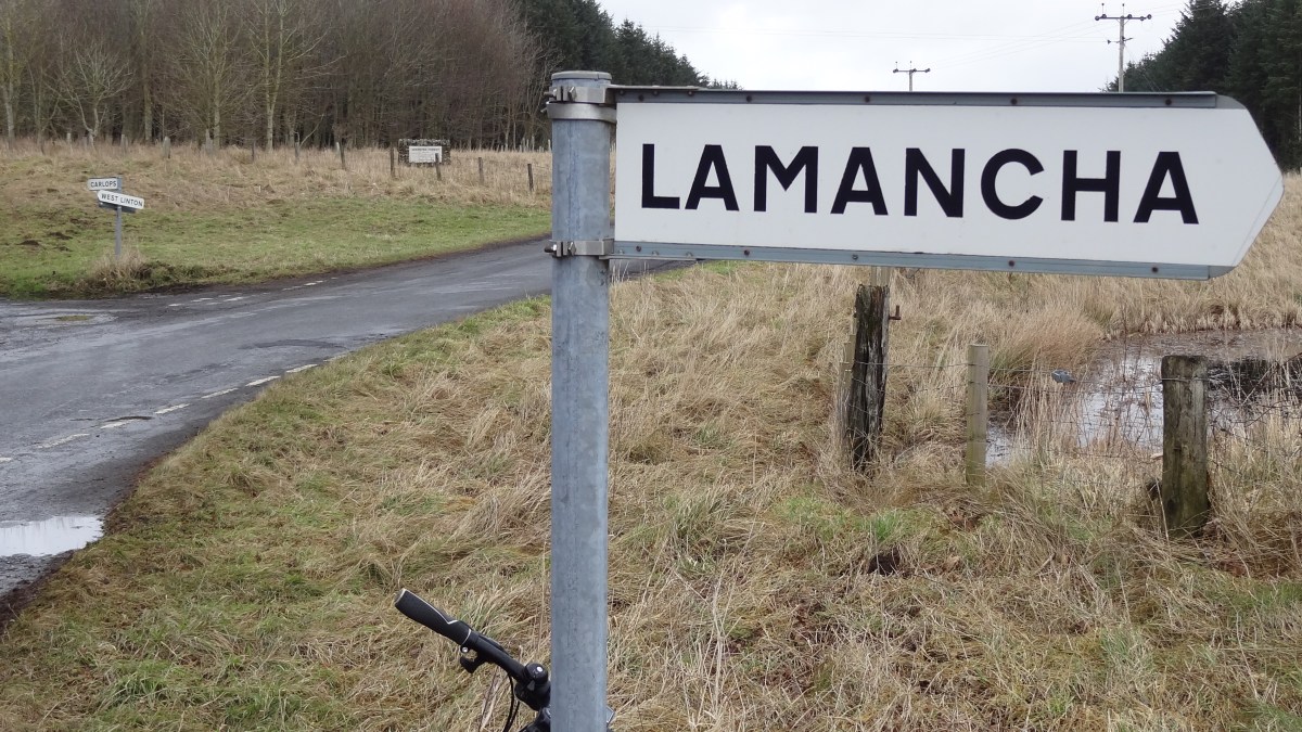
At this point we had no option but to turn right onto the A703 road. It’s the main road from Edinburgh to Peebles and not one I’d normally recommend due to the amount of fast traffic that uses it. However, we only had to go a few hundred yards along it (as fast as possible) to reach the minor road on the left which took us to Lamancha. This road is a great road for cycling as it’s almost completely deserted, is surrounded by beautiful Borders scenery and has a very good road surface with lots of really long straight sections. Some of the long straights were even downhill! After about 5 miles of this we arrived at a junction with another main road, the A701. This is a relatively quiet main road so much safer for us to cycle on, but first we stopped for a boiled egg (me) and a Yorkie bar (Dad) to give us an energy boost before tackling it.

We headed south along the A701 through a very nice valley. The road wasn’t too busy but the surface wasn’t all that smooth for a main road. It was mainly downhill though and in no time we had speeded past the hamlet of Lamancha (not much to see there) and also a place that sells tractors before reaching Romannobridge. Romannobridge is a very long village and it took a while to cycle right through it. Near the end, Dad spotted the actual bridge, so we stopped there for a photo. We then turned right onto the back road to West Linton. This is another great road with lots of nice views of the hills, including the Pentland Hills which became visible as we neared the village. The village itself is really lovely and quiet and would probably be a nice place to live. We stopped at the park for our lunch (oatcakes, cheese and carrot sticks).

We left West Linton along Deanfoot Road which takes you about 7 miles, most of the way to Penicuik. This is yet another amazing road to cycle on with some of the best possible views of the Pentland hills on one side and bleak open moorland on the other. I imagine it would get quite exposed here but thankfully, there was virtually no wind today. The road surface is pretty good, traffic is light and most of the road is completely straight, with the last few miles downhill and very fast. Along the way we were chased up a hill by a Border Collie (the dog won the race) and saw some rather homemade-looking signposts pointing roughly in the directions of Lamancha, West Linton and Carlops. For the last half a mile to Penicuik, we rejoined the A701 and sped down the hill to the town at well over 20 mph.

From there we took the old railway path (cycle route 196) for about 7 miles through Roslin Glen, Rosewell and Bonnyrigg until we reached Eskbank. This is a good path for cycling on and goes through some amazing railway tunnels along the way. It was very muddy in places though. In Bonnyrigg, we entered some sort of weird time warp, where at one point we were simultaneously both 2 miles and 3/4 of a mile from Eskbank…! (See photos for proof) At Eskbank we left the time warp (and cycle route 196) behind and took the B703 road through Newbattle. We then turned left onto a road called “The Beeches” which took us to Newtongrange. From there we followed the “Bryans” path which skirts around the east side of the town, eventually taking us through a small housing estate and onto Stobhill Road, which we then followed for the last mile or so back to Gorebridge.

Grand Tour of the Moorfoot Hills

Route Out – Gorebridge to Crichton to Tynehead to Fala Dam to Fala to Heriot to Pirntaton Farm. For route map click here.

Route Back – Pirntaton Farm to Over Shiels Farm to George Wood to Ladyside Farm to Middleton to Gorebridge. For route map click here.

A large part of this route is off road through Fala Moor and the Moorfoot Hills so make sure you remember to take a map with you so you don’t get lost. See images below for the maps we took with us.

  • Weather – Sunny and cloudy, light winds and quite warm.
  • Distance Travelled – 38.69 miles
  • Riding Time – 4 hours 31 minutes
  • Maximum Speed – 30.1 mph
  • Average Speed – 8.5 mph

The weather brightened up on Saturday afternoon, so after lunch Dad took me on an amazing cycle route through the Moorfoot Hills that he’d discovered a while ago. He told me it would be really scenic but also extremely steep in places so would be very hard. He was right…

The first part of the route is basically the same as the Gorebridge to Fala Dam route that we went on a few weeks ago. We varied it slightly by staying on the B6367 all the way from Crichton to Tynehead. This is a nice quiet road with good views of the Pentland and Moorfoot Hills but it also felt a lot steeper than it looked for most of the way. At Tynehead we turned left onto the B6458. I thought this road looked completely flat but it must have been slightly downhill and we fairly zoomed the few miles to the junction with the main A68 road at almost an average of 20mph. Then, after crossing over the A68 onto a single track road (where we saw some rather unusual looking goats), we sped downhill to Fala Dam (where we once again met up with the nice old dog that we saw the last time we stopped there). After Fala Dam there’s a really steep uphill section for about a mile until the village of Fala. Here, we stopped for a rest and some crisps in the play park before tackling one of the hardest sections of the route – the Fala Moor Road.

About 50 yards outside Fala, you need to cross over the busy A68 road to get onto the Fala Moor Road. It’s not really a road (Dad says it maybe used to be a long time ago) and it’s very bumpy and covered with loose stones making the relatively gentle slope really hard to cycle on – not at all suitable for road bikes. It was a bit of a slog really, but at least we saw 2 deer on the way up. Once at the top, the “road” becomes a bit less bumpy (thankfully) and levels out at around 300m high for a couple of miles through the moor and we got some nice views of the hills and some wind farms in the distance. The “road” ends suddenly at a sharp right turn and becomes a track through sheep and cow fields. Thanks to the recent rain and the cows, the track either side of the several gates along the way had turned into a muddy swamp which was impossible to cycle through. It was a bit of a relief to eventually reach Brothershiels Farm where we rejoined a proper tarmac road once more for the last mile until the junction with the main A7 road.

We only went on the main road for a few hundred yards but annoyingly, this was the bumpiest road surface of the day so if you are cycling on this part of the A7, please be careful and don’t go too fast in case you come a cropper… We soon turned off the main road and went under the under-pass to the other side of the Borders Railway line into the village of Heriot. After that we basically followed the railway line southwards on the Old Stage Road. This is a lovely, quiet single track road which has lots of up and downhill sections and lots of good views too (and lots of foraging opportunities!). After a few miles we reached the turning on the right for Pirntaton farm and the road started to go uphill. Dad had told me there would be some unbelievably good conker trees next to the farm – and he was right, I’ve never seen so may conkers before. We filled up our rucksack with as many as we could fit before carrying on up the narrow road as it became steeper and steeper the further into the hills we went. Eventually, at a height of about 350m, the road ran out, and we had a brilliant view of the Moorfoot Hills as we crossed a cattle grid onto the track which would lead us right over the hills to the other side…

This section was a lot of fun with loads of fast downhills but some incredibly steep uphills too. The views of the hills were amazing and we saw loads of wildlife – millions of grouse and pheasants, a heron, hares and buzzards. The track is a very good surface for most of the way – a bit like the kind of hard packed gravelly surface you find on some cycle paths –  and it only became too difficult to cycle on the very steepest parts where the surface was quite loose (I wouldn’t try this route on a road bike by the way…). Amazingly, we only had to push for a couple of very short sections. We had to cycle through 5 fords along the way (this is where the stream flows over the path). This was quite hard the first time but Dad told me to use a low gear and pedal as fast as possible otherwise I would get stuck – and he was right again and it wasn’t too bad at all actually. I only got my feet wet a couple of times! After a while we eventually managed to struggle our way at 2mph in gear 1 up to the highest point of the hill at around 525m. Here there is a small area of trees called George Wood where we stopped to forage for wild blueberries (very tasty). From there, the view was amazing and we could even see the Eildon Hills at Melrose far away in the distance. We also got a good view of the path we’d cycled up and could see exactly how ridiculously steep it was… The ride down the other side of the hill is basically all downhill (obviously) and is great fun. However, the first part is VERY steep so you have to be extremely careful not to go too fast or skid off the path into the heather… Soon enough, the slope becomes more gentle and we had an easy, fast decent (through the fords) the rest of the way to Ladyside Farm where we joined onto the B709.

The last part of the route follows the B7007 back to Gorebridge via Middleton and Fushiebridge. See the route Gorebridge to Dewar for more details about this section. Just before the high point in the road, we stopped at the entrance to the track to Blackhope  Farm and from there we got a good view back down the valley to the Hill that we’d cycled over the top of. It was quite a amazing to think we’d managed to do it. In total (according to Google Maps anyway) we’d cycled up nearly 3000 feet of accent over the whole afternoon which is almost as much as cycling to the top of a Ben Nevis (so Dad said anyway)! So when we got back to Gorebridge, we decided we deserved to stop at the Gorefry takeaway for a seafood pizza before heading home. It was a really amazing journey through the mountains and one I’ll certainly be going on again.

Gorebridge to The Forth Road Bridge (the long way)

Route Out – Gorebridge to Mayfield to Carberry to Whitecraig to Newcraighall to Bruntstane to Holyrood Park to Edinburgh City Centre to Haymarket to Silverknowes to Dalmeny to South Queensferry to The Forth Road Bridge. For route map click here.

Route Back – The Forth Road Bridge to South Queensferry to Dalmeny Estate to Silverknowes to Leith to Portobello to Musselburgh to Inversesk to Whitecraig to Dalkeith to Newbattle to Newtongrange to Gorebridge. Google Maps decide to be annoying so this route had to be split over 2 maps: click here for map 1 and here for map 2.

  • Weather – mostly sunny and warm with almost no wind.
  • Distance travelled – 61.67 miles
  • Riding time – 6 hours 10 minutes
  • Maximum speed – 31.4 mph
  • Average speed – 10.0 mph

I had been thinking about trying to cycle to the Forth Road Bridge for ages but had thought it would be far too difficult and would be impossible to avoid all the busy roads. But then I discovered that National Cycle Route no.1 went the whole way there and almost all of the route through the city of Edinburgh is off road on cycle paths. So, early on saturday morning Dad and I set off for the bridge…

We left Gorebridge along the B6372 but for a change, took the first left turning onto the quiet road that takes you high up a hill and back down the other side to Mayfield. Along this road we got some lovely views over the Midlothian countryside and one of the best views of the Pentland Hills you will ever see (so Dad said). We then cycled through the outskirts of Mayfield and then back into the countryside up another steep hill on a single track road to d’Arcy. From here we went fast downhill for about half a mile until the the turn off for the bumpy road to Fordel Mains. We stopped in our usual scenic spot for a quick drink and a photo with Edinburgh in the distance. After that was a really fun, fast section, mostly downhill for about 3 miles. We zoomed past Carberry at over 30 mph and reached the village of Whitecraig in no time at all and it was here that we joined National Cycle Route no.1.

From there onwards we basically followed the blue cycle route signs all the way to the Forth Bridge. Most of the route is on really smooth cycle paths (that used to be railway lines Dad told me) and it is so well signposted, it would be impossible to get lost… After a short section along the river Esk, then skirting round the edge of Mussleburgh Golf Course and Queen Margaret University, we got to the Newcraighall area of Edinburgh. Here there’s a short section on the road but soon we were back on the path again leading to Bruntstane Train Station, where Dad had to push his bike up and over the railway bridge to reach the other side of the track. I managed to cycle up the steps and over the bridge on my mountain bike though!

After that it was easy going and we soon reached the Innocent Railway path that took us along the side of Holyrood Park and the mountain Arthur’s Seat and then out of a really long tunnel into some quiet residential streets in St Leonards. Next the route took us through The Meadows park. Here I spotted a bike counter that told us we were the 864th and 865th cyclists to go past today. After The Meadows, you have no choice but to cycle on the busy main road for about a mile along George IV Bridge and the down The Mound. There’s a cycle lane at the side of the road so it’s not too dangerous but you still have to be very careful. After crossing the tram tracks on Princes Street, we diverted slightly off Route 1, heading along the pedestrianised and 1-way Rose Street so that we could stop at Greggs and grab a sausage roll. We rejoined the route at Charlotte Square and soon we were cycling along the relatively quiet residential streets of the West End heading for Haymarket. After carefully crossing over the main road (and some more tram tracks), we went around the back of the train station, saw a tram and lots of trains and went back onto the cycle path once more. This path took us quickly from Roseburn to Silverknowes, at one point passing through a massive crossroads where about 6 different cycle paths all join up (there are loads of really good signpost at that junction…). From Silverknowes, the route takes you along some very quiet roads through some posh parts of Edinburgh where there are massive houses, before taking you over the Cramond Brig Toll to the other side of the River Almond.

The next section of cycle path follows the main road (but is separate from the road) so it’s noisy and not too pleasant until the turn off for Dalmeny. Along this quiet road, just before the village, we got an amazing view over to the 3 Forth Bridges and soon enough, we’d gone through South Queensferry and were actually cycling on The Forth Road Bridge itself. I really liked cycling on the bridge and we got amazing views of the Forth Railway Bridge and saw loads of trains. When we stopped to take photos, we could feel the road bouncing under out feet because of all the traffic speeding past. The first half of the bridge is fairly uphill but once you reach the top it’s really fast all the way to the end (and Fife). Just make sure that, unlike us, you don’t go over the 15 mph speed limit… When we reached Fife we turned around and headed back to South Queensferry, where we ate an early lunch of cheese sandwiches at the waterfront, survived a wasp attack and then began our long journey home.

Leaving South Queensferry, we took Cycle Route no.76 through the Dalmeny Estate. This is a much bumpier path so not really suitable for road bikes but it’s very scenic. At first it follows the coast and you get great views of the bridges. There’s also several places where you can stop and go to the beach, one of which gives you an unusual view of Edinburgh and Arthur’s Seat in the distance. This beach also had an incredible amount of shells on it… The route then heads away from the sea and goes past Dalmeny House (which is probably the biggest house in the world!) before you head back through the countryside until you reach the Cramond Brig and Route no.1 once more.

We followed Route no.1 again until the massive cycle route interchange I mentioned earlier. At this point we chose the path (no.11) signposted for Leith and after a few miles of easy cycling we reached the Water of Leith, which is not a particularly nice looking river I thought. We then cycled through some quiet back streets and along the side of Leith Links and joined Route no.10. This route took us off road again for a few miles to Portobello Beach. The signposted route takes you right along the promenade and this should have been a lovely ride but today it was absolutely mobbed. There were musicians and bands playing every few yards and crowds of people kept getting in the way and making it unsafe and almost impossible to cycle. Luckily one of the bands we saw were quite good (they had about 20 guitarists and were playing The Beatles) so we watched them for a bit before taking a detour away from the beach and back onto the main road. If we’d managed to make it to the end of the promenade we would have joined onto this road anyway so it was fine. After about a mile or so, we made it to Musselburgh where we cycled past the harbour and along a much quieter promenade before heading for the town centre, where we stopped at Luca’s for an ice cream. We left Mussleburgh on the Inveresk road and it was here that Dad spotted his brother and family walking along the street. We stopped to chat to Uncle Andrew, Auntie Jill and my cousins Ella and Angus for a minute but unfortunately forgot to make them pose for a photo… This road took us back to Whitecraig once again and here we rejojned another part of Route no.1, heading along the cycle path to Dalkeith. This path goes through the woods in Newbattle and this is some of my favourite foraging country: there’s so many raspberries here! There’s even a lot of yellow raspberries here and nobody else seems to bother eating them – that suits me fine as they are the tastiest ones ever.

After a quick photo at Newbattle Abbey, we cycled uphill to Newtongrange where we stopped in the lovely park for our final rest of the day. There’s loads of really quiet back streets in Newtongrange that all look identical and can all end up taking you basically the right way, so you can choose your own route here. We decided to go past Square (not The Square or Charlotte Square or anything like that, just Square) because it’s one of the nicest parts of the village. After that, it was only about 1 mile further, all uphill to Gorebridge and home just in time for tea of scampi and roast potatoes. It was the furthest I’d ever cycled in a day but most of the route was quite flat so it wasn’t all that tiring. Even if 62 miles is too far for you, I would really recommend the many amazing cycle paths in Edinburgh. They can take you all over the city without having to worry about traffic and you hardly even realise that you are in the middle of a busy city at all. The paths are nicely surfaced, really well signposted and a real pleasure to cycle on so I’ll definitely be going back there.

Grand Tour of Midlothian

Route Out – Gorebridge to Gore Glen to Rosewell to Polton to Loanhead to Bilston Glen to Roslin. For route map click here.

Route Back – Roslin to Roslin Glen to Mount Lothian to Gladhouse Reservoir to Temple to Gorebridge. For route map click here.

  • Weather – sunny at first but light rain and windier later on.
  • Distance travelled – 29.4 miles
  • Riding time – 2 hours 58 minutes
  • Maximum speed – 27.0 mph
  • Average speed – 9.8 mph

On Saturday morning, Dad and I decided we would go for a grand tour of Midlothian and try to cycle to lots of places we hadn’t been to on our bikes before. We left Gorebridge via Engine Road which is possibly the bumpiest road in the word. This road takes you downhill to the A7 road where we turned right, and after about a hundred yards on the main road, we turned left onto the single track road that took us down into Gore Glen. The ride back up out of the glen is really steep and slow but it soon levels out and after a mile or so we turned right onto another even narrower, bumpy road which quickly led us to National Cycle Route no.1. Here we turned right, heading in the direction of Bonnyrigg but after half a mile we turned left onto the back road to Rosewell. This road was blocked by tree branches but there was just enough room for our bikes to squeeze past. We stopped for a quick drink and Dad spotted a mole that appeared to be lying on its back sunbathing with its mouth wide open…

We left the mole to rest in peace and sped away along the quiet road for a couple of miles until we reached the A6094. Here we turned right and then after a few hundred yards, turned right again into the village of Rosewell. We didn’t stop here but did see some houses with amazingly tall chimneys as we cycled through. Leaving Rosewell behind, we joined the cycle path of Route 196 for about 5 yards before crossing straight over the A6094 again onto the road to Polton. This road was little bit busier but it was nice and wide and had a good surface. When we reached the houses of Polton we took a turning to the left (the signpost said Springfield Mill) and at the top of the housing estate, we got a nice view over to Loanhead on the other side of the glen below us. Here the road becomes narrower and goes steeply downhill for a bit. It has quite a few corners so it’s not possible to go too fast but soon we found Springfield Mill at the bottom of the glen where there looks like there might be some nice walks in the woods. After a quick stop, we began the really steep climb up the other side of the glen to Loanhead. It reminded me of the steep hill at Crichton that we’ve cycled up loads of times before, the only difference being that it seemed even steeper and seemed to to on for much longer. Eventually, we reached the top without stopping even once, and entered Loanhead. We stopped for a well deserved packet of crisps (Dad) and raw carrot (me).

In Loanhead we joined onto the Loanhead Railway Path which is part of Cycle Route no.61. This is a lovely, scenic ride through Bilston Glen on a really good surface. It also has the most wild raspberries I’ve ever seen growing along both sides for the entire 2 miles to Roslin (we stopped to fill our faces of course…). At Roslin we decided to take a slight detour and followed a stream of tourists to Rosslyn Chapel where we stopped for a quick photo before heading back through the village and onto the B7003 road through Roslin Glen. This road goes steeply downhill and at one point there’s an increadibly tight bend where you have to go really slow to avoid crashing. This would be a really nice road to cycle on if it wasn’t so busy with traffic. Soon we turned off onto the quieter road signposted for Rosslynlee which was yet another very steep climb. We did get some good views of the Pentland Hills though. At the top we stopped to say hello to some cows and had a quick oatcake to give us some energy.

After our snack we cycled back down to the exact same spot on the A6094 which we’d come to earlier in the day just before Rosewell. This time we turned in the opposite direction along the main road. Today was the first time we’d cycled on this road and, although we only went on it for a couple of miles, it wasn’t very much fun as it was quite busy with cars overtaking us. We were quite glad to turn off at Rosslynlee Trout Fishery onto the quiet road to Mount Lothian. Here I spied some brilliant raspberries so we stopped to fill up again… At Mount Lothian we almost ended up joining a cycle race but the hundreds of cyclists we saw were speeding past us in the opposite direction. Soon we had the road to ourselves again and as we turned off onto the road to Gladhouse Reservoir, we started to feel the first spots of rain coming down. We stopped to put our jackets on and decided we’d try to get home as quickly as we could before we got completely soaked. The road alongside the reservoir (as well as the 4 or 5 miles from there to Temple) is one of my favourites: it’s a lovely smooth surface, it’s very quiet, has some great views of the mountains and most importantly, there’s tasty wild raspberries growing everywhere! Needless to say, our plan to get home a fast as possible was delayed by several foraging stops…

We sped downhill over the speed bumps in Temple at exactly the 20mph speed limit and then headed back to Gorebridge along the B6372 as fast as we could, arriving home just in time, as the rain really started to pour down. It was an interesting and varied route and despite lots of steep climbs, was a very enjoyable grand tour of Midlothian.

Gorebridge to Fala Dam

Route out – Gorebridge to Crichton to Fala Dam. For route map click here.

Rout back – Fala Dam to Tynehead to Halflawkiln Farm to Crichton to Newlandrig to Gorebridge. For route map click here.

  • Weather – cloudy but quite bright, not too warm and not much wind.
  • Distance travelled – 20.5 miles
  • Riding time – 2 hours 19 minutes
  • Maximum speed 28.0 mph
  • Average speed 8.8 mph

One of my favourite things about cycling in the countryside at this time of year, is that there is a foraging opportunity around every corner. During our cycle run on Sunday morning, Dad and I feasted on so many wild raspberries (and even some tasty early brambles) that we hardly even needed to eat any of the snacks we’d brought with us. I love free food!

I decided that I’d like to go for a cycle on some of the local roads that I hadn’t been on before so for a change, we left Gorebridge along Vogrie Road, heading in the same general direction as the Borders Railway line. Just outside Gorebridge you get a good view over the village and also the Pentland Hills so we stopped for a quick photo. This road is very quiet and you’re unlikely to meet any traffic at all but if you are lucky you may see a train. Just before Fushiebridge, we turned left to head steeply uphill for a while and at the top we got great views across to the hills all around. Then it was downhill for a short section, straight over the crossroads and downhill again for a bit. It was here that I reached my fastest speed of the day (and also where I found the ripe brambles). Soon, we could see the ruins of Crichton Castle in the distance and that meant the road would soon go steeply downhill into the gorge. This is a really fun piece of road to cycle on but it’s so steep and has lots of corners so you have to keep your brakes on to stop flying down the road far too fast… After the fun bit you have to cycle back up the other side of the gorge which is just as steep and seems to go on forever. Luckily I spotted a massive patch of raspberries about halfway up the hill so we stopped for a long time to fill our faces before carrying up the slope to Crichton.

At Crichton, we turned onto the B6367 for a few hundred yards before turning left onto a very narrow road which took us uphill once more. We got some good views across to Fife from here and also found loads more raspberries to fill up on. Some “kind” person had even left a couple of old sofas at the side of the road in case we needed to sit down and have a short rest. We didn’t bother but headed over the other side of the hill to the junction with the main A68 road where, believe it or not, we saw our first traffic of the day after already an hour or so out on the road. There’s a very short downhill section on the busy main road before you reach the Fala Dam turn off, but if you don’t want to ride on the A68 (and I don’t recommend it if you want to stay alive), there’s a section of pavement you can use instead to keep safe.

After another mile or so of deserted single track roads, we arrived in Fala Dam, speeding down the steep slope into the hamlet, where we stopped for a drink of water. A nice dog came over to make friends with us but we didn’t feed him any of our raspberries…  Then we turned right and headed back out of Fala Dam up another steep road and soon came to the A68 once again, where we had to wait for about 3 minutes until there was a gap in the traffic before we could cross over onto the B6458 road to Tynehead. This road should win a prize for being the straightest, quietest and more importantly, the flattest B road in Midlothian. It was a lovely road to cycle on. It also had plenty raspberries to growing along the side, so we stopped to forage once more on the way to Tynehead. At Tynehead we turned right onto the B6367 to head for home but not far along the road Dad decided it might be fun to take the turning for Halflawkiln Farm. He’d seen a road marked on the map which would take us to the A7 near Middleton and that would make the route more of a loop (and avoid going back via the steep hill at Crichton). The road to Halflawkiln Farm crosses a bridge over the Borders Railway and this morning, we spotted a few people with cameras lurking around. On a Sunday this normally means only one thing so we stopped to ask. Sure enough, a steam train came puffing passed only a few minutes later so this was easily the highlight of the day. Unfortunately, when we reached the farm, the road that Dad had seen on the map appeared to have disappeared into thin air and we ended up with a choice of going back or trying to find another route through a field of cows. We had been walking in this area before so knew the area well enough and ended up on the path that leads you through the trees to Crichton Castle. Unfortunately at this time of year, the path was extremely overgrown with nettles and ferns that even pushing our bikes was a real struggle. So after wasting about half an hour and getting stung several times, I had had enough and we turned around a headed back passed the farm to the B6367. Annoyingly, this ruined our average speed for the trip but we did get some nice views across Midlothian.

Back on the road, we speeded downhill to Crichton and then back down the really steep hill (stopping to eat some more raspberries) and then back up out of the gorge once more. I decided that it would be fun to see how fast I could cycle up the hill this time and managed to go over 8mph. Dad couldn’t even keep up… At the top we turned right and went along the single track road to Newlandrig and then headed back along the B6372 to Gorebridge in time for lunch. No more raspberries though – just cheese on toast!

Temple to Gladhouse Reservoir Circular Route

Route Out – Temple to Gladhouse Reservoir. For route map click here.

Route Back – Gladhouse Reservoir to Rosebery Reservoir to Temple. For route map click here.

  • Weather – mainly cloudy, dry and light winds.
  • Distance travelled – 10.01 miles
  • Riding time – 58 minutes
  • Maximum speed – 27.5 mph
  • Average speed – 10.4 mph

On thursday morning Dad and I took a special guest with us when we went for a short cycle run. The special guest was my sister Isla who is 6 years old and is already quite a good cyclist (but not as good as me obviously…). To shorten the route, we took the car to Temple and started from there. We parked next to a nice old boat believe it or not.

The first part of the route is along a narrow road with a nice smooth surface. It’s also very quiet and we saw only one vehicle all the way to Gladhouse. The road starts to climb steeply uphill about halfway along, near to Yorkston Farm but soon we reached the high point and got a good view over to the Moorfoot Hills as we sped downhill towards the reservoir. We stopped next to the water for some photos and a bag of crisps.

Cycling along the road alongside the reservoir is very pleasant and is mostly flat. The view across the reservoir towards the hills is quite nice too. Eventually, we came to a junction and turned right to head back uphill in the direction of Temple. This road was a little bit busier as it is the back road to Peebles (we saw about 4 cars in a mile!) but it’s safe enough for us and is popular with cyclists (we saw lots of them on this stretch of road). We then joined onto the B6372 which was also a bit busier but still a good cycling road and the mile or 2 we cycled on was mostly downhill so was good fun.

When we saw a signpost for Rosebery Reservoir we turned right onto a very narrow road. There’s a very steep downhill section just before the reservoir and that’s where I reached my fastest speed of the day. I was going so fast that I forgot to stop at the reservoir but Dad and Isla managed to get a quick photo before racing off after me. After the reservoir is a slow uphill section which takes you right through Yorkston Farm where we saw loads of sheep in the farmyard. I think they had been getting their fleeces cut off. Then it’s a lovely smooth ride downhill back to Temple on another quiet single track road. At a secret location somewhere on the road back, we stopped to forage for wild raspberries. Unfortunately though, there weren’t any ripe yet so we were not able to stuff our faces and headed back to the car with empty stomachs…

Grand Tour of the Scottish Borders

Route Out – Gorebridge to Middleton to Dewar to Innerleithen to Peel to Clovenfords. For route map click here.

Route Back – Clovenfords to Bowland to Stow to Fountainhall to Heriot to Middleton to Gorebridge. For route map click here.

  • Weather – hot and sunny with almost no wind.
  • Distance travelled – 58.68 miles
  • Riding time – 6 hours 23 minutes
  • Maximum speed – 29.5 mph
  • Average speed – 9.1 mph

On Tuesday I decided to go for a grand tour of the Scottish Borders which was going to be my longest cycle ever. Dad and I left just after 7am so that we could try and get back home in time for our tea. Amazingly, despite it being the only hot day of the Scottish summer, we actually managed this…

We left Gorebridge on the quiet B6372 road. After a couple of miles, just before turning off onto the sign-posted National Cycle Route no.1, we spotted a hot air balloon floating in the sky so we stopped to photograph it. It was low enough in the sky that we could see and hear the burning flame. This section of Route no.1 is a very quiet single track road which took us around the back of the Middleton Lime Works quarry before we reached Middleton, where we stopped for a quick snack beside a field of chickens. After that, we stayed on Route no.1 and cycled up into the Moorfoot Hills for about 3 miles along the B7007 until, at the top of the hill, we entered the Scottish Borders. The road was very quiet and we got some great views over to the Pentland Hills, Arthur’s Seat in Edinburgh and the new Forth Road Bridge. From the high point on the road of 404m near Carcant Wind Farm, it was downhill all the way to Innerleithen (apart from a short section just after Dewar which was suspiciously, and annoyingly, slightly uphill) so we sped down the road in no time at all. This is a lovely scenic road with hills on all sides. It’s also very quiet so a nice road to cycle on. Just before Innerleithen, we stopped for a short break to eat our crisps on some rocks next to the Leithen Water.

We didn’t stop in Innerleithen but carried on along Route no.1, firstly on a short section of cycle path which took us over a bridge to the south side of the River Tweed and then along the single track road which follows the river along to the village of Peel. This is a lovely quiet road with only a few short hills and almost no traffic at all. At one point I spotted a huge patch of wild raspberries so I stuffed my face for a good 10 minutes or so. I then decided to make some raspberry juice in my water bottle – it was tasty! At Peel, there’s an old bridge over the River Tweed where you get a really nice view so we stopped there for our lunch.

After that, there was short section on the A707 but luckily, it seemed to be very quiet for an “A” road so it was safe enough for us. We then turned off Route no.1 and headed into the village of Clovenfords. There’s a shop there and since it was by now starting to get quite hot, we decided to get an ice cream to try and cool ourselves down. It didn’t really work but at least it was tasty… The next couple of miles was very steeply uphill along another very quiet country road. We got some good views from the top when we finally got there and then we were able to speed back down the other side to the hamlet of Bowland. It was on this section that I reached my fastest speed of the day. Bowland has a nice archway leading to an old mansion house on the hill but we didn’t stop for a visit. Instead, we headed uphill again along a narrow private road (luckily the gates were open) which eventually took us to the quiet single track road on the Western side of the Borders Railway. We stayed on this road for around 12 miles and saw roughly 9 trains in this time so I was pleased. The highlight of the day came when we stopped for a rest at Stow Station and we saw 2 trains passing by just underneath the bridge.

From Stow, we headed northwards, going up and down hills all the way and saw no cars at all. We passed through the village of Fountainhall and eventually turned left onto the B709. This is another scenic and quiet road which took us through Heriot before eventually joining up with the B7007 again. Here we re-joined Route no.1 and headed back uphill through the Moorfoot Hills to enter Midlothian again. The views over to East Lothian on the way back downhill were really good. After Middleton we continued speeding downhill the rest of the way home to Gorebridge. It had been a long day of cycling and I was very tired by the end. I didn’t break my average or maximum speed records but it was easily the longest cycle run I’d ever managed so I was very happy (to get back home and tuck into my fish cakes at least!).

Gorebridge to Dalkeith the Long Way

Route out – Gorebridge to Dalhousie to Capielaw to Rosewell to Bonnyrigg to Eskbank to Dalkeith. For route map click here. Note that Google Maps doesn’t seem to know about all of the cycle routes through Dalkeith (no.196 and no.1). After Bonnyrigg, just follow the all the blue signs and this takes you mainly off road via Eskbank Station and Newbattle Golf Course until Dalkeith Campus.

Route back – Dalkeith to Crossgatehall to Cousland to Fordel Mains Farm to d’Arcy to Gorebridge. For route map click here.

  • Weather – sunny and cloudy, quite warm and very windy.
  • Distance travelled – 23.32 miles
  • Riding time – 2 hours 30 minutes
  • Maximum speed – 37.5 mph
  • Average speed – 9.3 mph

Today, Dad and I decided to go the long way to Dalkeith so that we could investigate one of the few sections of cycle route no.196 that we hadn’t already been on from Hardengreen Tesco to Crossgatehall. It was a lovely part of the route and I really enjoyed it.

Our route began from our house in Gorebridge as usual. We sped out of the village down the steep B704 at over 30mph (breaking the speed limit but not by more than 10% so I’m sure we won’t get a speeding ticket!). We stopped for a quick photo of Dalhousie Castle and then soon turned left onto cycle route no.1, heading for Carrington. After a mile or so we turned right onto a very quiet minor road and it was getting hot so I took off my fleece. About 10 seconds later a wasp flew in and decided to sting me on the arm – it was really sore! Believe or not, I was stung yesterday as well. How annoying… We then turned off this road onto a very bumpy single track road to Capielaw. This turned into a rather muddy track after a while, taking us around the back of Whitehill House Golf Course which looked rather nice. Eventually, the mud and potholes turned into proper road again and we sped the last mile downhill to Rosewell.

At Rosewell we joined the cycle path of route no.196 and zoomed downhill all the way through Bonnyrigg to Tesco, stopping just twice to forage for wild raspberries. From here there’s a new section of cycle path which goes through Eskbank Station. Sadly, we didn’t see any trains today. After the station, we must have missed the cycle route sign and cycled the wrong way for a few hundred yards before realising our mistake and turning round. The route no.196 signs appear to suggest cycling round Eskbank Toll roundabout but we thought it looked far too busy and dangerous so we took a short cut through The Justinlees car park instead. The next part of the route was my favourite, going through the woods alongside Newbattle Golf Course where we stopped on a bridge over the River Esk for a drink. From there it was all downhill along the cycle path and some sections of pavement until we reached a junction in the cycle route next to lots of electricity pylons, just before Whitecraig. We turned right and followed the sign for route no.196 until we reached the traffic lights at Crossgatehall.

After a short downhill section on the relatively quiet A6124, we then turned left and headed steeply uphill to the village of Cousland where we stopped for a quick oatcake and drink. In Cousland we spotted something we hadn’t seen before – some old narrow gauge railway trucks from the Cousland Lime Works. After Cousland we cycled uphill again until Fordel Mains Farm and then uphill once more to d’Arcy which was the highest point on the route and gave us a great view over to North Berwick Law, the Bass Rock, Traprain Law and the Lammermuir Hills. A few weeks ago we had come this way so that we could speed down a really steep section here. We broke our fastest ever speeds that day and today we completely smashed the records again. I reached 37.5mph and Dad even got to 41.9mph! It was really amazing going that fast. We then went along at a more reasonable speed for the last few miles home.

Gorebridge to Haddington via the 3 Saltouns

Route out – Gorebridge to Newlandrig to Crichton to Pathhead to West Saltoun to East Saltoun to Bolton to Haddington. For route map click here.

Route Back – Haddington to Samuelston to West Saltoun to Saltoun Station to Windy Mains to Whitburgh Mains to Pathhead to Ford to Edgehead to Gorebridge. For route map click here.

  • Weather – cloudy, dry, quite warm and not very windy.
  • Distance travelled – 40.35 miles
  • Riding time – 3 hours 54 minutes
  • Maximum speed – 28.4 mph
  • Average speed – 10.3 mph

The weather forecast was for heavy rain in the afternoon so I decided we would wake up at 5:30am so we could go for a very long cycle to Haddington in East Lothian and be safely home before we got wet. I actually slept through my alarm but luckily Dad woke me up and we were on the road by 6:15am.

We headed out along the B6372 and at the village of Newlandrig, just before Vogrie Country Park, we turned right on to a really smooth single track road which took us up a steep hill for a mile or so. At the end of this road we turned left and soon got a good view of the ruined Crichton Castle. The road took us very quickly down into the steep gorge and then very slowly up again to Crichton, which is really not much more than a few houses. From there we took the B6367 to Pathhead. This road is all downhill and we got there in only a minute or 2, entering the village on a nice newly resurfaced road with lovely speed bumps which we zoomed over at almost 20mph (which was fun).

The main A68 road passes through Pathhead but it was quieter than normal at this time of day so it was easy to get across the road and onto the minor road that took us downhill towards the massive lions guarding entrance to a country estate. We didn’t go in but instead headed for East Lothian, cycling passed millions of pylons along the way. The roads in East Lothian are quite flat compared to Midlothian so we sped along the route quicker than ever. We stopped at Lempockwells bus stop for an apple and a drink before heading for our first Saltoun of the day – West Saltoun. There’s a really good bus stop here too but we decided not to stop here until the way back. We did manage to take a photo of the most amazing 4-way signpost though (which lists all the mileages in fractions) and then cycled the 7/8 of a mile to East Saltoun. Here we discovered an old phone booth which had been turned into a library called the Book Nook.

Our next stop was in Bolton where we stopped for a nosey at a nice looking church. Then it was only a few miles to Haddington along a nice quiet road near the Tyne Water river. We arrived there by about 8:25am and headed to the public toilets. Unfortunately we were too early (they open at 9am!) so after a quick chocolate digestive and an oatcake we headed back into the countryside to look for a suitable tree. We took Cycle Route 196 out of the town, following a path along the river for a mile or so and then joining onto the road again. We followed Route 196 for a while, cycling along a really quiet road through Samuelston. Just before we got to West Saltoun again, we really did need to have a bathroom break so we stopped behind a massive tree to relieve ourselves. A herd of cows in the field ran up to investigate and after seeing what we were doing, decide they would join in too…!

We stopped in the amazing bus stop in West Saltoun for another oatcake before heading back along Route 196 for 3/5 of a mile to Saltoun Station. This is where there used to be a railway station and is where the cycle route turns into a cycle path again, heading to Pencaitland and Ormiston. We went the opposite way though along a narrow road through a farm. At one point we came to a locked gate and were about to lift our bikes over when the nice farmer came and opened it for us. After that we cycled passed the sawmill at Windy Mains and then onto the single track road which takes you down to the ford. According to the massive ruler thing at the side of the road which measures the depth of the water, I am now 5 feet tall! Last time we stopped here, a brown bear stole my chocolate digestive but this time the bear was nowhere to be seen so I enjoyed my biscuit…

The next section was completely traffic-free and took us onto Salters Road which heads steeply downhill. It was here that I reached my fastest speed of the day (for the first time). A couple of miles later, just passed Whitburgh Mains Farm, there’s another long downhill section where I reached my fastest speed of the day again before heading back along Ormiston Road into Pathhead. From here, we zoomed down the steep road to Ford without even breaking the 30mph speed limit. In Ford we got a great view of the Lothian Bridge viaduct which carries the A68 road in and out of Pathhead. That was my favourite view of the day. It was a steep climb out of Ford and up to Edgehead but after turning left onto the narrow farm road home, it seemed to level out a lot and it was mostly easy going for the last 3 miles to Gorebridge.

Gorebridge to Penicuik Circular Route

Route out – Gorebridge to Bonnyrigg to Rosewell to Roslin Glen to Penicuik. For route map click here. Google Maps says to go onto the A6094 for a short section before Rosewell but you don’t need to do this – just follow the path of Cycle Route 196 instead.

Route back – Penicuik to Mount Lothian Farm to Edgelaw Reservoir to Carrington to Gore Glen to Gorebridge. For route map click here.

  • Weather – mostly cloudy, cold at first but warm later, some bright spells and no wind.
  • Distance travelled – 22.18 miles
  • Riding time – 2 hours 9 minutes
  • Maximum speed – 32.8 mph
  • Average speed – 10.3 mph

On Sunday morning we got up early and by 7am we were already on our way to Penicuik, which is near the Pentland Hills about 10 miles from our house. I had been thinking of cycling there for a while and there are lots of different ways to get there. Today, we decided to go there along the Dalkeith to Penicuik Walkway which follows the route of the old railway line.

To save time, we headed straight out of Gorebridge along the main B704 road. At this time of the day on a Sunday traffic is really quiet, but I wouldn’t recommend cycling on it normally. This road heads steeply downhill and me and Dad both reached 30mph before we reached the traffic lights at the crossroads with the A7. We went straight through the lights and headed downhill again passed Dalhousie Castle where we stopped for a quick photo. Soon we reached the town of Bonnyrigg which is about 3 miles from Gorebridge and just before the town centre, we turned left onto Cycle Route no.196 which follows the Dalkeith to Penicuik Walkway. Straight away we saw evidence of the old railway with the disused Bonnyrigg station platform. At this point the cycle path is a nice smooth surface and quite flat. The only real hazard is that you have to make sure you don’t cycle through dog poo – there is a lot of of it on this section of the route. Dad also discovered that you have to watch out for the wildlife too – he accidentally ran over a massive slug and it splattered all over his knee!

The next village along the line is Rosewell and here I spotted a no.49 double decker bus heading into the village. We stopped here for our first snack of the day: I had an apple and Dad had a banana. After Rosewell, the path becomes much more bumpy and muddy in places as you head into the picturesque Roslin Glen. We didn’t see any dog poo on this section of the path but there was a lot of horse poo to avoid instead… We passed another old station platform and cycled under and over some bridges and through 2 old railway tunnels before we eventually arrived in Penicuik.

Penicuik is a bit bigger and has more shops than Gorebridge but we didn’t go into the town centre,  just stopping for a few minutes to have our crisps. We then turned onto the B6372 and cycled up the really steep hill out of the town and into the countryside. The road was very quiet apart from lots of other cyclists and we stopped for a few photos along the way, including one at Mount Lothian Farm. This road is quite high up and in the winter you get a lot of snow here but today it was far too hot for snow… After a few miles, we took a turning off the road and followed a track through the trees and down to Edgelaw Reservoir. On the way, we spotted a deer and at the reservoir we spotted lots of people fishing. We didn’t spot any fish though.

After the reservoir we left the muddy track behind and went back onto a nice smooth, straight and deserted road which took us a few miles (almost all downhill) to Carrington. It was on this section that I managed to go over 30mph two more times. Dad even went over 35mph at one point. Carrington is a very quiet little village and it has some nice benches so we stopped for our last snack of the day – chocolate digestives! From Carrington, we sped downhill all the way to Gore Glen on the really quiet single track road. Just before the glen, I reached my world record fastest speed of 32.8mph. All these downhill sections came at a price though as the road from Gore Glen back to Gorebridge is uphill all the way. It was fine though because we eaten our digestives so had lots of energy. Soon we were back home, less than 3 hours after we’d left. Amazingly our average speed was also a world record for us today at 10.3mph.