Gorebridge to Tweedbank (Volume 2)

Route out – Gorebridge to Crichton to Fala Dam to Fala to Gilston to Fountainhall to Stow to Langshaw to Gattonside to Melrose to Eildon to Newton St Boswells to Bowden to Darnick to Tweedbank. For route map click here.

Route back – Borders Railway (Tweedbank to Gorebridge).

  • Weather – sunny with a light breeze. Cool at first but warm later.
  • Distance travelled – 44.35 miles
  • Riding time – 4 hours 26 minutes
  • Maximum speed – 35.4 mph
  • Average speed – 10.0 mph
  • Height climbed – 3245 feet

On Saturday Dad and I continued our recent theme of cycling to Tweedbank and then getting the train home to Gorebridge, this time going the hard way over lots of really steep hills. The first part of the route takes you through some of the most scenic parts of Midlothian on very quiet single track roads which are perfect for cycling. The route we took is exactly the same as one we went on previously when going from Gorebridge to Fala Dam so read that blog for more detail. We were out really early (7am start) so this meant there was loads of wildlife out and about. We spotted 2 buzzards, 3 deer and 1 hare in only the first few miles from the house. After Fala Dam there’s a huge steep hill to climb on the way to Fala Village. Fala looks like it would be a fine place to stay so we stayed for a bit, stopping there for a well earned break. I had an orange for my snack and Dad had a much healthier snack (so he said) of a bag of salt and vinegar crisps…

After that we headed out of the village, downhill and extremely fast on the B6457 for a mile or so until we entered East Lothian just before the junction with the B6368. Here, we turned right and headed towards the hills in the distance. Eventually, we came to the junction with the main A68 road – normally a road that we would avoid like the plague as it’s really busy. However, today we had no choice but to venture onto it, turning left and cycling gradually uphill for a few hundred yards before turning off (using the handy right turn lane for safety) onto the B6368 once again – AKA the Gilston Road. By the way, our minute or so on the A68 was actually fine as it was still early in the day and the traffic was relatively light. The road surface was also nice and smooth. Anyway, from this point on, the B6368 is actually a really quiet single track road and it climbs right along the border between Midlothian and the Scottish Borders (actually just inside the Scottish Borders) quite steeply at first up to the high point of 369 m at some historic place called Soutra Aisle. We stopped for a look at it but I preferred the view of the Soutra Hill wind turbines in the distance. The 6 miles we cycled along the road were brilliant fun with lots of amazingly fast downhill sections and some short but steep uphills. The views of the hills and countryside were nice and we saw lots of baby lambs in the fields – and also a dead badger at the side of the road for the 2nd time in 2 days… We also only passed 1 or 2 cars in half an hour which made the cycle even more pleasant.

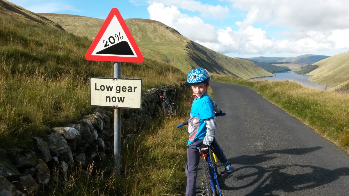
The Gilston road ends with a fast downhill section which takes you to the junction with the A7 road, the main road between Edinburgh and Galashiels. It’s a much safer road to cycle on than the A68 as it is nowhere near as busy for some reason. We turned left and cycled for a mile or 2, slightly downhill and really fast along the newly resurfaced road, before turning right into the village of Fountainhall. We then took the quiet back road south for a few miles of ups and downs through the peaceful and picturesque Borders countryside. The road basically follows the route of the railway line and luckily we spotted a few trains today, including one with an incredible 5 coaches (most unusual for the Borders Railway!). Soon we reached Stow where we turned off the back road and cycled downhill past the train station and over a bridge across the Gala Water and into the main part of the village. There’s a few shops and cafes in Stow but we only stopped long enough to photograph the 15% gradient sign at the side of the B6362 (signposted for Lauder). We weren’t going that way though and instead followed the Border Loop cycle route sign up an equally steep (or more likely even more steep) narrow road that took us out of Stow and into the countryside again. The road was unbelievably steep for the first while, easily the steepest road we’ve cycled up. Dad checked the map later on and reckons we climbed 200m in only a mile or so. The hill seemed to go on forever but luckily, someone had had the good idea to put a bench halfway up so we stopped there for a snack and to enjoy the views of the hills. After what seemed like forever, the road started to level out a bit to what I would describe as “only quite steep” and the wind farm came into view. It’s quite an amazing sight to see the wind turbines right up close, though today, they were barely turning at all due to the lack of wind… After the high point on the road of 372m it was all downhill for ages and we fairly sped along, trying not to crash at a right-angled bend, before passing a farm and a nice woodland and then reaching the junction with the back road from Lauder to Galashiels.

We turned right here and cycled south towards Gala, mainly downhill and very fast again along a reasonably quiet and reasonably surfaced road. There were some cars but the road is wide enough for them to overtake safely enough. The views along this road are pretty good, especially as you near Gala and the Eildon Hills come in to view in the distance. After that really fun section, we came to the B6374 road from Galshiels to Melrose. We turned left for Melrose. This road was not much fun at all with a lot of traffic and corners, making it hard for cars to get past us. After a few minutes, Dad spotted a signpost for Gattonside Mains and decided to follow it, turning off the busy road and going left onto a deserted single track road. This was certainly a long cut but was worth it to get away from all the cars. It turned out to be one of the best cycling roads ever as it climbed up high above the River Tweed and the views of the Eildon Hills were unexpectedly good. We saw no traffic at all – just 1 horse and 1 dog – and after a couple of miles, the road went steeply downhill and we sped into the village of Gattonside far too fast, even with our brakes on full… We crossed over the main road in Gattonside and then headed for the River Tweed, crossing into Melrose over the Chain Suspension Bridge as we did the last time we were here. Arriving in Melrose, we soon noticed that the town was much busier than usual – we hadn’t realised that the Melrose 7s rugby tournament was on today. Luckily, our favorite bakery and ice cream shop were less mobbed than the surrounding streets so we enjoyed a lunch of 2 macaroni pies (Dad) and a cheese and onion pasty (me) followed by a raspberry cone (me) and a 2 scoop tub (Dad).

After lunch, we had plenty energy and plenty time left before we needed to get a train home so we decided to cycle around the Eildon Hills before heading back to Tweedbank station. For some reason I really like the Eildon Hills and me and Dad often come down here to climb them but this would be my first time cycling around them. First we left Melrose and followed Cycle Route no.1 along a mainly traffic free road to the left of the hills. There’s a gate blocking the road so only bikes can go past a certain point beside the Rhymer’s Stone. Soon you start to get good views to the south as we cycled past the village of Eildon itself and then onto the town of Newtown St Boswells. Here we took the B6398 road to Bowden which is a lovely straight road that takes you around the back of the Eildon hills and gives you probably the best unspoiled views of all. After Bowden (which seemed like a lovely little village), we turned right onto the B6359 which turned out to be suspiciously uphill for quite a while but at least it was a quiet road so we plodded along enjoying the views for a couple of miles. Then we came to the best part of the ride. We followed a signpost for the 4 Abbeys cycle route and turned off onto a narrow road on the left. This turned out to be one of the steepest and fastest roads I’ve ever been on and it was brilliant fun despite a few hairy moments on the corners. It was a bit like downhill mountain biking with out any of the mud, rocks or trees… In only a minute we’d sped all the way to Darnick and from there, we simply had to follow the Cycle Route no.1 signs for a couple of miles back to the station at Tweedbank. We got the 1:30pm train and were home just after 2pm. Brilliant weather, brilliant scenery and a brilliant day out.

How many other ways can we go from Gorebridge to Tweedbank? Who knows…?

Gorebridge to Tweedbank (the long way)

Route out – Gorebridge to Middleton to Heriot to Fountainhall to Stow to Clovenfords to Galashiels to Tweedbank to Darnick to Melrose to Gattonside to Tweedbank. For route map click here.

Route back – Borders Railway (Tweedbank to Gorebridge).

  • Weather – sunny, warm and almost no wind at all.
  • Distance travelled – 46.06 miles
  • Riding time – 4 hours 18 minutes
  • Maximum speed – 29.4 mph
  • Average speed – 10.7 mph

Today, Dad and I decided to get up early and take a advantage of the brilliant weather by going for a long cycle through some of the most scenic parts of the Scottish Borders. For the first time ever, we also decided to do a one-way journey and then take the quick way home – on the Borders Railway.

The first part of the route from Gorebridge to the top of the Moorfoot Hills is exactly the same as one we did last last summer so for more details read that blog. It had snowed earlier in the week and despite the warm weather, we discovered quite a few large snow patches along the roadside near to Middleton and also on the high parts of the B7007 which took us up and over the top of the Moorfoot Hills. We also found an old sofa that some stupid idiot had dumped at the roadside… The highest of the hills in this area is Blackhope Scar and it was still fairly covered in snow which made for some great views as we cycled along the almost deserted road. At the bottom of the hill, just after Garvald Farm, we turned left onto the B709. This is a beautifully quiet section of single track road, roughly 4 or 5 fast, slightly downhill miles in this direction. The scenery was also nice in the sunshine today. We sped through Heriot and after climbing a short steep hill, we turned right onto the Old Stage Road.

The Old Stage Road is another very quiet single track road which takes you through the villages of Fountainhall and Stow. It basically runs parallel to the main A7 road, with the Borders Railway in between them. It’s a lovely road to cycle on because it is so quiet (more bikes than cars), the views are good and despite some quite steep uphill sections, there’s loads of really fast downhill bits. Heading south as we were today, it seemed as though there were more downs than ups and we certainly made good time. Oh, and another good thing about this road – you always see plenty of trains! Two things to note about this road though, there are a couple of cattle grids (one right at the bottom of a really steep hill so be careful not to hit it too fast) and also quite a few places where the road surface is rather bumpy. About 10 miles along this road we came to the one really killer hill of the day. It wasn’t so much that it was steep (though it was) but the fact that it seemed to go on for miles and miles. Thankfully the views were good on the way up and when we eventually reached the top, we found the perfect place to stop for lunch (boiled eggs, salad, oatcakes and crisps), a small patch of Beech trees with a stunning view right down the valley to the Eildon Hills at Melrose and the snow-covered Cheviot Hills in the far distance. After lunch we sped back down the other side of the hill, past a reservoir, a rock called “Dignity” and a field full of ponies. Soon enough, we whizzed down one more hill at 30 mph into the village of Clovenfords in the Tweed Valley.

As it was a nice day, we thought we’d nip into the shop in Clovernfords for an ice cream but unfortunately it now appears to be closed. So we carried on, taking the B710 downhill for a mile or so before turning left onto the A707 which runs alongside the River Tweed. It’s fairly quiet for an A road and we weren’t on it for too long anyway. After 2 miles or so we turned left following the Cycle Route no.1 signpost onto the B7060. This road climbs gradually and you end up quite high up with nice views back down the valley to the river below. After a short while, we turned left onto a very quiet narrow and scenic road which took us a few miles uphill, passing a nice little lake along the way, before speeding back down the hill into Galashiels. Judging by how quiet this road is, it must be a secret back entrance to the town…

At Gala, we skirted around the town centre, taking the A7 for a few hundred yards before turning off on the right just before Asda, onto a nice cycle path along the river side. We followed this path (which later became Cycle Route no.1 again) all the way to Tweedbank. At one point just before Tweedbank station, the path crosses a bridge over the River Tweed where you get an amazing view. It also runs very close to the railway line here and luckily for us, a train sped past at exactly the right moment… We decided not to stop at the station just yet but carried on along route no.1 into the historic village of Darnick and then into the town of Melrose. Here, just next to Melrose Abbey, we did find an ice cream shop so stopped to fill up on sugar and saturated fat. Dad had 2 scoops, the greedy monkey! We had a little bit of time to kill before the train home so we took the long way back to the station via the Chain Bridge. This is an unusual pedestrian suspension bridge crossing the River Tweed from Melrose to Gattonside. No more than 8 people are allowed on the bridge at any one time apparently… We then cycled a mile or so back along the riverside on the B6360 until we came to the B6372 and another bridge over the river, this one a hump-backed bridge with traffic lights. After the bridge, we turned right to go back along the path of route no.1 for a couple of minutes until we reached Tweedbank station again. This time we got on the train and were home in only half an hour!

Gorebridge to Romannobridge (the long way)

Route out – Gorebridge to Temple to Portmore Loch to Lamancha to Romannobridge. For route maps click here and here.

Route back – Romannobridge to West Linton to Penicuik to Roslin Glen to Rosewell to Bonnyrigg to Eskbank to Newbattle to Newtongrange to Gorebridge. For route map click here.

  • Weather – dry and cold, mostly cloudy with a few sunny intervals and almost no wind.
  • Distance travelled – 44.57 miles
  • Riding time – 4 hours 27 minutes
  • Maximum speed – 29.2 mph
  • Average speed – 10 mph

Last Sunday Dad took me on a tour of some of parts of Midlothian and the northern Borders that we hadn’t cycled through before. It was freezing cold but we still had a great day out in the countryside.

We left Gorebridge on the quiet B6372 road, soon passing by the entrance to Arniston House before turning off at the signpost for Temple. The village of Temple is a lovely place but unknown to most people, there are actually 2 sides to the village. Dad described it a being a bit like a Beatles 7″ single: most people choose to turn left and uphill through the main part of the village (the A-side. eg. “I Want To Hold Your Hand”) but if you turn right and head downhill, you discover an even nicer but less visited side of the village (the B-side. eg. “This Boy”). Anyway, enough of Dad’s nonsense… We chose the B-side and headed down the steep hill, stopping to have a look at the ruins of the Old Temple Kirk on the way. After that, we faced a monster climb which took us back up the narrow road until it joined up with the B6372 once again.

We stayed on this road for a few miles going up and down (mostly up actually) over the many hidden dips until we reached the turn off for the back road to Peebles. This is a great road for cycling on as there’s very few cars and the road surface is mainly very good (Dad thought it was the smoothest road surface he’s ever cycled on). The sun even tried to come out to melt away some of the low clouds and give us a decent view of the Moorfoot hills. We cycle this way quite often but we normally turn left and head along the side of Gladhouse Reservoir. Today we kept going straight, heading for the Scottish Borders. A couple of miles past the Borders sign, we stopped at the side of the road and Dad lifted the bikes over a locked gate which marked the start of the track to Portmore Loch. A few minutes of bumpy path later, we reached the loch, a very peaceful and picturesque place to stop and have our crisps. We then followed the track on the west side of the loch, heading south into the woods. It was rather muddy but as it was nearly all downhill for a mile or two, the going was fast and it was actually really good fun, with lots of nice bumps to jump over. Eventually, just after having a sneaky peak at the massive and very posh looking Portmore House (which seemed to suddenly appear amongst the trees as if from nowhere), the mud turned into a proper road surface again and we fairly zoomed downhill along this section of private road until we reached the gatehouse at the entrance to the estate.

At this point we had no option but to turn right onto the A703 road. It’s the main road from Edinburgh to Peebles and not one I’d normally recommend due to the amount of fast traffic that uses it. However, we only had to go a few hundred yards along it (as fast as possible) to reach the minor road on the left which took us to Lamancha. This road is a great road for cycling as it’s almost completely deserted, is surrounded by beautiful Borders scenery and has a very good road surface with lots of really long straight sections. Some of the long straights were even downhill! After about 5 miles of this we arrived at a junction with another main road, the A701. This is a relatively quiet main road so much safer for us to cycle on, but first we stopped for a boiled egg (me) and a Yorkie bar (Dad) to give us an energy boost before tackling it.

We headed south along the A701 through a very nice valley. The road wasn’t too busy but the surface wasn’t all that smooth for a main road. It was mainly downhill though and in no time we had speeded past the hamlet of Lamancha (not much to see there) and also a place that sells tractors before reaching Romannobridge. Romannobridge is a very long village and it took a while to cycle right through it. Near the end, Dad spotted the actual bridge, so we stopped there for a photo. We then turned right onto the back road to West Linton. This is another great road with lots of nice views of the hills, including the Pentland Hills which became visible as we neared the village. The village itself is really lovely and quiet and would probably be a nice place to live. We stopped at the park for our lunch (oatcakes, cheese and carrot sticks).

We left West Linton along Deanfoot Road which takes you about 7 miles, most of the way to Penicuik. This is yet another amazing road to cycle on with some of the best possible views of the Pentland hills on one side and bleak open moorland on the other. I imagine it would get quite exposed here but thankfully, there was virtually no wind today. The road surface is pretty good, traffic is light and most of the road is completely straight, with the last few miles downhill and very fast. Along the way we were chased up a hill by a Border Collie (the dog won the race) and saw some rather homemade-looking signposts pointing roughly in the directions of Lamancha, West Linton and Carlops. For the last half a mile to Penicuik, we rejoined the A701 and sped down the hill to the town at well over 20 mph.

From there we took the old railway path (cycle route 196) for about 7 miles through Roslin Glen, Rosewell and Bonnyrigg until we reached Eskbank. This is a good path for cycling on and goes through some amazing railway tunnels along the way. It was very muddy in places though. In Bonnyrigg, we entered some sort of weird time warp, where at one point we were simultaneously both 2 miles and 3/4 of a mile from Eskbank…! (See photos for proof) At Eskbank we left the time warp (and cycle route 196) behind and took the B703 road through Newbattle. We then turned left onto a road called “The Beeches” which took us to Newtongrange. From there we followed the “Bryans” path which skirts around the east side of the town, eventually taking us through a small housing estate and onto Stobhill Road, which we then followed for the last mile or so back to Gorebridge.

Hawick to Saughtree (mostly) Circular Route

Route out – Hawick to Stobs Castle to Bonchester Bridge to Saughtree. For route map click here.

Route back – Saughtree to Steel Road to Whitrope Heritage Centre to Stobs Castle to Hawick. For route map click here.

  • Weather – Mainly cloudy and cool with some sunny intervals and an annoying northerly wind on the way back.
  • Distance travelled – 42.99 miles
  • Riding time – 4 hours 25 minutes
  • Maximum speed – 34.1 mph
  • Average speed – 9.7 mph

It’s not every day that you see cows on the road next to a cattle grid or some old trains completely in the middle of nowhere, but last wednesday Dad and I saw both…

I have been enjoying cycling in the Scottish Borders recently so I decided that we would go on a long route through the hills to the south of Hawick, one of the main towns in the Borders. We headed south out of the town along the B6399. This is a lovely quiet road that basically follows a small river and is mostly flat for the first 4 miles or so. After apparently passing Stobs Castle (which we couldn’t see from the road) there was a steep uphill section which gave good views of the countryside looking back down to where we’d come from. At the top of the climb we turned left onto the single track road signposted for Bonchester Bridge. This road climbed relatively gradually until we reached a height of well over 300m and was deserted apart apart from a herd of cows that we met at the top of the hill. We had to wait till they cleared the road before we could cross over the cattle grid. After that it was very fast down the other side with amazing views as far as the Eildon Hills near Melrose in one direction and (probably) England in the other. The single track road eventually joined onto the A6088 for the last mile to Bonchester Bridge. This was a really fun short section despite being a main road. There was almost no traffic at all and it was all downhill so we speeded there in no time at all.

There isn’t much to see in Bonchester Bridge (apart from a bridge) so we carried on out of the village on another very quiet, narrow road (passing an odd looking church at Hobkirk along the way) before climbing up an incredibly steep (but short) section which took us up to the B6357 road which is another quiet road with a good surface for cycling on. We had cycled on another part of this road before when we’d visited Rowanburn a couple of weeks ago but this section of the road was much more challenging. Soon the road began to climb very steeply uphill – probably at least a 10% gradient, though there were no signs. It seemed to go uphill for a long time but it was actually only a few miles really. At the top of the hill we got a nice view over to the Kielder Forrest in the distance and I even found some brambles to munch on to give me an energy boost. It was really hard cycling to the top (over 350m high) but it was worth it because it meant we got to speed back down the other side of hill as fast as we could all the way to Saughtree a few miles away.

Here, we passed the turning for Kielder that we cycled on before but we ignored the signs and continued along the almost traffic-free B6357 for a few more miles of lovely smooth, flat cycling through the Borders, following the Liddel water until we spotted a Cycling Byway signpost pointing to the right. We went this way onto a very narrow road that took us through some really peaceful, pleasant countryside for a few miles, passing under an old (dismantled) railway bridge at a tiny hamlet called Steel Road before eventually joining up with the B6399 once again. At this point we turned right to begin the journey back to Hawick. Unfortunately though, the wind had decided to increase and for the last 15 miles of the route we would be cycling straight into the wind. To make things even worse, the next section was all uphill for a long time…

Actually, it wasn’t all that bad as the road was quiet and the sun came out for a while so we just plodded along slowly until we reached the top of the hill (well over 300m again!). I bet it is a lot more fun going in the other direction though. Anyway, just before the top of the hill, we went underneath another old railway bridge but this time, on the other side we got a really unexpected surprise to see a line of old railway engines and carriages right on the roadside, completely in the middle of nowhere. I love trains so this was easily the highlight of the day. It turns out that this was the Whitrope Heritage Centre and this section of old track was once part of the old Borders Railway (Waverley Line). The centre was closed for the year but we did stop long enough to get some nice photos and we sat on an old section of track to have a snack. Not far north from here on the road back to Hawick, we spotted a lovely old railway viaduct as well. I really hope that the new Borders Railway is extended to run through this part of the country again all the way to Carlisle as it really is very scenic and it would be a very nice train ride. Shortly after the viaduct we passed the turning for Bonchester Bridge once more and then headed back down the hill, before having an easy cycle for the last few miles back to Hawick. According to Google Maps, we climbed over 2600 feet today and it really felt like it as there were a lot of hard uphill sections on this route. But if you don’t mind the steep hills, and fancy a day out in some very quiet and (at times) very interesting countryside, then this is the route for you.

Grand Tour of the Scotland-England Border

Route out – Rowanburn to Kershope Bridge to Newcastleton Forest to Kielder Forest to Kielder Water to Kielder. For route map click here.

Route back – Kielder to Newcastleton to Rowanburn. For route map click here.

  • Weather – mostly sunny and relatively warm with a light breeze but one long rain shower later in the day.
  • Distance travelled – 49.91 miles
  • Riding time – 5 hours 3 minutes
  • Maximum speed – 31.9 mph
  • Average speed – 9.8 mph

On the way home from our holiday in Wales in July, we had stopped for a rest in the lovely (and brilliantly named) village of Rowanburn in Dumfries and Galloway, not far from the border between Scotland and England. I had noticed that the roads near Rowanburn looked perfect for cycling so I’d been thinking of going there for a cycle for ages. Finally, last Saturday, Dad and I managed to go back there with our bikes to have a grand tour of the Scotland-England border.

We headed north out of Rowanburn along the B6357. This is lovely smooth road for cycling on and not too busy with traffic. After less than a mile we entered the Scottish Borders and had to cycle up a short but steep 11% gradient section of road so that fairly warmed our legs up. Soon after, we turned right onto the B6318 which immediately took us steeply downhill to a bridge over the Liddel Water and back up another extremely steep hill into Cumbria. We were in England for the first time today! Around here, the Liddel Water marks where the Scotland-England border is for quite a long distance and our route basically followed this in a north-east direction along very quiet, scenic and narrow roads for about 5 miles until we almost reached a place called Kershopefoot. Here, the border changes direction, heading more towards the east along a different river called the Kershope Burn. At a junction, we headed right and then over the border river and up a very steep section, back into the Scottish Borders. The road goes relatively high up here and the views are really nice. Soon we doubled back on ourselves at an acute angle and headed back down the hill to England again at Kershope Bridge. We stopped here to have an early lunch among the sheep to give us an energy boost before tackling the hardest part of the route.

At Kershope Bridge we turned left and followed the signs for National Cycle Route no.10 which took us into the forest on a reasonably smooth landrover track. After a short while the track crossed over a bridge across the burn back into the Newcastleton Forest in Scotland. After this the path followed the border burn for a long time and the path seemed to become bumpier and bumpier along the way. It was also all uphill and really hard going at times and I almost thought about turning back. Luckily I spied some wild blueberries growing at the edge of the fir trees so I stopped to fill my face and I cheered up a bit after that. Eventually, we reached another bridge and this took us over the border again to England and the Kielder Forest in Northumberland. This was the worst section of all as the path became un-ridable due to the loose stones and the steepness of it, even on a mountain bike. After pushing up the slope to the highest point, the path leveled out but the loose stones made it very unpleasant to ride along. I really was wondering why Sustrans had made this a signposted cycle route. It must have been someone’s idea of a joke surely… It would have made a nice walk though. Thankfully, the bumpy loose stoney path ended when it joined onto another forest road. This was a really nice smooth track and was all downhill so we sped the last few miles to the Kielder Water in no time at all. After about 15 miles of deserted forest, we were finally back in civilisation and saw people for the first time in over 2 hours…

We stopped at the reservoir for a much needed break and a snack of oatcakes. Then we headed onto lovely smooth road once again and sped off northwards in the direction of Kielder. This road is unclassified but on this section it was more like an A road, nice and wide with a white line down the middle and a nice surface for cycling on. Not too much traffic either so that was good. Dad spotted a sign post pointing to an interestingly named place called Gowan Burn and we thought about taking a detour to see what was there. But Dad didn’t think we’d have time for that as we still had about 25 miles to go and we wanted to be back at the car by tea time. So, at Kielder village we just stopped at the shop for Smarties (me) and Yorkie (Dad) before heading in the direction of Scotland once more. The road had by now reverted to single track with passing places and the weather had reverted to rain. Despite the weather, we stopped at the border to photograph all the amazing signs.

The last 20 miles or so of the route was along the B6357 again, heading roughly south and following the Liddel Water once more. It was also almost all downhill and very fast through the quiet countryside along the nice smooth road surface. We stopped in the pleasant little village of Newcastleton to have our last proper break of the day before following the river (which turned into the Scotland-England border once again) back to Rowanburn. It was a long and tiring day but we had crossed the border a total of six times and I really enjoyed most of the route. The roads are very good quality, quite quiet and the scenery is nice so I would highly recommend cycling in this area. Apart from cycle route no.10 through the forest that is – that is NOT recommended at all!

Grand Tour of the Scottish Borders vol.2

Route Out – Innerleithen to Traquair to St Mary’s Loch to Megget Reservoir to Talla Reservoir to Tweedsmuir. For route map click here.

Route Back – Tweedsmuir to Stobo to Lyne Station to Pebbles to Cardona to Innerleithen. For route maps click here and here. Note that there is a bridge over the River Tweed just after Lyne Station that Google Maps doesn’t know about which is why the route back is spilt into two maps. Just follow the Borders Loop signs and you won’t get lost…

  • Weather – cold and misty at first but sunny and warm for most of the day apart from one light shower in the afternoon.
  • Distance travelled – 54.43 miles
  • Riding time – 5 hours 27 minutes
  • Maximum speed – 28.4 mph
  • Average speed – 9.9 mph

On Saturday, Dad and I decided to go on another grand tour of the Scottish Borders. It was very cold when we left the house and as we drove along the road through the Moorfoot Hills the temperature dropped to 1 degrees C. It had only risen by a couple of degrees by the time we arrived in Innerleithen where we would begin the tour, so it was lucky we had brought our gloves…

We headed out of Innerleithen through the freezing mist along the B709. This is very quiet, scenic and in places narrow road, and after passing the village of Traquair, the weather brightened up and the road climbed gradually uphill for what seemed like an age through the hills. Someone has helpfully painted some funny messages on the road along the way. Just as the steepest section begins it says “and up”, and just when you think you’ve had enough it tells you it is “a wee bit further”. Eventually the good news arrived at the top of the climb with the message “and down” along with a smilie face. From there, there was a few fast and fun miles of downhill cycling until the junction with the A708. Here we turned right onto the main road which seemed quite quiet for an “A” road. After a few miles of fairly flat road, we came to the head of St Mary’s Loch. There was a thick fog hanging around over the loch and the water was so still that it was almost like a mirror. The reflection of the hills on the water surface was amazing.

Leaving the loch behind, we turned right onto the single track road to Tweedsmuir. Dad had driven along this road before and warned me that it would be very hilly in places – and he was right. It was a really fun road to cycle on though and one of the most scenic too as it goes right through some of the highest of the Border hills. This section was virtually traffic free (apart from a police car and a quad bike) but at one point we were almost driven off the road by a flock of sheep. One of the steepest climbs takes you past Megget Reservoir. We stopped here for a chocolate digestive or 2 (well I had 1 and Dad had 2) and we were overtaken by a large group of cyclists who seemed to be taking part in some sort of race. They were going much faster than us certainly. Apparently this reservoir provides drinking water to the city of Edinburgh (at least that’s what the information sign said). The road follows the reservoir for a few miles going up and down all the time. Eventually, after passing by 2 half eaten hedgehogs and a guilty looking buzzard, we stopped at the far end of the reservoir and for an early lunch. The road then went steeply uphill for a while until, finally, we reached the highest point of the road at about 450m high according to the map. From there the view down through the hills to the Talla reservoir was stunning and the road down to it was incredibly steep – the sign said it was a 20% gradient so I was glad were going down and not up this hill. Strangely, the group of cyclists we saw earlier were racing back up this steep hill as fast as they could. It must have been torture. We left them to it and sped the other way as slowly as possible (15mph with brakes fully on!) in order to avoid crashing and were soon cycling on the flat road alongside the Talla reservoir with impressive mountains on both sides. At the far end of the reservoir we saw a deer jump in and start swimming for the other side. Dad said he didn’t know deer could swim. Maybe they can’t. Hopefully it made it across OK… Then it was only a short downhill stretch to the village of Tweedsmuir where we had a rest (and another digestive) before tackling the next section of the grand tour.

We turned right after Tweedsmuir onto the main A701 road. This is a very scenic road to cycle on. The only problem is that it’s a main road, and although it’s the signposted “Borders Loop” cycle route and is not too busy for an “A” road, it seems to be popular with motor bikes too and we got over-taken loads of times, making it not too pleasant really. Because of all the hills everywhere, there are no other possible roads to take so we had no option but to go this way or back up over the 20% climb … so the A701 won. Annoyingly, there’s a dismantled railway line which basically follows the road all the way. If only someone would turn this into a cycle path, then we could have avoided the main road altogether… Anyway, after about 7 miles we were glad to turn off onto the B712 which is one of the back road to Peebles. To make the route more interesting we soon detoured left off this road onto a single track road which climbed high up and gave great views of the countryside and the hills of the Tweed valley. It was along this road, after 34 miles of cycling, that we finally found our first brambles of the day. So we stopped to stuff our faces of course. Then, after a fast downhill section, we rejoined the B712 and cycled past Stobo Castle. Strangely enough, the B712 was even busier with traffic than the A701 and was not much fun at all despite the good views. It was quite a relief to turn off onto the narrow road for Lyne Station.

There used to be a railway station at Lyne Station back when there were steam trains running, and here we followed the Borders Loop signs again and went under the bridge of the dismantled railway line (which is a signposted walk to Peebles), then over a narrow bridge across the River Tweed (the one Google Maps doesn’t know about). After a short muddy, bumpy section through the trees, we ended up back on single track road again with lots of ups and downs for the next few miles. When we came to an amazing signpost with about a million signs on it, we followed the one for Peebles. This took us on a long cut right around the side of a hill and seems to take you in completely the wrong direction for a good while. Then there’s a lovely flat, straight section for the last mile or so into the town of Peebles.

In Peebles, we crossed a pedestrian bridge over the Tweed just off the B7062 road and then cycled through the rugby and football pitches until we came to the A72 road. Here we spotted the signpost for the Peebles to Innerleithen railway path so we followed this lovely cycle route for the 5 miles back to the car. The railway path follows the river, goes right through the middle of Cardrona golf course and you get lots of good views along the way. It’s an ideal cycle path for young cyclists as it’s very flat and other than a very short section through a quiet housing estate, it’s all off road – highly recommended. Anyway, it was a long but an brilliant day out. If you don’t mind all the steep uphill sections (we climbed over 2500 feet today), the Borders is the best place in the world for cycling. I’m already planning for the Grand Tour of the Scottish Borders vol.3…

Grand Tour of the Moorfoot Hills

Route Out – Gorebridge to Crichton to Tynehead to Fala Dam to Fala to Heriot to Pirntaton Farm. For route map click here.

Route Back – Pirntaton Farm to Over Shiels Farm to George Wood to Ladyside Farm to Middleton to Gorebridge. For route map click here.

A large part of this route is off road through Fala Moor and the Moorfoot Hills so make sure you remember to take a map with you so you don’t get lost. See images below for the maps we took with us.

  • Weather – Sunny and cloudy, light winds and quite warm.
  • Distance Travelled – 38.69 miles
  • Riding Time – 4 hours 31 minutes
  • Maximum Speed – 30.1 mph
  • Average Speed – 8.5 mph

The weather brightened up on Saturday afternoon, so after lunch Dad took me on an amazing cycle route through the Moorfoot Hills that he’d discovered a while ago. He told me it would be really scenic but also extremely steep in places so would be very hard. He was right…

The first part of the route is basically the same as the Gorebridge to Fala Dam route that we went on a few weeks ago. We varied it slightly by staying on the B6367 all the way from Crichton to Tynehead. This is a nice quiet road with good views of the Pentland and Moorfoot Hills but it also felt a lot steeper than it looked for most of the way. At Tynehead we turned left onto the B6458. I thought this road looked completely flat but it must have been slightly downhill and we fairly zoomed the few miles to the junction with the main A68 road at almost an average of 20mph. Then, after crossing over the A68 onto a single track road (where we saw some rather unusual looking goats), we sped downhill to Fala Dam (where we once again met up with the nice old dog that we saw the last time we stopped there). After Fala Dam there’s a really steep uphill section for about a mile until the village of Fala. Here, we stopped for a rest and some crisps in the play park before tackling one of the hardest sections of the route – the Fala Moor Road.

About 50 yards outside Fala, you need to cross over the busy A68 road to get onto the Fala Moor Road. It’s not really a road (Dad says it maybe used to be a long time ago) and it’s very bumpy and covered with loose stones making the relatively gentle slope really hard to cycle on – not at all suitable for road bikes. It was a bit of a slog really, but at least we saw 2 deer on the way up. Once at the top, the “road” becomes a bit less bumpy (thankfully) and levels out at around 300m high for a couple of miles through the moor and we got some nice views of the hills and some wind farms in the distance. The “road” ends suddenly at a sharp right turn and becomes a track through sheep and cow fields. Thanks to the recent rain and the cows, the track either side of the several gates along the way had turned into a muddy swamp which was impossible to cycle through. It was a bit of a relief to eventually reach Brothershiels Farm where we rejoined a proper tarmac road once more for the last mile until the junction with the main A7 road.

We only went on the main road for a few hundred yards but annoyingly, this was the bumpiest road surface of the day so if you are cycling on this part of the A7, please be careful and don’t go too fast in case you come a cropper… We soon turned off the main road and went under the under-pass to the other side of the Borders Railway line into the village of Heriot. After that we basically followed the railway line southwards on the Old Stage Road. This is a lovely, quiet single track road which has lots of up and downhill sections and lots of good views too (and lots of foraging opportunities!). After a few miles we reached the turning on the right for Pirntaton farm and the road started to go uphill. Dad had told me there would be some unbelievably good conker trees next to the farm – and he was right, I’ve never seen so may conkers before. We filled up our rucksack with as many as we could fit before carrying on up the narrow road as it became steeper and steeper the further into the hills we went. Eventually, at a height of about 350m, the road ran out, and we had a brilliant view of the Moorfoot Hills as we crossed a cattle grid onto the track which would lead us right over the hills to the other side…

This section was a lot of fun with loads of fast downhills but some incredibly steep uphills too. The views of the hills were amazing and we saw loads of wildlife – millions of grouse and pheasants, a heron, hares and buzzards. The track is a very good surface for most of the way – a bit like the kind of hard packed gravelly surface you find on some cycle paths –  and it only became too difficult to cycle on the very steepest parts where the surface was quite loose (I wouldn’t try this route on a road bike by the way…). Amazingly, we only had to push for a couple of very short sections. We had to cycle through 5 fords along the way (this is where the stream flows over the path). This was quite hard the first time but Dad told me to use a low gear and pedal as fast as possible otherwise I would get stuck – and he was right again and it wasn’t too bad at all actually. I only got my feet wet a couple of times! After a while we eventually managed to struggle our way at 2mph in gear 1 up to the highest point of the hill at around 525m. Here there is a small area of trees called George Wood where we stopped to forage for wild blueberries (very tasty). From there, the view was amazing and we could even see the Eildon Hills at Melrose far away in the distance. We also got a good view of the path we’d cycled up and could see exactly how ridiculously steep it was… The ride down the other side of the hill is basically all downhill (obviously) and is great fun. However, the first part is VERY steep so you have to be extremely careful not to go too fast or skid off the path into the heather… Soon enough, the slope becomes more gentle and we had an easy, fast decent (through the fords) the rest of the way to Ladyside Farm where we joined onto the B709.

The last part of the route follows the B7007 back to Gorebridge via Middleton and Fushiebridge. See the route Gorebridge to Dewar for more details about this section. Just before the high point in the road, we stopped at the entrance to the track to Blackhope  Farm and from there we got a good view back down the valley to the Hill that we’d cycled over the top of. It was quite a amazing to think we’d managed to do it. In total (according to Google Maps anyway) we’d cycled up nearly 3000 feet of accent over the whole afternoon which is almost as much as cycling to the top of a Ben Nevis (so Dad said anyway)! So when we got back to Gorebridge, we decided we deserved to stop at the Gorefry takeaway for a seafood pizza before heading home. It was a really amazing journey through the mountains and one I’ll certainly be going on again.

Grand Tour of the Scottish Borders

Route Out – Gorebridge to Middleton to Dewar to Innerleithen to Peel to Clovenfords. For route map click here.

Route Back – Clovenfords to Bowland to Stow to Fountainhall to Heriot to Middleton to Gorebridge. For route map click here.

  • Weather – hot and sunny with almost no wind.
  • Distance travelled – 58.68 miles
  • Riding time – 6 hours 23 minutes
  • Maximum speed – 29.5 mph
  • Average speed – 9.1 mph

On Tuesday I decided to go for a grand tour of the Scottish Borders which was going to be my longest cycle ever. Dad and I left just after 7am so that we could try and get back home in time for our tea. Amazingly, despite it being the only hot day of the Scottish summer, we actually managed this…

We left Gorebridge on the quiet B6372 road. After a couple of miles, just before turning off onto the sign-posted National Cycle Route no.1, we spotted a hot air balloon floating in the sky so we stopped to photograph it. It was low enough in the sky that we could see and hear the burning flame. This section of Route no.1 is a very quiet single track road which took us around the back of the Middleton Lime Works quarry before we reached Middleton, where we stopped for a quick snack beside a field of chickens. After that, we stayed on Route no.1 and cycled up into the Moorfoot Hills for about 3 miles along the B7007 until, at the top of the hill, we entered the Scottish Borders. The road was very quiet and we got some great views over to the Pentland Hills, Arthur’s Seat in Edinburgh and the new Forth Road Bridge. From the high point on the road of 404m near Carcant Wind Farm, it was downhill all the way to Innerleithen (apart from a short section just after Dewar which was suspiciously, and annoyingly, slightly uphill) so we sped down the road in no time at all. This is a lovely scenic road with hills on all sides. It’s also very quiet so a nice road to cycle on. Just before Innerleithen, we stopped for a short break to eat our crisps on some rocks next to the Leithen Water.

We didn’t stop in Innerleithen but carried on along Route no.1, firstly on a short section of cycle path which took us over a bridge to the south side of the River Tweed and then along the single track road which follows the river along to the village of Peel. This is a lovely quiet road with only a few short hills and almost no traffic at all. At one point I spotted a huge patch of wild raspberries so I stuffed my face for a good 10 minutes or so. I then decided to make some raspberry juice in my water bottle – it was tasty! At Peel, there’s an old bridge over the River Tweed where you get a really nice view so we stopped there for our lunch.

After that, there was short section on the A707 but luckily, it seemed to be very quiet for an “A” road so it was safe enough for us. We then turned off Route no.1 and headed into the village of Clovenfords. There’s a shop there and since it was by now starting to get quite hot, we decided to get an ice cream to try and cool ourselves down. It didn’t really work but at least it was tasty… The next couple of miles was very steeply uphill along another very quiet country road. We got some good views from the top when we finally got there and then we were able to speed back down the other side to the hamlet of Bowland. It was on this section that I reached my fastest speed of the day. Bowland has a nice archway leading to an old mansion house on the hill but we didn’t stop for a visit. Instead, we headed uphill again along a narrow private road (luckily the gates were open) which eventually took us to the quiet single track road on the Western side of the Borders Railway. We stayed on this road for around 12 miles and saw roughly 9 trains in this time so I was pleased. The highlight of the day came when we stopped for a rest at Stow Station and we saw 2 trains passing by just underneath the bridge.

From Stow, we headed northwards, going up and down hills all the way and saw no cars at all. We passed through the village of Fountainhall and eventually turned left onto the B709. This is another scenic and quiet road which took us through Heriot before eventually joining up with the B7007 again. Here we re-joined Route no.1 and headed back uphill through the Moorfoot Hills to enter Midlothian again. The views over to East Lothian on the way back downhill were really good. After Middleton we continued speeding downhill the rest of the way home to Gorebridge. It had been a long day of cycling and I was very tired by the end. I didn’t break my average or maximum speed records but it was easily the longest cycle run I’d ever managed so I was very happy (to get back home and tuck into my fish cakes at least!).

Gorebridge to Dewar over the mountains

Route out – Gorebridge to Borthwick to North Middleton to Middleton to Blackhope Farm to Dewar. For route map click here.

Route home – Dewar to Blackhope Farm to Middleton to Fushiebridge to Gorebridge. For route map click here.

  • Weather – sunny and cloudy, cool with a chilly wind on high ground.
  • Distance travelled – 23.69 miles
  • Riding time – 2 hours 53 minutes
  • Maximum speed – 27.8 mph
  • Average speed – 8.2 mph

On Sunday morning I decided to take Dad on a cycle run over the top of the Moorfoot Hills. We had been along the B7007 from Middleton to Innerleithen many times in the car but had always thought that it would be a bit too steep for us to cycle on. As it it turned out, we were completely wrong and it wasn’t too difficult at all.

The first mile or so from Gorebridge was all uphill and extremely steep but soon you got a great view across to the Pentland Hills in one direction and the Moorfoot Hills in another. From there it was downhill all the way to Borthwick Castle and it was here that I reached my fastest speed of the day. Just before the castle, we crossed a bridge over the Borders railway but didn’t see any trains. We then had a short steep section which took us to the village of North Middleton. Here, we used the underpass to cross the busy A7 main road, before heading uphill once more, passing by a dead badger before reaching Middleton, where we stopped for a snack next to the National Cycle Network signpost.

From Middleton we headed gradually uphill for around 3 miles as we headed to the highest point of the road through the Moorfoot Hills. It was quite an easy ride and I even managed to ride all the way up in gears 8 and 9. On the way the views across to the Pentland Hills, Edinburgh and Fife were really good. We could even see some snow capped mountains a long way north as well as the new Forth Road Bridge peaking up above the horizon. We stopped for an early lunch of tiger prawns and cheese sandwiches just off the main road at the start of the track which leads to Blackhope Farm. From there we could see the second highest of the Moorfoot hills, Blackhope Scar. After lunch, we speeded the rest of the way downhill to our destination Dewar. There isn’t much in Dewar but we did discover an old bus which appears to have been turned into into someone’s house.

On the way back we spotted a massive bird flying close to the ground. Dad said it was much bigger than a Buzzard and may even have been an Eagle but he wasn’t sure. At the highest point in the road, we stopped to look at the unusual signpost which told us that we were 404m above sea level and that Newcastle was 168 miles away – a bit too far for us. I thought we would be lucky to do that in 5 or 6 days! We took a slightly different route back to Gorebridge from Middleton, by passing North Middleton and Borthwick and heading back via Fushiebridge. Luckily for me, we stopped at the railway bridge just in time to see a train going passed on its way to Gorebridge station so we followed it the last couple of miles back to our staring point.