Edinburgh to Bathgate Circular Route

Route out – Edinburgh (South Lauder Road to The Meadows to Slateford to Wester Hailes) to Ratho to Broxburn to Winchburgh to Linlithgow to Beecraigs Country Park to Cairnpapple Hill to Bathgate. For route map click here.

Route back – Bathgate to Livingston Village to Mid Calder to East Calder to Kirknewton to Balerno to Currie to Juniper Green to Edinburgh (Slateford to The Meadows to South Lauder Road). For route map click here. Google Maps is wrong for some of the section through Livingston. Just stay on Route 75 all the way and you won’t get lost.

  • Weather – Light rain at first, then mainly cloudy with some sunny intervals and no wind. Quite cold too.
  • Distance travelled – 56.35 miles
  • Riding time – 6 hours 51 minutes
  • Maximum speed – 33.1 mph
  • Average speed – 8.2 mph

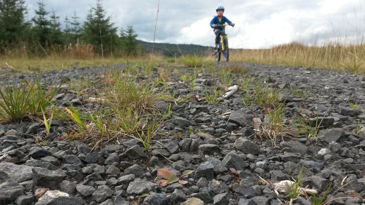
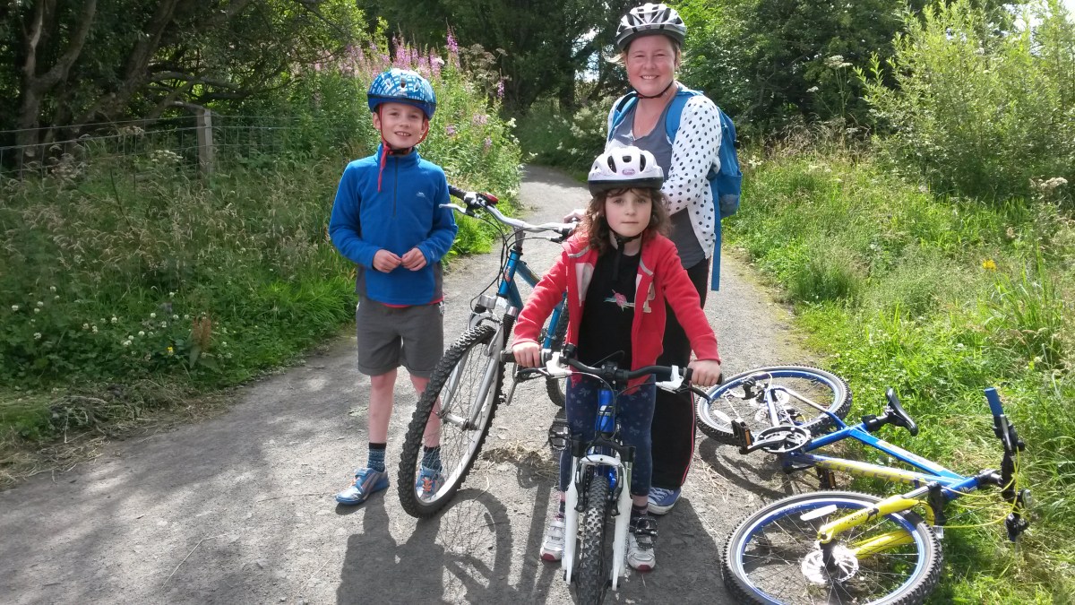
The weather here has been very cold for weeks so Dad and I hadn’t been out cycling for ages. Luckily, on Saturday it looked like it would actually be a fine day to go for a cycle – still cold but at least it wasn’t frosty for once… Dad wanted to head south (as usual) for a route around the Scottish Borders but I decided that we would investigate two of the really good cycle routes nearer to home which start in Edinburgh: National Cycle Routes 754 and 75.

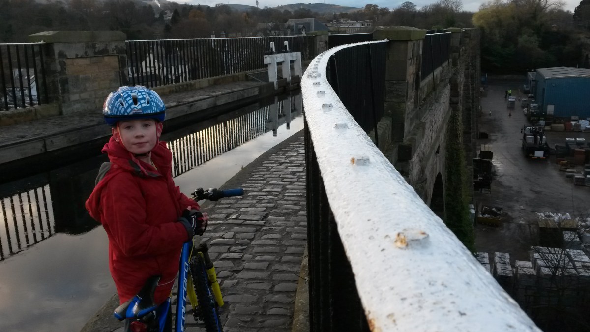
We parked the car in The Grange which one of the poshest areas in Edinburgh where all the houses appear to be mansions. Not much like Gorebridge then… Here we followed one of the signposted “quiet routes” (no.6) to The Meadows where we joined onto Route 75. After a short section along the cycle path through the park, we followed the route 75 signs onto the road for half a mile or so before turning off onto the Union Canal at Fountainbridge. The path alongside the canal soon becomes route 754, is completely flat and takes you all the way to Glasgow without going on any roads at all. We weren’t going that far today though – our first main destination of the day was Linlithgow, 22 miles away. The quality of the canal path varies a lot along the way. In Edinburgh it is quite a nice surface but is quite busy with pedestrians and dogs so you need to be very careful not to fall in the water or crash into anyone. Outside the city it is often very narrow, muddy, bumpy or squelchy with leaves so I found it a bit of a monotonous plod at times and it was a lot slower than I’d thought it would be. Because you are low down and never go up any hills, the views are not all that good either but there are some interesting bits, especially the amazing aqueducts which carry the canal high up over roads or rivers: the Slateford Aqueduct, the Scott Russell Aqueduct which crosses over the City Bypass and the Almond Aqueduct are all very impressive and it’s worth cycling along this route just to see these. Note that you have to push your bike along the aqueducts as the path is extremely narrow and made of cobbles and you really don’t want to fall into the water… The canal passes through some towns and villages along the way including Ratho, Broxburn and Winchburgh. Eventually, after the bumpiest section of the canal path, we finally reached Linlithgow.

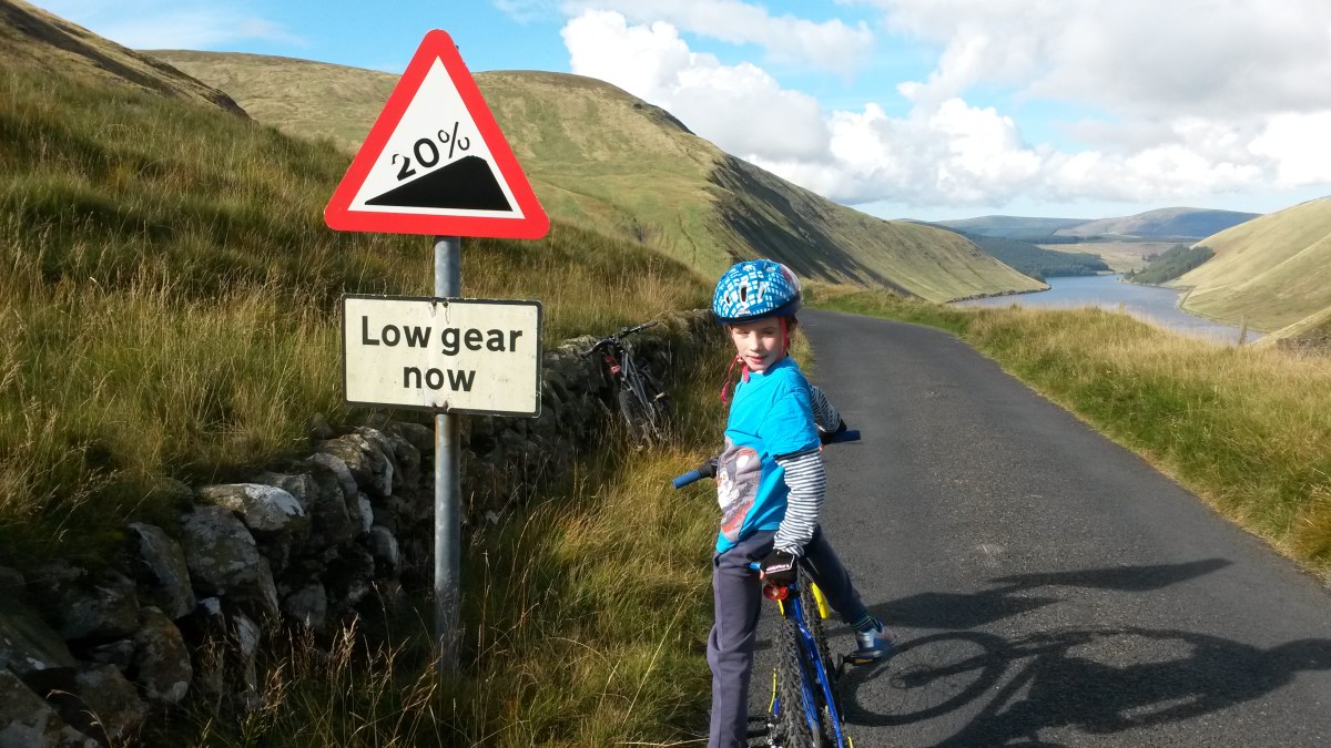
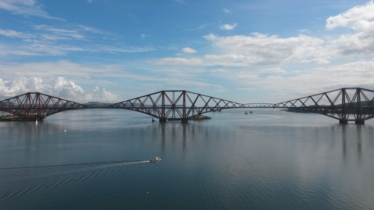
In Linlithgow, I was glad to get off the path and onto a proper road again and we cycled past the train station and into the town centre where Dad said he knew of a really good bakers where we could get some lunch. We ate our (very tasty) macaroni pies beside Linlithgow Loch where we got a good view of Linlithgow Palace. We also had to fend off a flock of pesky seagulls who were trying to steal our food! After that we turned onto the minor road to Bathgate and this turned out to be one of the hardest few miles of cycling I’ve ever done. This road heads south from the town and goes incredibly steeply uphill. We climbed about 350m in only 2 or 3 miles I think as the road winds its way through Beecraigs Country Park. Beware though: this may be an unclassified road (so not even a B road) but it was unexpectedly busy with traffic. This is particularly an issue when you are toiling up roughly a 10% gradient slope at only 3 or 4 mph… However, this was more than made up for with the good views back down towards the Forth where I spied a railway viaduct in the distance. Near the top we turned off onto an even more minor (and thankfully quieter) road which climbed up even further as we cycled past Cairnpapple Hill. From here we had an amazing view back down towards the 3 Forth Bridges and could even see North Berwick Law far far away in the distance. After that came the most fun section as we sped back down the other side of the hill (14% gradient at one point according to the sign) to the town of Bathgate.

In Bathgate we managed to find the signpost for Route 75 next to a supermarket so followed it onto a nice smooth cycle path. The path is nice and wide and mostly flat with some slight ups and down to keep it interesting and fairly fast. It was also very quiet and a pleasure to cycle on. We passed some weird pyramid things and crossed over the M8 motorway before travelling through some woodland that reminded me of Gore Glen near our house. After a while we came to an unexpectedly nice part of the town of Livingston – Livingston Village – not at all like the ring roads, roundabouts and housing schemes of rest of the town. Then the path followed the River Almond, past the football stadium and then headed through the woods to Mid Calder. This is a lovely part of the route and I’ll be coming back here again. Unfortunately, it was around here that Dad got a puncture on his back tyre so we had to waste quite a long time while he changed the inner tube. Dad always carries plenty spare tubes and tools in his bag when we go cycling just in case. It’s actually quite amazing that after over 1000 miles, this is the first time either of us have had a flat tyre. By this time, the light was starting to fade (too dark for photos anyway!) and we still had a quite a long way to go. So we sped as fast as we could through East Calder and Kirknewton (crossing over the level crossing at the train station was the best bit) before heading onto the quiet back road for a few miles to Balerno, near the Pentland Hills on the outskirts of Edinburgh.

By the time we got there, it really was pretty dark and it was clear that our bike lights, though they may have been useful in helping traffic see us, weren’t exactly doing much to help us see as we cycled. Our intended route from Balerno was to follow Route 75 along the Water of Leith until it joined back onto the Union Canal but the cycle path was just far too dark and wouldn’t have been safe. Dad made the decision that we would stick to roads with streetlights and we basically just cycled along the pavement alongside the main A70 road through Currie and Juniper Green for about 8 miles all the way back to the Meadows (passing the Slateford Aqueduct on the way). I’m sure the Water of Leith path would have been much nicer but I’ll have to come back during daylight hours to find out. Although I couldn’t predict that Dad would get a puncture or that the Union Canal route would be so slow, I did learn an important lesson today. In winter when there are less hours of daylight, it would be more sensible to stick to slightly shorter routes rather than ending up having to cycle for an hour in the dark. Still, it was nice to be out on my bike again after such a long break and we even had seafood pizza for tea when we got home!

Hawick to Saughtree (mostly) Circular Route

Route out – Hawick to Stobs Castle to Bonchester Bridge to Saughtree. For route map click here.

Route back – Saughtree to Steel Road to Whitrope Heritage Centre to Stobs Castle to Hawick. For route map click here.

  • Weather – Mainly cloudy and cool with some sunny intervals and an annoying northerly wind on the way back.
  • Distance travelled – 42.99 miles
  • Riding time – 4 hours 25 minutes
  • Maximum speed – 34.1 mph
  • Average speed – 9.7 mph

It’s not every day that you see cows on the road next to a cattle grid or some old trains completely in the middle of nowhere, but last wednesday Dad and I saw both…

I have been enjoying cycling in the Scottish Borders recently so I decided that we would go on a long route through the hills to the south of Hawick, one of the main towns in the Borders. We headed south out of the town along the B6399. This is a lovely quiet road that basically follows a small river and is mostly flat for the first 4 miles or so. After apparently passing Stobs Castle (which we couldn’t see from the road) there was a steep uphill section which gave good views of the countryside looking back down to where we’d come from. At the top of the climb we turned left onto the single track road signposted for Bonchester Bridge. This road climbed relatively gradually until we reached a height of well over 300m and was deserted apart apart from a herd of cows that we met at the top of the hill. We had to wait till they cleared the road before we could cross over the cattle grid. After that it was very fast down the other side with amazing views as far as the Eildon Hills near Melrose in one direction and (probably) England in the other. The single track road eventually joined onto the A6088 for the last mile to Bonchester Bridge. This was a really fun short section despite being a main road. There was almost no traffic at all and it was all downhill so we speeded there in no time at all.

There isn’t much to see in Bonchester Bridge (apart from a bridge) so we carried on out of the village on another very quiet, narrow road (passing an odd looking church at Hobkirk along the way) before climbing up an incredibly steep (but short) section which took us up to the B6357 road which is another quiet road with a good surface for cycling on. We had cycled on another part of this road before when we’d visited Rowanburn a couple of weeks ago but this section of the road was much more challenging. Soon the road began to climb very steeply uphill – probably at least a 10% gradient, though there were no signs. It seemed to go uphill for a long time but it was actually only a few miles really. At the top of the hill we got a nice view over to the Kielder Forrest in the distance and I even found some brambles to munch on to give me an energy boost. It was really hard cycling to the top (over 350m high) but it was worth it because it meant we got to speed back down the other side of hill as fast as we could all the way to Saughtree a few miles away.

Here, we passed the turning for Kielder that we cycled on before but we ignored the signs and continued along the almost traffic-free B6357 for a few more miles of lovely smooth, flat cycling through the Borders, following the Liddel water until we spotted a Cycling Byway signpost pointing to the right. We went this way onto a very narrow road that took us through some really peaceful, pleasant countryside for a few miles, passing under an old (dismantled) railway bridge at a tiny hamlet called Steel Road before eventually joining up with the B6399 once again. At this point we turned right to begin the journey back to Hawick. Unfortunately though, the wind had decided to increase and for the last 15 miles of the route we would be cycling straight into the wind. To make things even worse, the next section was all uphill for a long time…

Actually, it wasn’t all that bad as the road was quiet and the sun came out for a while so we just plodded along slowly until we reached the top of the hill (well over 300m again!). I bet it is a lot more fun going in the other direction though. Anyway, just before the top of the hill, we went underneath another old railway bridge but this time, on the other side we got a really unexpected surprise to see a line of old railway engines and carriages right on the roadside, completely in the middle of nowhere. I love trains so this was easily the highlight of the day. It turns out that this was the Whitrope Heritage Centre and this section of old track was once part of the old Borders Railway (Waverley Line). The centre was closed for the year but we did stop long enough to get some nice photos and we sat on an old section of track to have a snack. Not far north from here on the road back to Hawick, we spotted a lovely old railway viaduct as well. I really hope that the new Borders Railway is extended to run through this part of the country again all the way to Carlisle as it really is very scenic and it would be a very nice train ride. Shortly after the viaduct we passed the turning for Bonchester Bridge once more and then headed back down the hill, before having an easy cycle for the last few miles back to Hawick. According to Google Maps, we climbed over 2600 feet today and it really felt like it as there were a lot of hard uphill sections on this route. But if you don’t mind the steep hills, and fancy a day out in some very quiet and (at times) very interesting countryside, then this is the route for you.

Grand Tour of the Scotland-England Border

Route out – Rowanburn to Kershope Bridge to Newcastleton Forest to Kielder Forest to Kielder Water to Kielder. For route map click here.

Route back – Kielder to Newcastleton to Rowanburn. For route map click here.

  • Weather – mostly sunny and relatively warm with a light breeze but one long rain shower later in the day.
  • Distance travelled – 49.91 miles
  • Riding time – 5 hours 3 minutes
  • Maximum speed – 31.9 mph
  • Average speed – 9.8 mph

On the way home from our holiday in Wales in July, we had stopped for a rest in the lovely (and brilliantly named) village of Rowanburn in Dumfries and Galloway, not far from the border between Scotland and England. I had noticed that the roads near Rowanburn looked perfect for cycling so I’d been thinking of going there for a cycle for ages. Finally, last Saturday, Dad and I managed to go back there with our bikes to have a grand tour of the Scotland-England border.

We headed north out of Rowanburn along the B6357. This is lovely smooth road for cycling on and not too busy with traffic. After less than a mile we entered the Scottish Borders and had to cycle up a short but steep 11% gradient section of road so that fairly warmed our legs up. Soon after, we turned right onto the B6318 which immediately took us steeply downhill to a bridge over the Liddel Water and back up another extremely steep hill into Cumbria. We were in England for the first time today! Around here, the Liddel Water marks where the Scotland-England border is for quite a long distance and our route basically followed this in a north-east direction along very quiet, scenic and narrow roads for about 5 miles until we almost reached a place called Kershopefoot. Here, the border changes direction, heading more towards the east along a different river called the Kershope Burn. At a junction, we headed right and then over the border river and up a very steep section, back into the Scottish Borders. The road goes relatively high up here and the views are really nice. Soon we doubled back on ourselves at an acute angle and headed back down the hill to England again at Kershope Bridge. We stopped here to have an early lunch among the sheep to give us an energy boost before tackling the hardest part of the route.

At Kershope Bridge we turned left and followed the signs for National Cycle Route no.10 which took us into the forest on a reasonably smooth landrover track. After a short while the track crossed over a bridge across the burn back into the Newcastleton Forest in Scotland. After this the path followed the border burn for a long time and the path seemed to become bumpier and bumpier along the way. It was also all uphill and really hard going at times and I almost thought about turning back. Luckily I spied some wild blueberries growing at the edge of the fir trees so I stopped to fill my face and I cheered up a bit after that. Eventually, we reached another bridge and this took us over the border again to England and the Kielder Forest in Northumberland. This was the worst section of all as the path became un-ridable due to the loose stones and the steepness of it, even on a mountain bike. After pushing up the slope to the highest point, the path leveled out but the loose stones made it very unpleasant to ride along. I really was wondering why Sustrans had made this a signposted cycle route. It must have been someone’s idea of a joke surely… It would have made a nice walk though. Thankfully, the bumpy loose stoney path ended when it joined onto another forest road. This was a really nice smooth track and was all downhill so we sped the last few miles to the Kielder Water in no time at all. After about 15 miles of deserted forest, we were finally back in civilisation and saw people for the first time in over 2 hours…

We stopped at the reservoir for a much needed break and a snack of oatcakes. Then we headed onto lovely smooth road once again and sped off northwards in the direction of Kielder. This road is unclassified but on this section it was more like an A road, nice and wide with a white line down the middle and a nice surface for cycling on. Not too much traffic either so that was good. Dad spotted a sign post pointing to an interestingly named place called Gowan Burn and we thought about taking a detour to see what was there. But Dad didn’t think we’d have time for that as we still had about 25 miles to go and we wanted to be back at the car by tea time. So, at Kielder village we just stopped at the shop for Smarties (me) and Yorkie (Dad) before heading in the direction of Scotland once more. The road had by now reverted to single track with passing places and the weather had reverted to rain. Despite the weather, we stopped at the border to photograph all the amazing signs.

The last 20 miles or so of the route was along the B6357 again, heading roughly south and following the Liddel Water once more. It was also almost all downhill and very fast through the quiet countryside along the nice smooth road surface. We stopped in the pleasant little village of Newcastleton to have our last proper break of the day before following the river (which turned into the Scotland-England border once again) back to Rowanburn. It was a long and tiring day but we had crossed the border a total of six times and I really enjoyed most of the route. The roads are very good quality, quite quiet and the scenery is nice so I would highly recommend cycling in this area. Apart from cycle route no.10 through the forest that is – that is NOT recommended at all!

Grand Tour of the Scottish Borders vol.2

Route Out – Innerleithen to Traquair to St Mary’s Loch to Megget Reservoir to Talla Reservoir to Tweedsmuir. For route map click here.

Route Back – Tweedsmuir to Stobo to Lyne Station to Pebbles to Cardona to Innerleithen. For route maps click here and here. Note that there is a bridge over the River Tweed just after Lyne Station that Google Maps doesn’t know about which is why the route back is spilt into two maps. Just follow the Borders Loop signs and you won’t get lost…

  • Weather – cold and misty at first but sunny and warm for most of the day apart from one light shower in the afternoon.
  • Distance travelled – 54.43 miles
  • Riding time – 5 hours 27 minutes
  • Maximum speed – 28.4 mph
  • Average speed – 9.9 mph

On Saturday, Dad and I decided to go on another grand tour of the Scottish Borders. It was very cold when we left the house and as we drove along the road through the Moorfoot Hills the temperature dropped to 1 degrees C. It had only risen by a couple of degrees by the time we arrived in Innerleithen where we would begin the tour, so it was lucky we had brought our gloves…

We headed out of Innerleithen through the freezing mist along the B709. This is very quiet, scenic and in places narrow road, and after passing the village of Traquair, the weather brightened up and the road climbed gradually uphill for what seemed like an age through the hills. Someone has helpfully painted some funny messages on the road along the way. Just as the steepest section begins it says “and up”, and just when you think you’ve had enough it tells you it is “a wee bit further”. Eventually the good news arrived at the top of the climb with the message “and down” along with a smilie face. From there, there was a few fast and fun miles of downhill cycling until the junction with the A708. Here we turned right onto the main road which seemed quite quiet for an “A” road. After a few miles of fairly flat road, we came to the head of St Mary’s Loch. There was a thick fog hanging around over the loch and the water was so still that it was almost like a mirror. The reflection of the hills on the water surface was amazing.

Leaving the loch behind, we turned right onto the single track road to Tweedsmuir. Dad had driven along this road before and warned me that it would be very hilly in places – and he was right. It was a really fun road to cycle on though and one of the most scenic too as it goes right through some of the highest of the Border hills. This section was virtually traffic free (apart from a police car and a quad bike) but at one point we were almost driven off the road by a flock of sheep. One of the steepest climbs takes you past Megget Reservoir. We stopped here for a chocolate digestive or 2 (well I had 1 and Dad had 2) and we were overtaken by a large group of cyclists who seemed to be taking part in some sort of race. They were going much faster than us certainly. Apparently this reservoir provides drinking water to the city of Edinburgh (at least that’s what the information sign said). The road follows the reservoir for a few miles going up and down all the time. Eventually, after passing by 2 half eaten hedgehogs and a guilty looking buzzard, we stopped at the far end of the reservoir and for an early lunch. The road then went steeply uphill for a while until, finally, we reached the highest point of the road at about 450m high according to the map. From there the view down through the hills to the Talla reservoir was stunning and the road down to it was incredibly steep – the sign said it was a 20% gradient so I was glad were going down and not up this hill. Strangely, the group of cyclists we saw earlier were racing back up this steep hill as fast as they could. It must have been torture. We left them to it and sped the other way as slowly as possible (15mph with brakes fully on!) in order to avoid crashing and were soon cycling on the flat road alongside the Talla reservoir with impressive mountains on both sides. At the far end of the reservoir we saw a deer jump in and start swimming for the other side. Dad said he didn’t know deer could swim. Maybe they can’t. Hopefully it made it across OK… Then it was only a short downhill stretch to the village of Tweedsmuir where we had a rest (and another digestive) before tackling the next section of the grand tour.

We turned right after Tweedsmuir onto the main A701 road. This is a very scenic road to cycle on. The only problem is that it’s a main road, and although it’s the signposted “Borders Loop” cycle route and is not too busy for an “A” road, it seems to be popular with motor bikes too and we got over-taken loads of times, making it not too pleasant really. Because of all the hills everywhere, there are no other possible roads to take so we had no option but to go this way or back up over the 20% climb … so the A701 won. Annoyingly, there’s a dismantled railway line which basically follows the road all the way. If only someone would turn this into a cycle path, then we could have avoided the main road altogether… Anyway, after about 7 miles we were glad to turn off onto the B712 which is one of the back road to Peebles. To make the route more interesting we soon detoured left off this road onto a single track road which climbed high up and gave great views of the countryside and the hills of the Tweed valley. It was along this road, after 34 miles of cycling, that we finally found our first brambles of the day. So we stopped to stuff our faces of course. Then, after a fast downhill section, we rejoined the B712 and cycled past Stobo Castle. Strangely enough, the B712 was even busier with traffic than the A701 and was not much fun at all despite the good views. It was quite a relief to turn off onto the narrow road for Lyne Station.

There used to be a railway station at Lyne Station back when there were steam trains running, and here we followed the Borders Loop signs again and went under the bridge of the dismantled railway line (which is a signposted walk to Peebles), then over a narrow bridge across the River Tweed (the one Google Maps doesn’t know about). After a short muddy, bumpy section through the trees, we ended up back on single track road again with lots of ups and downs for the next few miles. When we came to an amazing signpost with about a million signs on it, we followed the one for Peebles. This took us on a long cut right around the side of a hill and seems to take you in completely the wrong direction for a good while. Then there’s a lovely flat, straight section for the last mile or so into the town of Peebles.

In Peebles, we crossed a pedestrian bridge over the Tweed just off the B7062 road and then cycled through the rugby and football pitches until we came to the A72 road. Here we spotted the signpost for the Peebles to Innerleithen railway path so we followed this lovely cycle route for the 5 miles back to the car. The railway path follows the river, goes right through the middle of Cardrona golf course and you get lots of good views along the way. It’s an ideal cycle path for young cyclists as it’s very flat and other than a very short section through a quiet housing estate, it’s all off road – highly recommended. Anyway, it was a long but an brilliant day out. If you don’t mind all the steep uphill sections (we climbed over 2500 feet today), the Borders is the best place in the world for cycling. I’m already planning for the Grand Tour of the Scottish Borders vol.3…

Redford to Carrot Hill

Route out – Redford to Greystone to Carrot Hill. For route map click here.

Route back – Carrot Hill to Inverarity to Whigstreet to West Hills to Redford. For route map click here.

  • Weather – sunny and warm with a light breeze.
  • Distance travelled – 22.04 miles
  • Riding time – 1 hour 55 minutes
  • Maximum speed – 28.8 mph
  • Average speed – 11.5 mph

We were up north visiting Granny and Granda last weekend and since the weather was really nice, Dad and I decided to go for a cycle in the Angus countryside. I had spotted an intriguingly named place called Carrot Hill on the map and since it was only around 10 miles from Granny’s house we decided to head for there. To look for carrots obviously…

We left Granny’s house in the village of Redford after lunch and headed along the B961 for a few hundred yards, past the primary school, before turning left to go down the single track “Slade” road. This is really just a farm road and soon we reached the farm where there were mountains of grain piled up next to the road. After the farm, the road turned into a bumpy track for a while but after passing the disused Carmyllie Quarries, we were back on tarmac again on another very quiet road which headed slightly uphill past lots of potato and wheat fields to a high point near Drummygar where we got a nice view over to the hills in the north west (and also found some brambles to eat…).

The roads around here are all quiet and in quite good condition so it was a smooth cycle up to Mains of Carmyllie farm where we stopped to enjoy the views over the Angus countryside. From there it was steeply downhill to Greystone but at the bottom of the hill we had to slow down to avoid some tractors that were parked in the middle of the road. Next we turned left onto the B9128 for a short way before turning right onto the B9127. You get some great views of the Grampiam Mountains far in the distance along this road so we stopped for a photo or 2. Eventually we came to a crossroads and had to check the ancient map that we’d “stolen” from Granda to make sure we went the right way. The right way was actually left onto the B978. This road is a bit busier than the others we were on today because it’s one of the back roads from Forfar to Dundee. One of the cars that overtook us tooted its horn – it was Granny’s car! I thought I knew where they were going…

The B978 goes steeply downhill and then back uphill again for a couple of miles. At the top, we got a good view over to the sea about 10 miles away near Dundee. It seemed to take ages but eventually we turned right onto a quiet narrow, straight road and we could see Carrot Hill in the distance. I couldn’t see any carrots though. At the end of the road we turned right and soon came to the parking area where – surprise surprise – we saw Granny and Granda and Auntie Janis, Mum and Isla. They had come to meet us and were all wearing their Rowan’s Recommended Riding Routes t-shirts too. Well, apart from Mum that is. As a punishment, we made her take a photo of us all at the amazing viewpoint overlooking the Grampian Mountains. It’s one of the most scenic places we’ve ever been to on our bikes I think. The visibility was so good that we could even see Lochnagar, one of the highest mountains in Scotland, around 40 miles away. After the photo, we walked part of the way up Carrot Hill but found no carrots at all – only wild blueberries, and lots of them. I filled my face of course, to give me energy for the journey back…

The next section was extremely fast downhill and was great fun. However, even though it is a quiet road, there are quite a few sharp corners so we had to be careful not to go too fast. It was still the fastest part of the route though. We then cycled through a couple of miles of nice countryside until we came to the village of Inverarity. Here, we turned right onto the B9127 which took us gradually uphill to a small place Whigstreet. Just before we reached the village we finally did find some carrots – growing in a field! At the crossroads in Whigstreet, we turned left onto another narrow road which went slightly uphill for a bit and then though some woods. After a mile or we turned right onto a completely straight and flat road which took us quickly to the B9128 once more, close to a place called Craichie. We didn’t go there though but turned right to head back to Redford. This road is a lot more uphill than it looks but the view from the top across the hills to Forfar is really quite nice. After that, it was mostly downhill (apart from an easy uphill section at West Hills) on yet another single track road the last mile or 2 back to Granny’s House.

Cycling in Angus is really enjoyable. It’s not as hilly as Midlothian or The Borders and there’s an incredible number of quiet country roads to choose from. The scenery is also amazing. I think we’ll be coming back later on to do a Grand Tour of Angus so stay tuned for that…

Grand Tour of the Moorfoot Hills

Route Out – Gorebridge to Crichton to Tynehead to Fala Dam to Fala to Heriot to Pirntaton Farm. For route map click here.

Route Back – Pirntaton Farm to Over Shiels Farm to George Wood to Ladyside Farm to Middleton to Gorebridge. For route map click here.

A large part of this route is off road through Fala Moor and the Moorfoot Hills so make sure you remember to take a map with you so you don’t get lost. See images below for the maps we took with us.

  • Weather – Sunny and cloudy, light winds and quite warm.
  • Distance Travelled – 38.69 miles
  • Riding Time – 4 hours 31 minutes
  • Maximum Speed – 30.1 mph
  • Average Speed – 8.5 mph

The weather brightened up on Saturday afternoon, so after lunch Dad took me on an amazing cycle route through the Moorfoot Hills that he’d discovered a while ago. He told me it would be really scenic but also extremely steep in places so would be very hard. He was right…

The first part of the route is basically the same as the Gorebridge to Fala Dam route that we went on a few weeks ago. We varied it slightly by staying on the B6367 all the way from Crichton to Tynehead. This is a nice quiet road with good views of the Pentland and Moorfoot Hills but it also felt a lot steeper than it looked for most of the way. At Tynehead we turned left onto the B6458. I thought this road looked completely flat but it must have been slightly downhill and we fairly zoomed the few miles to the junction with the main A68 road at almost an average of 20mph. Then, after crossing over the A68 onto a single track road (where we saw some rather unusual looking goats), we sped downhill to Fala Dam (where we once again met up with the nice old dog that we saw the last time we stopped there). After Fala Dam there’s a really steep uphill section for about a mile until the village of Fala. Here, we stopped for a rest and some crisps in the play park before tackling one of the hardest sections of the route – the Fala Moor Road.

About 50 yards outside Fala, you need to cross over the busy A68 road to get onto the Fala Moor Road. It’s not really a road (Dad says it maybe used to be a long time ago) and it’s very bumpy and covered with loose stones making the relatively gentle slope really hard to cycle on – not at all suitable for road bikes. It was a bit of a slog really, but at least we saw 2 deer on the way up. Once at the top, the “road” becomes a bit less bumpy (thankfully) and levels out at around 300m high for a couple of miles through the moor and we got some nice views of the hills and some wind farms in the distance. The “road” ends suddenly at a sharp right turn and becomes a track through sheep and cow fields. Thanks to the recent rain and the cows, the track either side of the several gates along the way had turned into a muddy swamp which was impossible to cycle through. It was a bit of a relief to eventually reach Brothershiels Farm where we rejoined a proper tarmac road once more for the last mile until the junction with the main A7 road.

We only went on the main road for a few hundred yards but annoyingly, this was the bumpiest road surface of the day so if you are cycling on this part of the A7, please be careful and don’t go too fast in case you come a cropper… We soon turned off the main road and went under the under-pass to the other side of the Borders Railway line into the village of Heriot. After that we basically followed the railway line southwards on the Old Stage Road. This is a lovely, quiet single track road which has lots of up and downhill sections and lots of good views too (and lots of foraging opportunities!). After a few miles we reached the turning on the right for Pirntaton farm and the road started to go uphill. Dad had told me there would be some unbelievably good conker trees next to the farm – and he was right, I’ve never seen so may conkers before. We filled up our rucksack with as many as we could fit before carrying on up the narrow road as it became steeper and steeper the further into the hills we went. Eventually, at a height of about 350m, the road ran out, and we had a brilliant view of the Moorfoot Hills as we crossed a cattle grid onto the track which would lead us right over the hills to the other side…

This section was a lot of fun with loads of fast downhills but some incredibly steep uphills too. The views of the hills were amazing and we saw loads of wildlife – millions of grouse and pheasants, a heron, hares and buzzards. The track is a very good surface for most of the way – a bit like the kind of hard packed gravelly surface you find on some cycle paths –  and it only became too difficult to cycle on the very steepest parts where the surface was quite loose (I wouldn’t try this route on a road bike by the way…). Amazingly, we only had to push for a couple of very short sections. We had to cycle through 5 fords along the way (this is where the stream flows over the path). This was quite hard the first time but Dad told me to use a low gear and pedal as fast as possible otherwise I would get stuck – and he was right again and it wasn’t too bad at all actually. I only got my feet wet a couple of times! After a while we eventually managed to struggle our way at 2mph in gear 1 up to the highest point of the hill at around 525m. Here there is a small area of trees called George Wood where we stopped to forage for wild blueberries (very tasty). From there, the view was amazing and we could even see the Eildon Hills at Melrose far away in the distance. We also got a good view of the path we’d cycled up and could see exactly how ridiculously steep it was… The ride down the other side of the hill is basically all downhill (obviously) and is great fun. However, the first part is VERY steep so you have to be extremely careful not to go too fast or skid off the path into the heather… Soon enough, the slope becomes more gentle and we had an easy, fast decent (through the fords) the rest of the way to Ladyside Farm where we joined onto the B709.

The last part of the route follows the B7007 back to Gorebridge via Middleton and Fushiebridge. See the route Gorebridge to Dewar for more details about this section. Just before the high point in the road, we stopped at the entrance to the track to Blackhope  Farm and from there we got a good view back down the valley to the Hill that we’d cycled over the top of. It was quite a amazing to think we’d managed to do it. In total (according to Google Maps anyway) we’d cycled up nearly 3000 feet of accent over the whole afternoon which is almost as much as cycling to the top of a Ben Nevis (so Dad said anyway)! So when we got back to Gorebridge, we decided we deserved to stop at the Gorefry takeaway for a seafood pizza before heading home. It was a really amazing journey through the mountains and one I’ll certainly be going on again.

Gorebridge to The Forth Road Bridge (the long way)

Route Out – Gorebridge to Mayfield to Carberry to Whitecraig to Newcraighall to Bruntstane to Holyrood Park to Edinburgh City Centre to Haymarket to Silverknowes to Dalmeny to South Queensferry to The Forth Road Bridge. For route map click here.

Route Back – The Forth Road Bridge to South Queensferry to Dalmeny Estate to Silverknowes to Leith to Portobello to Musselburgh to Inversesk to Whitecraig to Dalkeith to Newbattle to Newtongrange to Gorebridge. Google Maps decide to be annoying so this route had to be split over 2 maps: click here for map 1 and here for map 2.

  • Weather – mostly sunny and warm with almost no wind.
  • Distance travelled – 61.67 miles
  • Riding time – 6 hours 10 minutes
  • Maximum speed – 31.4 mph
  • Average speed – 10.0 mph

I had been thinking about trying to cycle to the Forth Road Bridge for ages but had thought it would be far too difficult and would be impossible to avoid all the busy roads. But then I discovered that National Cycle Route no.1 went the whole way there and almost all of the route through the city of Edinburgh is off road on cycle paths. So, early on saturday morning Dad and I set off for the bridge…

We left Gorebridge along the B6372 but for a change, took the first left turning onto the quiet road that takes you high up a hill and back down the other side to Mayfield. Along this road we got some lovely views over the Midlothian countryside and one of the best views of the Pentland Hills you will ever see (so Dad said). We then cycled through the outskirts of Mayfield and then back into the countryside up another steep hill on a single track road to d’Arcy. From here we went fast downhill for about half a mile until the the turn off for the bumpy road to Fordel Mains. We stopped in our usual scenic spot for a quick drink and a photo with Edinburgh in the distance. After that was a really fun, fast section, mostly downhill for about 3 miles. We zoomed past Carberry at over 30 mph and reached the village of Whitecraig in no time at all and it was here that we joined National Cycle Route no.1.

From there onwards we basically followed the blue cycle route signs all the way to the Forth Bridge. Most of the route is on really smooth cycle paths (that used to be railway lines Dad told me) and it is so well signposted, it would be impossible to get lost… After a short section along the river Esk, then skirting round the edge of Mussleburgh Golf Course and Queen Margaret University, we got to the Newcraighall area of Edinburgh. Here there’s a short section on the road but soon we were back on the path again leading to Bruntstane Train Station, where Dad had to push his bike up and over the railway bridge to reach the other side of the track. I managed to cycle up the steps and over the bridge on my mountain bike though!

After that it was easy going and we soon reached the Innocent Railway path that took us along the side of Holyrood Park and the mountain Arthur’s Seat and then out of a really long tunnel into some quiet residential streets in St Leonards. Next the route took us through The Meadows park. Here I spotted a bike counter that told us we were the 864th and 865th cyclists to go past today. After The Meadows, you have no choice but to cycle on the busy main road for about a mile along George IV Bridge and the down The Mound. There’s a cycle lane at the side of the road so it’s not too dangerous but you still have to be very careful. After crossing the tram tracks on Princes Street, we diverted slightly off Route 1, heading along the pedestrianised and 1-way Rose Street so that we could stop at Greggs and grab a sausage roll. We rejoined the route at Charlotte Square and soon we were cycling along the relatively quiet residential streets of the West End heading for Haymarket. After carefully crossing over the main road (and some more tram tracks), we went around the back of the train station, saw a tram and lots of trains and went back onto the cycle path once more. This path took us quickly from Roseburn to Silverknowes, at one point passing through a massive crossroads where about 6 different cycle paths all join up (there are loads of really good signpost at that junction…). From Silverknowes, the route takes you along some very quiet roads through some posh parts of Edinburgh where there are massive houses, before taking you over the Cramond Brig Toll to the other side of the River Almond.

The next section of cycle path follows the main road (but is separate from the road) so it’s noisy and not too pleasant until the turn off for Dalmeny. Along this quiet road, just before the village, we got an amazing view over to the 3 Forth Bridges and soon enough, we’d gone through South Queensferry and were actually cycling on The Forth Road Bridge itself. I really liked cycling on the bridge and we got amazing views of the Forth Railway Bridge and saw loads of trains. When we stopped to take photos, we could feel the road bouncing under out feet because of all the traffic speeding past. The first half of the bridge is fairly uphill but once you reach the top it’s really fast all the way to the end (and Fife). Just make sure that, unlike us, you don’t go over the 15 mph speed limit… When we reached Fife we turned around and headed back to South Queensferry, where we ate an early lunch of cheese sandwiches at the waterfront, survived a wasp attack and then began our long journey home.

Leaving South Queensferry, we took Cycle Route no.76 through the Dalmeny Estate. This is a much bumpier path so not really suitable for road bikes but it’s very scenic. At first it follows the coast and you get great views of the bridges. There’s also several places where you can stop and go to the beach, one of which gives you an unusual view of Edinburgh and Arthur’s Seat in the distance. This beach also had an incredible amount of shells on it… The route then heads away from the sea and goes past Dalmeny House (which is probably the biggest house in the world!) before you head back through the countryside until you reach the Cramond Brig and Route no.1 once more.

We followed Route no.1 again until the massive cycle route interchange I mentioned earlier. At this point we chose the path (no.11) signposted for Leith and after a few miles of easy cycling we reached the Water of Leith, which is not a particularly nice looking river I thought. We then cycled through some quiet back streets and along the side of Leith Links and joined Route no.10. This route took us off road again for a few miles to Portobello Beach. The signposted route takes you right along the promenade and this should have been a lovely ride but today it was absolutely mobbed. There were musicians and bands playing every few yards and crowds of people kept getting in the way and making it unsafe and almost impossible to cycle. Luckily one of the bands we saw were quite good (they had about 20 guitarists and were playing The Beatles) so we watched them for a bit before taking a detour away from the beach and back onto the main road. If we’d managed to make it to the end of the promenade we would have joined onto this road anyway so it was fine. After about a mile or so, we made it to Musselburgh where we cycled past the harbour and along a much quieter promenade before heading for the town centre, where we stopped at Luca’s for an ice cream. We left Mussleburgh on the Inveresk road and it was here that Dad spotted his brother and family walking along the street. We stopped to chat to Uncle Andrew, Auntie Jill and my cousins Ella and Angus for a minute but unfortunately forgot to make them pose for a photo… This road took us back to Whitecraig once again and here we rejojned another part of Route no.1, heading along the cycle path to Dalkeith. This path goes through the woods in Newbattle and this is some of my favourite foraging country: there’s so many raspberries here! There’s even a lot of yellow raspberries here and nobody else seems to bother eating them – that suits me fine as they are the tastiest ones ever.

After a quick photo at Newbattle Abbey, we cycled uphill to Newtongrange where we stopped in the lovely park for our final rest of the day. There’s loads of really quiet back streets in Newtongrange that all look identical and can all end up taking you basically the right way, so you can choose your own route here. We decided to go past Square (not The Square or Charlotte Square or anything like that, just Square) because it’s one of the nicest parts of the village. After that, it was only about 1 mile further, all uphill to Gorebridge and home just in time for tea of scampi and roast potatoes. It was the furthest I’d ever cycled in a day but most of the route was quite flat so it wasn’t all that tiring. Even if 62 miles is too far for you, I would really recommend the many amazing cycle paths in Edinburgh. They can take you all over the city without having to worry about traffic and you hardly even realise that you are in the middle of a busy city at all. The paths are nicely surfaced, really well signposted and a real pleasure to cycle on so I’ll definitely be going back there.

Grand Tour of Midlothian

Route Out – Gorebridge to Gore Glen to Rosewell to Polton to Loanhead to Bilston Glen to Roslin. For route map click here.

Route Back – Roslin to Roslin Glen to Mount Lothian to Gladhouse Reservoir to Temple to Gorebridge. For route map click here.

  • Weather – sunny at first but light rain and windier later on.
  • Distance travelled – 29.4 miles
  • Riding time – 2 hours 58 minutes
  • Maximum speed – 27.0 mph
  • Average speed – 9.8 mph

On Saturday morning, Dad and I decided we would go for a grand tour of Midlothian and try to cycle to lots of places we hadn’t been to on our bikes before. We left Gorebridge via Engine Road which is possibly the bumpiest road in the word. This road takes you downhill to the A7 road where we turned right, and after about a hundred yards on the main road, we turned left onto the single track road that took us down into Gore Glen. The ride back up out of the glen is really steep and slow but it soon levels out and after a mile or so we turned right onto another even narrower, bumpy road which quickly led us to National Cycle Route no.1. Here we turned right, heading in the direction of Bonnyrigg but after half a mile we turned left onto the back road to Rosewell. This road was blocked by tree branches but there was just enough room for our bikes to squeeze past. We stopped for a quick drink and Dad spotted a mole that appeared to be lying on its back sunbathing with its mouth wide open…

We left the mole to rest in peace and sped away along the quiet road for a couple of miles until we reached the A6094. Here we turned right and then after a few hundred yards, turned right again into the village of Rosewell. We didn’t stop here but did see some houses with amazingly tall chimneys as we cycled through. Leaving Rosewell behind, we joined the cycle path of Route 196 for about 5 yards before crossing straight over the A6094 again onto the road to Polton. This road was little bit busier but it was nice and wide and had a good surface. When we reached the houses of Polton we took a turning to the left (the signpost said Springfield Mill) and at the top of the housing estate, we got a nice view over to Loanhead on the other side of the glen below us. Here the road becomes narrower and goes steeply downhill for a bit. It has quite a few corners so it’s not possible to go too fast but soon we found Springfield Mill at the bottom of the glen where there looks like there might be some nice walks in the woods. After a quick stop, we began the really steep climb up the other side of the glen to Loanhead. It reminded me of the steep hill at Crichton that we’ve cycled up loads of times before, the only difference being that it seemed even steeper and seemed to to on for much longer. Eventually, we reached the top without stopping even once, and entered Loanhead. We stopped for a well deserved packet of crisps (Dad) and raw carrot (me).

In Loanhead we joined onto the Loanhead Railway Path which is part of Cycle Route no.61. This is a lovely, scenic ride through Bilston Glen on a really good surface. It also has the most wild raspberries I’ve ever seen growing along both sides for the entire 2 miles to Roslin (we stopped to fill our faces of course…). At Roslin we decided to take a slight detour and followed a stream of tourists to Rosslyn Chapel where we stopped for a quick photo before heading back through the village and onto the B7003 road through Roslin Glen. This road goes steeply downhill and at one point there’s an increadibly tight bend where you have to go really slow to avoid crashing. This would be a really nice road to cycle on if it wasn’t so busy with traffic. Soon we turned off onto the quieter road signposted for Rosslynlee which was yet another very steep climb. We did get some good views of the Pentland Hills though. At the top we stopped to say hello to some cows and had a quick oatcake to give us some energy.

After our snack we cycled back down to the exact same spot on the A6094 which we’d come to earlier in the day just before Rosewell. This time we turned in the opposite direction along the main road. Today was the first time we’d cycled on this road and, although we only went on it for a couple of miles, it wasn’t very much fun as it was quite busy with cars overtaking us. We were quite glad to turn off at Rosslynlee Trout Fishery onto the quiet road to Mount Lothian. Here I spied some brilliant raspberries so we stopped to fill up again… At Mount Lothian we almost ended up joining a cycle race but the hundreds of cyclists we saw were speeding past us in the opposite direction. Soon we had the road to ourselves again and as we turned off onto the road to Gladhouse Reservoir, we started to feel the first spots of rain coming down. We stopped to put our jackets on and decided we’d try to get home as quickly as we could before we got completely soaked. The road alongside the reservoir (as well as the 4 or 5 miles from there to Temple) is one of my favourites: it’s a lovely smooth surface, it’s very quiet, has some great views of the mountains and most importantly, there’s tasty wild raspberries growing everywhere! Needless to say, our plan to get home a fast as possible was delayed by several foraging stops…

We sped downhill over the speed bumps in Temple at exactly the 20mph speed limit and then headed back to Gorebridge along the B6372 as fast as we could, arriving home just in time, as the rain really started to pour down. It was an interesting and varied route and despite lots of steep climbs, was a very enjoyable grand tour of Midlothian.

Gorebridge to Fala Dam

Route out – Gorebridge to Crichton to Fala Dam. For route map click here.

Rout back – Fala Dam to Tynehead to Halflawkiln Farm to Crichton to Newlandrig to Gorebridge. For route map click here.

  • Weather – cloudy but quite bright, not too warm and not much wind.
  • Distance travelled – 20.5 miles
  • Riding time – 2 hours 19 minutes
  • Maximum speed 28.0 mph
  • Average speed 8.8 mph

One of my favourite things about cycling in the countryside at this time of year, is that there is a foraging opportunity around every corner. During our cycle run on Sunday morning, Dad and I feasted on so many wild raspberries (and even some tasty early brambles) that we hardly even needed to eat any of the snacks we’d brought with us. I love free food!

I decided that I’d like to go for a cycle on some of the local roads that I hadn’t been on before so for a change, we left Gorebridge along Vogrie Road, heading in the same general direction as the Borders Railway line. Just outside Gorebridge you get a good view over the village and also the Pentland Hills so we stopped for a quick photo. This road is very quiet and you’re unlikely to meet any traffic at all but if you are lucky you may see a train. Just before Fushiebridge, we turned left to head steeply uphill for a while and at the top we got great views across to the hills all around. Then it was downhill for a short section, straight over the crossroads and downhill again for a bit. It was here that I reached my fastest speed of the day (and also where I found the ripe brambles). Soon, we could see the ruins of Crichton Castle in the distance and that meant the road would soon go steeply downhill into the gorge. This is a really fun piece of road to cycle on but it’s so steep and has lots of corners so you have to keep your brakes on to stop flying down the road far too fast… After the fun bit you have to cycle back up the other side of the gorge which is just as steep and seems to go on forever. Luckily I spotted a massive patch of raspberries about halfway up the hill so we stopped for a long time to fill our faces before carrying up the slope to Crichton.

At Crichton, we turned onto the B6367 for a few hundred yards before turning left onto a very narrow road which took us uphill once more. We got some good views across to Fife from here and also found loads more raspberries to fill up on. Some “kind” person had even left a couple of old sofas at the side of the road in case we needed to sit down and have a short rest. We didn’t bother but headed over the other side of the hill to the junction with the main A68 road where, believe it or not, we saw our first traffic of the day after already an hour or so out on the road. There’s a very short downhill section on the busy main road before you reach the Fala Dam turn off, but if you don’t want to ride on the A68 (and I don’t recommend it if you want to stay alive), there’s a section of pavement you can use instead to keep safe.

After another mile or so of deserted single track roads, we arrived in Fala Dam, speeding down the steep slope into the hamlet, where we stopped for a drink of water. A nice dog came over to make friends with us but we didn’t feed him any of our raspberries…  Then we turned right and headed back out of Fala Dam up another steep road and soon came to the A68 once again, where we had to wait for about 3 minutes until there was a gap in the traffic before we could cross over onto the B6458 road to Tynehead. This road should win a prize for being the straightest, quietest and more importantly, the flattest B road in Midlothian. It was a lovely road to cycle on. It also had plenty raspberries to growing along the side, so we stopped to forage once more on the way to Tynehead. At Tynehead we turned right onto the B6367 to head for home but not far along the road Dad decided it might be fun to take the turning for Halflawkiln Farm. He’d seen a road marked on the map which would take us to the A7 near Middleton and that would make the route more of a loop (and avoid going back via the steep hill at Crichton). The road to Halflawkiln Farm crosses a bridge over the Borders Railway and this morning, we spotted a few people with cameras lurking around. On a Sunday this normally means only one thing so we stopped to ask. Sure enough, a steam train came puffing passed only a few minutes later so this was easily the highlight of the day. Unfortunately, when we reached the farm, the road that Dad had seen on the map appeared to have disappeared into thin air and we ended up with a choice of going back or trying to find another route through a field of cows. We had been walking in this area before so knew the area well enough and ended up on the path that leads you through the trees to Crichton Castle. Unfortunately at this time of year, the path was extremely overgrown with nettles and ferns that even pushing our bikes was a real struggle. So after wasting about half an hour and getting stung several times, I had had enough and we turned around a headed back passed the farm to the B6367. Annoyingly, this ruined our average speed for the trip but we did get some nice views across Midlothian.

Back on the road, we speeded downhill to Crichton and then back down the really steep hill (stopping to eat some more raspberries) and then back up out of the gorge once more. I decided that it would be fun to see how fast I could cycle up the hill this time and managed to go over 8mph. Dad couldn’t even keep up… At the top we turned right and went along the single track road to Newlandrig and then headed back along the B6372 to Gorebridge in time for lunch. No more raspberries though – just cheese on toast!

Loch Leven Loop

Route Out – Vane Farm to Kinross to Loch Leven’s Larder. Starting point is here. Then follow the cycle path round the loch in clockwise direction (path not shown on Google Maps but it’s impossible to get lost…).

Route Back – Loch Leven’s Larder to Vane Farm.

  • Weather – mostly cloudy, some sunny intervals, very warm and quite windy.
  • Distance travelled – 13.67 miles
  • Riding time – 1 hour 20 minutes
  • Maximum speed – 19.0 mph
  • Average speed 10.2 mph

Last Sunday (31st July) I went for a nice short cycle around Loch Leven in Perth and Kinross with Dad and two special guests, my sister Isla and my Mum. The route is all off road, not too far and almost all flat so was easy enough for Mum to come too. She is not a very experienced cyclist and doesn’t like going on proper roads (she thinks roads are very dangerous), so this was perfect for her. Actually, most of the roads we cycle on have hardly any traffic so are quite safe I think. In many ways, cycle paths like the one at Loch Leven are more dangerous because they are so busy (especially at the weekend) and have many more hazzards to watch out for: young children learning to ride their bikes, dogs, pedestrians, push chairs and worst of all, stupid cyclists who think it’s OK to ride on the right hand side of the path and refuse to move across to the left to let you passed. Also, although the path is a really good surface most of the way, it is quite narrow in places and very overgrown at the sides with nettles, thistles and wild raspberries so you have to take care not to go too near the edge.

We got lots of nice views of the loch as well as the Fife and Perthshire hills today. We also spent a lot of time foraging for raspberries and really stuffed our faces. However, by midday we were still hungry so decided to take a slight detour off the main path and stopped for lunch at Loch Leven’s Larder. I had a smoked haddock quiche which was very tasty. We sat outside for lunch and noticed there were loads of annoying wasps flying around. Luckily for us, they weren’t at all interested in quiche, but did seem to be enjoying the fizzy drinks that the people at every other table were drinking…

One thing to note about this route is that if you park at Vane Farm like we did, you have to go down and then back up some steep steps to go under the underpass which takes you to the start of the path on the other side of the B9097 road. This wasn’t very easy with bikes so parking at the waterside in Kinross might be a better starting point, especially if you have small children. There’s also a nice play park there to keep the kids amused whilst you load the bikes off and on the car.